

Description
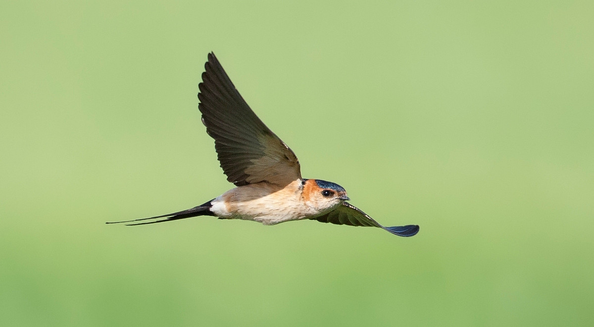
Trilho da Estação da Biodiversidade de Alvor (Alvor Biodiversity Stations Trail) is a nature trail with a series of information boards following the low cliffs just north of Alvor harbour. An area with typical Iberian birds. The habitat is rocky, mixed-species scrub interspersed by numerous paths, with views over the adjoining estuary. Typical birds include Red-legged Partridge, Iberian Magpie, Spotless Starling, Sardinian Warbler and European Serin with a chance of European Bee-eater and Red-rumped Swallow. In winter, Black Redstart, European Stonechat and Spanish Sparrow can also be found. A rich matos flora features various orchids, with butterflies including Iberian Marbled White and Knapweed Fritillary. The path can be followed northwards to reach the Abicada Dam, with its extensive saltmarshes. It is possible to make a circular walk back to the centre of Alvor by following Caminho Maria Pires through farmland.
_________________________
Português: O Trilho da Estação da Biodiversidade de Alvor é um trilho natural com uma série de painéis informativos que acompanham as falésias baixas a norte do porto de Alvor. O habitat é um matagal rochoso com um misto de espécies, intercalado por numerosos caminhos, com vista para a ria adjacente. Aves típicas incluem Red-legged Partridge , Iberian Magpie , Spotless Starling, Sardinian Warbler e European Serin com chance de European Bee-eater e Red-rumped Swallow. No inverno, Black Redstart, European Stonechat e Spanish Sparrow também podem ser encontrados. A rica flora de matos apresenta diversas orquídeas, com borboletas, incluindo a borboleta-branca-marmoreada-ibérica e a borboleta-fritilária-de-centáurea. O caminho pode ser seguido em direção ao norte para chegar à Barragem da Abicada, com seus extensos sapais. É possível fazer uma caminhada circular de volta ao centro de Alvor seguindo o Caminho Maria Pires por terras agrícolas.
Details
Access
The Alvor Biodiversity Stations Trail is located just north of the town of Alvor. Press a P on the map for directions to a parking. The trail is reached simply by following the path north from Alvor harbour, past the lifeboat museum, for 300 metres. The first information board is by a building used by local fishermen. The trail then extends for 1 km. Although there are numerous informal paths, the limits of public access are unclear and it is best to follow the information boards close to the cliffs. An hour is sufficient to walk the trail, which can be combined with a visit to nearby sites such as Alvor Dunes. You can return the same way or take the lower path, skirting a chain-link fence, to reach Abicada dam. If you do this, please be aware that the final section is steep, requiring the use of rope hand-holds for a short section.
_________________________
Português: O acesso ao trilho é feito simplesmente seguindo o caminho para norte a partir do porto de Alvor, passando pelo museu dos barcos salva-vidas, durante 300 metros. O primeiro painel informativo encontra-se junto a um edifício utilizado pelos pescadores locais. O trilho estende-se então por 1 km. Embora existam inúmeros caminhos informais, os limites de acesso público não são claros e é melhor seguir os painéis informativos perto das falésias. Uma hora é suficiente para percorrer o trilho, que pode ser combinado com uma visita a locais próximos, como as Dunas de Alvor. Pode regressar pelo mesmo caminho ou seguir o caminho mais baixo, contornando uma vedação de arame, para chegar à barragem da Abicada. Se o fizer, tenha em atenção que o troço final é íngreme, exigindo a utilização de pegas de corda durante um curto troço.


 ) to insert bird names in your own language. The birdnames will automatically be translated for other users!