


Description
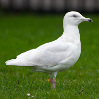
Sunk Island is a landscape of large arable fields bordered by drainage channels and few trees. Excellent views overlooking the saltmarshes and the Humber can be made from the courtesy path running eastwards along the embankment from Stone Creek. It is a good area to see geese, ducks, gulls, terns, waders and other water birds and sea birds. See the birdlist below. Some of the more rare birds that have been observed here are Dotterel, Black Tern, Ivory Gull, Glaucous Gull, Iceland Gull, Red-rumped Swallow, European Turtle Dove, Eurasian Wryneck and Pallid Harrier.
Details
Access
Situated off the A1033 turn right at Church Street and head to Cherr, Cobb Sands Road approximately 10 miles from Hull. Follow the Road to Stone Creek. You can drive to Patrington and Ottringahm over a bridge at Stone Creek. You can park on laybys on single track roads. Please take into consideration that these roads are used by large agricultural machinery so please don't block any roads.


 ) to insert bird names in your own language. The birdnames will automatically be translated for other users!