


Charger images
Les formats d'image autorisés sont de type jpeg, png ou gif
La taille maximale du fichier doit être de 20MB


Sand Point and Sand Bay are in North Somerset on the shore of the Severn Estuary.
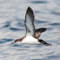
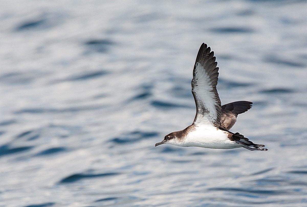
Sand Point at 158 foot tall, is a smaller version of Brean Down Nature Reserve and Brean Beach (see separate entry) further South. Sand Point lies North of Weston-Super-Mare, the point comprises of grassland (close cropped by rabbits), the slopes have Hawthorn (Crataegus), Elder (Sambucus) and Blackberry (Rubus) forming extensive scrubland. During Spring mornings this scrubland holds passage migrant Pouillot fitis, Pouillot véloce, Locustelle tachetée, Fauvette à tête noire, Gobemouche noir and Pipit des arbres. More open areas have passage migrant Traquet motteux and Merle à plastron. Depending on season the seawatcher can expect to see Plongeon catmarin, Puffin des Anglais, Fou de Bassan, Fulmar boréal, Mouette tridactyle, Bernache cravant, Canard pilet, Labbe parasite, Grand Labbe, Labbe pomarin and the occasional Mouette de Sabine (in Autumn), all during North West onshore winds in particular.
Sand Bay being on the Severn Estuary has a high tide range, birds can be at long distance at low tide, 2 hours either side of high tide improve your chance of seeing Grand Gravelot, Courlis corlieu, Bécasseau sanderling and Bécasseau maubèche (all in small numbers) during Spring and Autumn, Wintering birds include Courlis cendré, Chevalier gambette, Pluvier argenté and sometimes 2000+ Bécasseau variable, at high tide some birds use the saltmarsh at the North end of the beach as a high tide roost.
BE AWARE Livestock may be present on site.
BE AWARE, Weston-Super-Mare is known for it's large amount of roundabouts. On M5 motorway (Northbound or Southbound), exit at junction 21 signed Weston-S-Mare A370. At large roundabout take exit signed Weston-S-Mare A370, stay in Left hand lane, leave this road on Left slip road signed B3440. Continue on this road (crossing over A370), on this B3440 get in middle lane following signs to North Worle/Crematorium/Kewstoke/Sand Bay. Continue on this B3440 also called Queen's Way and follow signs (on multiple roundabouts) to Kewstoke/Sand Bay. On leaving Weston-Super-Mare the road becomes Lower Norton Road and eventually becomes narrow, at next junction on Kewstoke seafront turn Right signed Sand Point only, continue on this road (Beach Road) until reaching National Trust car park (Fee Payable) at the end of the road.
 ) Insérez les noms d'oiseau dans votre langue. Ils seront automatiquement traduits pour les autres usagers !
Votre feedback sera transmis à l’auteur.rice de cette zone et à l’équipe éditoriale de Birdingplaces, qui l’utiliseront pour améliorer la qualité des informations. (Vous souhaitez publier un commentaire visible en bas de page ? Fermez cette fenêtre et choisissez l’Option 1 : « Publier un commentaire, un conseil ou une observation ».)
Veuillez fournir des suggestions d'améliorations ou d'ajouts au texte de ce site ornithologique.
Veuillez fournir vos suggestions d'améliorations ou d'ajouts à la carte.
Veuillez fournir des suggestions d'améliorations ou d'ajouts à la liste des oiseaux.
Cliquez sur l'icône de l'oiseau () Insérez les noms d'oiseau dans votre langue. Ils seront automatiquement traduits pour les autres usagers !