


Charger images
Les formats d'image autorisés sont de type jpeg, png ou gif
La taille maximale du fichier doit être de 20MB


Stoke - Dyer's Lookout - Hartland Quay - Speke's Mill Valley are on the coast in North West Devon.
The area has a mixture of habitats including a village, wooded valleys, coastal cliffs and farmland. The small village of Stoke has a church (St Nectans) with a 128 foot tower (often called the Cathedral of North Devon), that is still used by sailors at sea today as a navigation point. If using this small car park please pay fee in honesty box.
Dyer's Lookout with steep high cliffs are renowned among British rockclimbers, the cliffs give good views out to sea, further out to sea to the North North West you can see Lundy Island (see separate entry).
Hartland Quay has some of the roughest seas during winter in the South West, the former harbour dating back to Henry VIII, was completely destroyed by winter storms in the late 1880's, the road down to the Quay is a Toll Road (Fee Payable), but it does have 3 large car parks.
Further South on the South West Coast Path (described as being challenging in places), brings you to Speke's Mill Mouth Waterfall, one of the tallest in Devon (157 feet) that falls from the Milford River directly onto the beach below.
Speke's Mill Valley heads inland from the waterfall, eventually coming to farmland and at times very narrow roads some of which are totally unsuitable for motor vehicles, heading North brings you back to the village of Stoke.
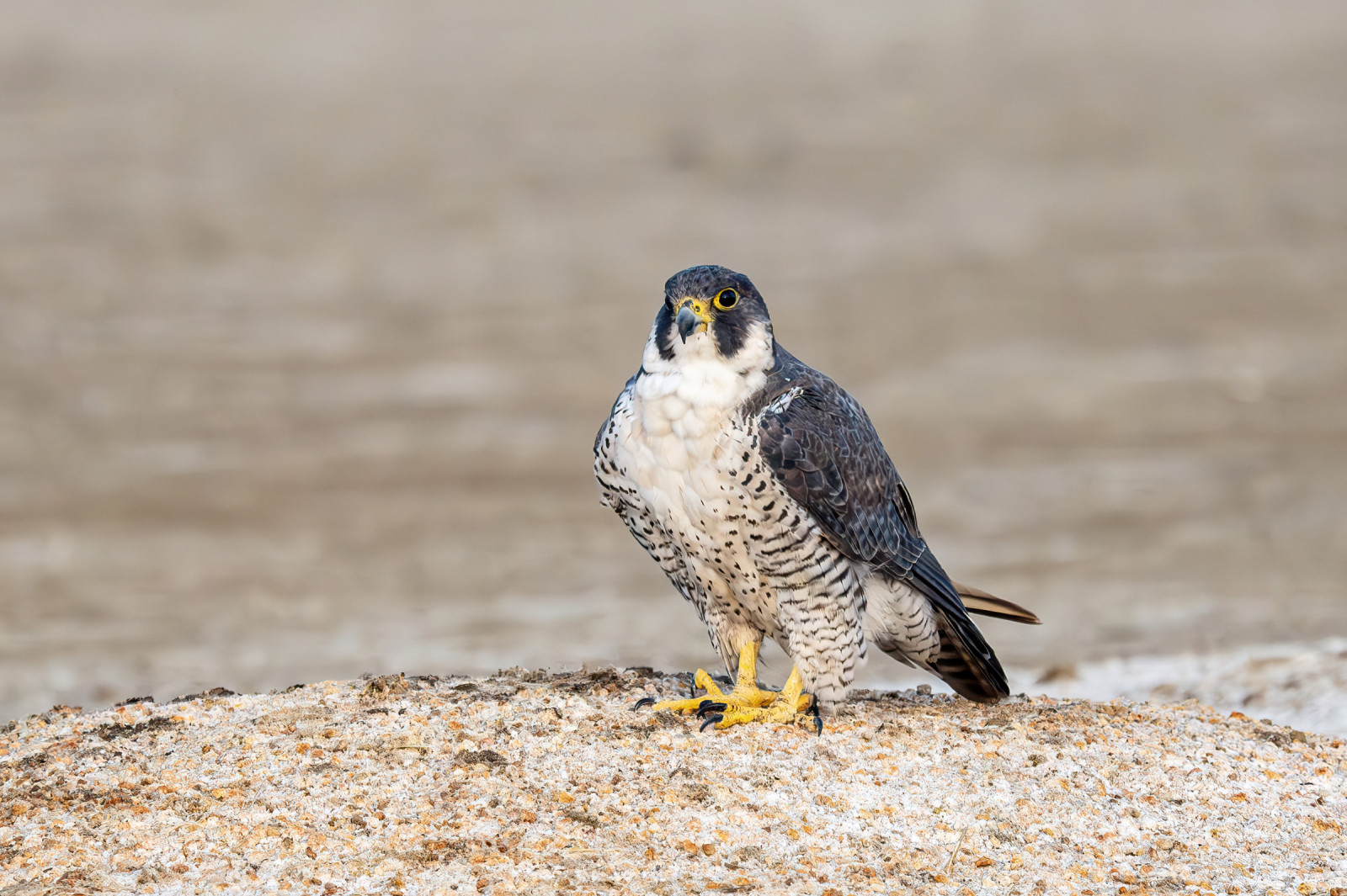
Some birds you can expect, depending on weather conditions and season are, Faucon pèlerin, Fulmar boréal, Grand Cormoran, Cormoran huppé, Pouillot véloce, Fauvette à tête noire, Hirondelle rustique, Huîtrier pie, Pipit maritime and Bergeronnette des ruisseaux, amongst many others.
Note: press STARS on map for extra information.
The main road A39 between Bideford (to the North East) and Bude (further to the South), is East of the site. If traveling from Bideford leave (Westwards) on the A39, on passing through Clovelly Cross roundabout take the next Right signed Hartland/Lundy Heliport on B3248. Continue on this road soon signed Hartland/Stoke, continue on this road (DO NOT TAKE ROAD SIGNED HARTLAND POINT/LIGHTHOUSE/LUNDY HELIPORT TURNING), until reaching the large village of Hartland. Pass through this village (BE AWARE SOME ROADS ARE ONE WAY ONLY), follow signs saying Hartland Quay/Stoke. The road soon passes through a wooded area and the village of Stoke and the tall church tower soon comes into view on the right were there is a small car park (honesty box). Hartland Quay and car parks is further along this road.
 ) Insérez les noms d'oiseau dans votre langue. Ils seront automatiquement traduits pour les autres usagers !
Votre feedback sera transmis à l’auteur.rice de cette zone et à l’équipe éditoriale de Birdingplaces, qui l’utiliseront pour améliorer la qualité des informations. (Vous souhaitez publier un commentaire visible en bas de page ? Fermez cette fenêtre et choisissez l’Option 1 : « Publier un commentaire, un conseil ou une observation ».)
Veuillez fournir des suggestions d'améliorations ou d'ajouts au texte de ce site ornithologique.
Veuillez fournir vos suggestions d'améliorations ou d'ajouts à la carte.
Veuillez fournir des suggestions d'améliorations ou d'ajouts à la liste des oiseaux.
Cliquez sur l'icône de l'oiseau () Insérez les noms d'oiseau dans votre langue. Ils seront automatiquement traduits pour les autres usagers !