


Charger images
Les formats d'image autorisés sont de type jpeg, png ou gif
La taille maximale du fichier doit être de 20MB


Rough Tor and Brown Willy are in North Bodmin Moor in Central Cornwall.
Bodmin Moor is an Area of Outstanding Natural Beauty (AONB). Rough Tor at 1,313 foot and Brown Willy (from the Cornwall language 'Bronn Winnili - meaning 'Hill of Swollows') at 1,378 foot are Cornwall's two highest points. During good weather in Summer it can become moderately busy. Make no mistake during bad weather and especially during Winter it is a bleak place, it is Cornwall's least populated area and on certain days you may be the only person for several miles. Because of this remoteness take suitable clothing even during Summer, weather can change very quickly. Tell someone of your destination and approximate time of your return, a headtorch, map or GPS device, a mobile phone but in some areas reception is poor.
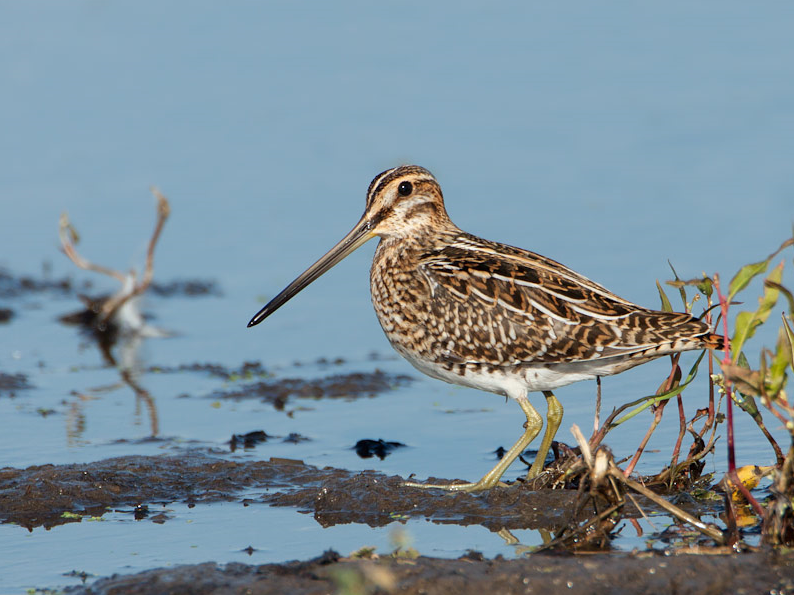
During freezing Winter weather most birds leave higher ground for lower elevations, sometimes the only birds remaining are some hardy Grand Corbeau. During milder Winter weather Pluvier doré, Bécassine des marais, Tarier pâtre, Pipit farlouse, Buse variable, Linotte mélodieuse, Sizerin cabaret and small numbers of Tarin des aulnes can be found. During Summer you can find Traquet motteux, Locustelle tachetée, Fauvette des jardins, Pouillot fitis and Hirondelle rustique. There is a very large Étourneau sansonnet roost at Rough Tor Plantation just to the North (Press STAR on map). With those with more time, check farmland either side of long straight access road.
Brown Willy gives its name to a meteorological phenomenon called The Brown Willy Effect, South Westerly or Westerly winds hitting high ground can cause heavy showers or more prolonged rain in surrounding areas, in August 2004 this effect was believed to have been the cause of the Boscastle flood and in March 2006 a long line of showers stretched from Bodmin Moor 145 miles to Oxfordshire.
The long distance A39 main road (in Cornwall called The Atlantic Highway), from Barnstaple (in North Devon) to Indian Queens (far to the South West) passes fairly close to the site, from both directions at the town of Camelford turn South East into Roughtor Road (the blue Rough Tor sign on wall is often obscured - Press STAR on map). This road (unsigned throughout) eventually takes you to the large Rough Tor car park.
 ) Insérez les noms d'oiseau dans votre langue. Ils seront automatiquement traduits pour les autres usagers !
Votre feedback sera transmis à l’auteur.rice de cette zone et à l’équipe éditoriale de Birdingplaces, qui l’utiliseront pour améliorer la qualité des informations. (Vous souhaitez publier un commentaire visible en bas de page ? Fermez cette fenêtre et choisissez l’Option 1 : « Publier un commentaire, un conseil ou une observation ».)
Veuillez fournir des suggestions d'améliorations ou d'ajouts au texte de ce site ornithologique.
Veuillez fournir vos suggestions d'améliorations ou d'ajouts à la carte.
Veuillez fournir des suggestions d'améliorations ou d'ajouts à la liste des oiseaux.
Cliquez sur l'icône de l'oiseau () Insérez les noms d'oiseau dans votre langue. Ils seront automatiquement traduits pour les autres usagers !