

Beskrivning
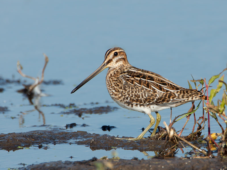
Hörlinge ängar is a wetland area with wet meadows. At periods of high water during spring and autumn, the meadows flood and Vieån amalgamate with Helge å to form an impressive delta. It is a nice wet meadow area that dries out later in the summer and then large parts of the area are mowed. More than 200 species of birds has been documented here, which is a high number for a shore meadow area in the woodlands of northern Skåne. Characteristic species for Hörlinge ängar are primarily wading birds and ducks. Birds such as enkelbeckasin, gluttsnäppa, svartsnäppa, storspov, rödbena, knipa, Skedand and Kricka. But also buskskvätta, sydnäktergal, kärrsångare, sävsångare, rörsångare and törnsångare.
Detaljer
Tillgänglighet
At Hörlinge meadows, east of Verum and Vittsjö in the northern parts of Hässleholm municipality, there is an outdoor museum and bird tower as part of Vieåleden. The Vieåleden trail (see the map) connects Skeingeborg's unique castle ruin from the Middle Ages with the wetlands and Skåneleden in the north. From the car park it is only about 300 meters to the bird tower. At the parking lot there is also a picnic table and toilet. At the outdoor museum you will have a good view of the extensive meadows and the opportunity to get more information.
Terräng och habitat
Våtmark , SlättFörhållanden
Öppet landskapRundtur
JaTubkikare behövs?
Kan vara användbartBästa säsong för skådning
Vår , Höst , SommarBästa tid för ett besök
Höststräck , VårsträckRutt
Bred stigHur ansträngande vandring
Lätt vandringNås
Till fotsFågeltorn / plattform
JaExtra information
On the map you see the circular Vieåleden trail of 12 km through the surrounding area. Note: to get around the entire trail, use a raft to cross the Helge River, which divides the area into two parts. The raft is generally in the river during mid-May to the end of October, but is of course very dependent on water levels, weather and wind. The rest of the year you can unfortunately not walk the trail in its entirety, but you can walk parts of it.


 ) Lägg till fågelnamen på ditt egna språk, namnen kommer automatiskt översättas till andra användare.