Beskrivning
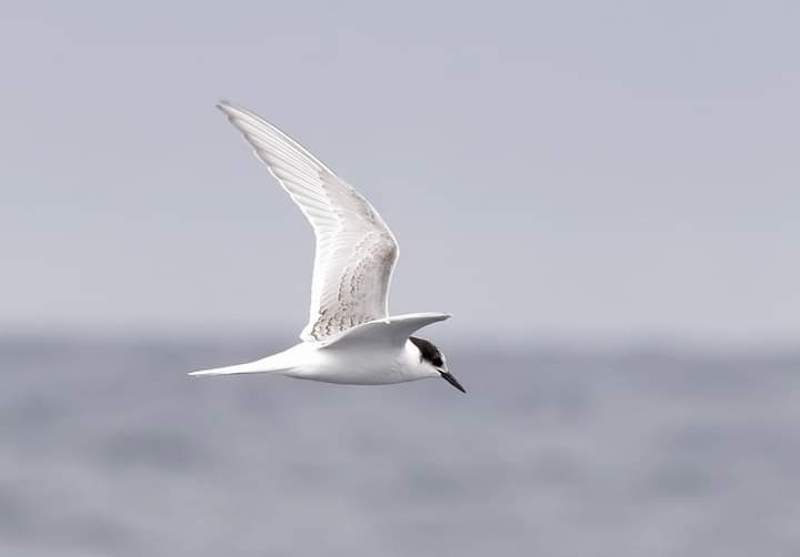
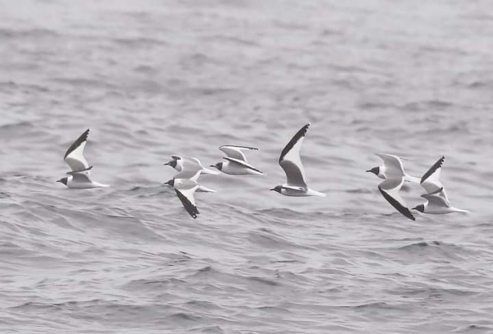
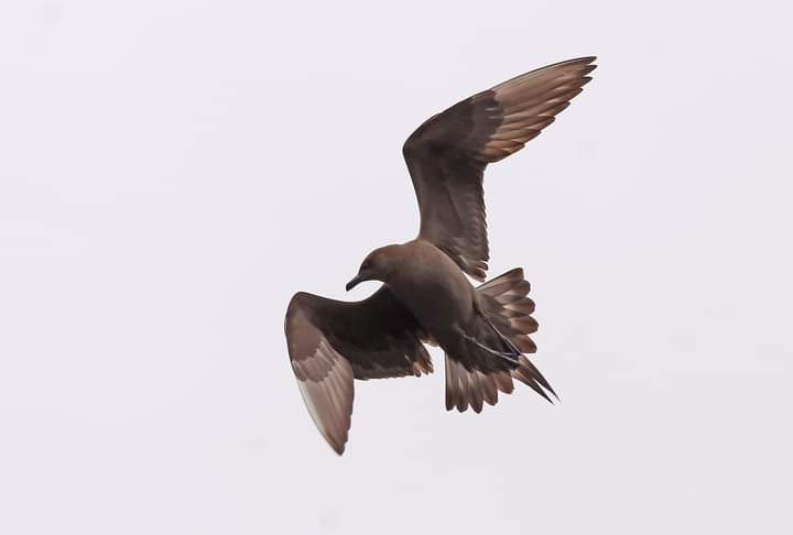
Reaching into the sea in order to divide the waters of the Atlantic from those of the Bay of Biscay, Estaca de Bares is the northernmost point of the entire Iberian Peninsula. From this green and imposing headland one commands a spectacular view. Estaca de Bares is one of the best birding spots in Europa and, in fact, has a permanent ornithological station. Thousands and thousands of birds pass through here every year – especially from September to December. Best is to Estaca de Bares with north or northwest winds between late August and early December. Estaca de Bares is a large rocky outcrop and has rugged cliffs, low lying gorse and heather vegetation, with a wetland area with reeds in its most sheltered point and tree crops elsewhere. The sea facing this area is an unrivalled point in Galicia (and one of the best in Europe) to observe seabirds. Also, it is a feeding ground for many birds that breed in the area. Among the birds you can see are seabirds like storlabb, bredstjärtad labb, kustlabb, fjällabb, stormfågel, havssula, tärnmås, Kentsk tärna, Gulnäbbad lira, större lira, grålira, mindre lira, balearisk lira and toppskarv, but also landbirds like nattskärra and provencesångare.
_________________________
Español: Gran lugar para aves en paso. Adentrándose en el mar para separar las aguas del Atlántico de las del Cantábrico, Estaca de Bares es el punto más septentrional de toda la península ibérica. Desde este promontorio gris, verde e imponente se domina una vista espectacular. Estaca de Bares es uno de los mejores puntos de observación de aves de Europa, de hecho cuenta con una estación ornitológica permanente. Miles y miles de aves pasan por aquí cada año, en especial de septiembre a diciembre. Varias especies de pardelas , pagalos, gaviotas, etc..
Detaljer
Tillgänglighet
You can make a circular walk of about 5 km long over the headland. Click on the P in the map to get directions to the parking.
_________________________
Español: Se puede hacer una caminata circular de unos 5 km de longitud sobre el cabo. Haga clic en la P en el mapa para obtener indicaciones para llegar al estacionamiento.


 ) Lägg till fågelnamen på ditt egna språk, namnen kommer automatiskt översättas till andra användare.