
Beskrivning
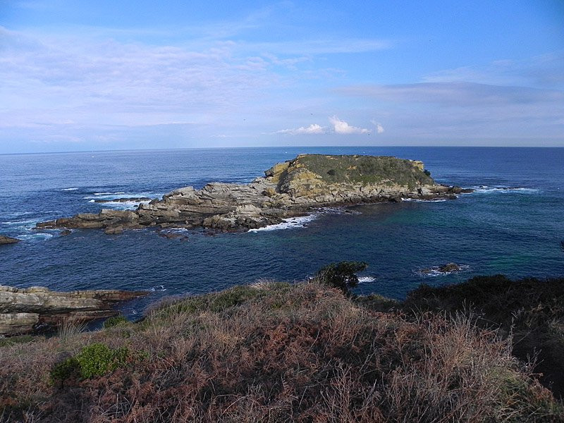
When there is a storm at sea, many species of seabirds take refuge at Cabo de Higuer. Several toppskarv can regularly be seen on the island of Amuitz and the coastal waters are frequently visited by havssula, Kentsk tärna and Gråtrut. The forest vegetation is rich in forest species such as svarthätta, rödhake, koltrast, etc.
_________________________
Espagnol: Cabo Higuer es el cabo más oriental del Cantábrico y el extremo más noroccidental de los Pirineos. Desde aquí parte el sendero pirenaico GR-11. Cuando hay temporal en alta mar, muchas especies de aves marinas se refugian aquí. Habitualmente pueden verse varios ejemplares de toppskarv en la isla de Amuitz y con cierta frecuencia la costa es sobrevolada por havssula, Kentsk tärna, Gråtrut. Entre la vegetación boscosa abundan las especies forestales como svarthätta, rödhake, koltrast, etc.
Detaljer
Tillgänglighet
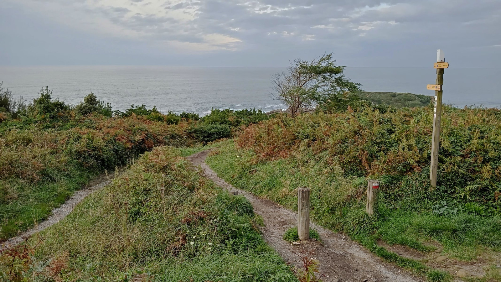
You can get to Cabo de Higuer by car from the fishing port of Hondarribia. You can park in front of the Faro de Higuer campsite. Press P on the map for directions. From there, a path runs along the lighthouse and either leads to the coves or straight ahead. Just when the path becomes steeper, you have some unbeatable views of the island of Amuitz. This is the observation point. With a telescope you can easily see the birds perched on the island: toppskarv, Storskarv, Gråtrut, medelhavstrut and those flying along the coast: havssula, Kentsk tärna and others.
_________________________
Espagnol: Se llega en coche viniendo desde el Puerto Pesquero de Hondarribia. Se puede aparcar frente al Camping Faro de Higuer. Desde ahí, un camino bordea el faro y se dirige o bien a las calas, o bien de frente. Justo cuando el caminito de vuelve más abrupto tenemos ante nosotros uns vistas inmejorables de la isla de Amuitz. Éste es el punto de observación. Con el telescopio se ven con facilidad las aves posadas en la isla: toppskarv, Storskarv, Gråtrut, medelhavstrut y las que sobrevuelan la costa: havssula, Kentsk tärna y otras.


 ) Lägg till fågelnamen på ditt egna språk, namnen kommer automatiskt översättas till andra användare.