Beskrivning
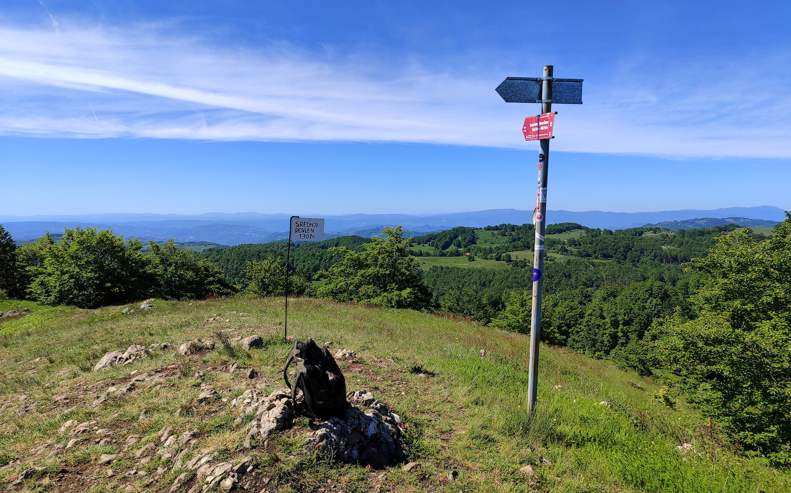
The Povlen Mountain is the highest in the Valjevske Mountains range, featuring three prominent peaks: Veliki Povlen (Big Povlen) at 1,271 meters, Srednji Povlen (Middle Povlen) at 1,301 meters, and Mali Povlen (Small Povlen) at 1,346 meters. Paradoxically, the peaks are named such because the nearest and smallest peak (Veliki Povlen), when viewed from the Debelo Brdo mountain pass, appears to be the tallest, while the farthest and highest peak (Mali Povlen) appears to be the lowest.
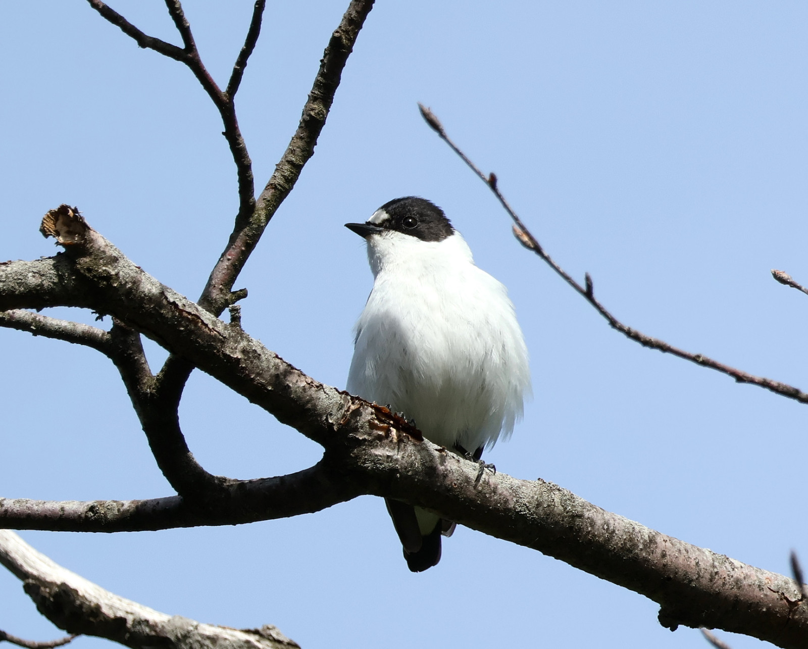
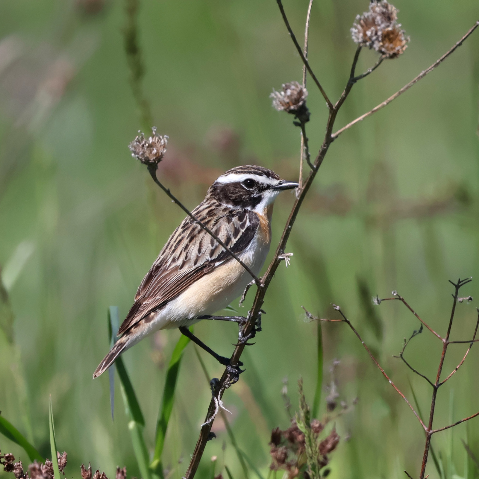
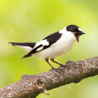
Despite its height, the area surrounding the Povlen peaks is predominantly a deciduous forest, consisting mainly of beech and oak trees. There are also small patches of conifers (mostly spurce), the largest around Veliki Povlen, the first and smallest peak. The plateau between the peaks is bordered by scrubby slopes and features green meadows, the most notable of which is Kneževo Polje (Duke's Field), located beneath the highest peak, Mali Povlen. These meadows and scrublands are home to various bird species, including buskskvätta, trädpiplärka, dubbeltrast, gulsparv, häcksparv, and occasionally ringtrast. The northern slopes of the Povlen peaks, with their dense beech forest, provide an ideal habitat for halsbandsflugsnappare and even mindre flugsnappare, along with more common species such as rödhake, gärdsmyg, koltrast, and taltrast. In the patches of confiers look for svartmes, talltita, kungsfågel, and brandkronad kungsfågel.
Additionally, the area is inhabited by soaring birds like korp, ormvråk, Bivråk, ormörn, and sparvhök. gåsgam occasionally come from the nearby Trešnjica River Gorge following the valley of the Trešnjica River, which springs below the Srednji Povlen peak.
This region is part of the Important Bird Area (IBA) Valjevske Mountains.
Detaljer
Tillgänglighet
To access Povlen's three peaks, take the regional road from Valjevo town to Bajina Bašta, which crosses over Debelo Brdo mountain pass. You can park at the mountain pass or turn left onto the macadam road and continue for about 1.2 km to the 'P' marked point, which is the most convenient point to start the route on foot. From here, one road leads left to the northern forested slopes and the well of the Povlenska Reka (Povlen's Stream), while the other continues straight over the plateau between the peaks further up to the Kneževo Polje. Both of these roads are also passable by car, although the road to Povlenska Reka through dense beach forest occasionally can have heavy puddles. The connecting walking path between these two roads over viewpoint Ploče towards Srednji Povlen is currently in a very bad shape, overgrown with vegetation and with a lot of fallen trees, although it is passable with a careful, albeit grueling hike.
Terräng och habitat
Skog , Berg , Spridda träd och buskar , Platå , SlättFörhållanden
Bergigt , Kulligt , Öppet landskapRundtur
JaTubkikare behövs?
Kan vara användbartBästa säsong för skådning
Sommar , VårBästa tid för ett besök
Sommar , VårRutt
Bred stig , Grusväg , Smal stigHur ansträngande vandring
Ansträngande vandringNås
Till fots , Cykel , BilFågeltorn / plattform
JaExtra information
The nearby village of Zarožje, with its cliffs surrounding the Church of Svete Trojice, may conceal some interesting surprises.
Länkar
- 'Debelo brdo' eBird hotspot
- 'Povlen Mountain' eBird hotspot
- 'Zarožje' eBird hotspot
- eBird barchart of all hotspots
- IBA Valjevske Mountains


 ) Lägg till fågelnamen på ditt egna språk, namnen kommer automatiskt översättas till andra användare.