.jpg)
Beskrivning
Dubovacki Rit Reserve lies between the village of Dubovac and the river Danube, is about a mile long and consists of open water, reedbeds and willow and poplar riparian forest, with adjoining junipers on grassy sand dunes. Surrounding Danube shallows are a significant wintering area for waterbirds.
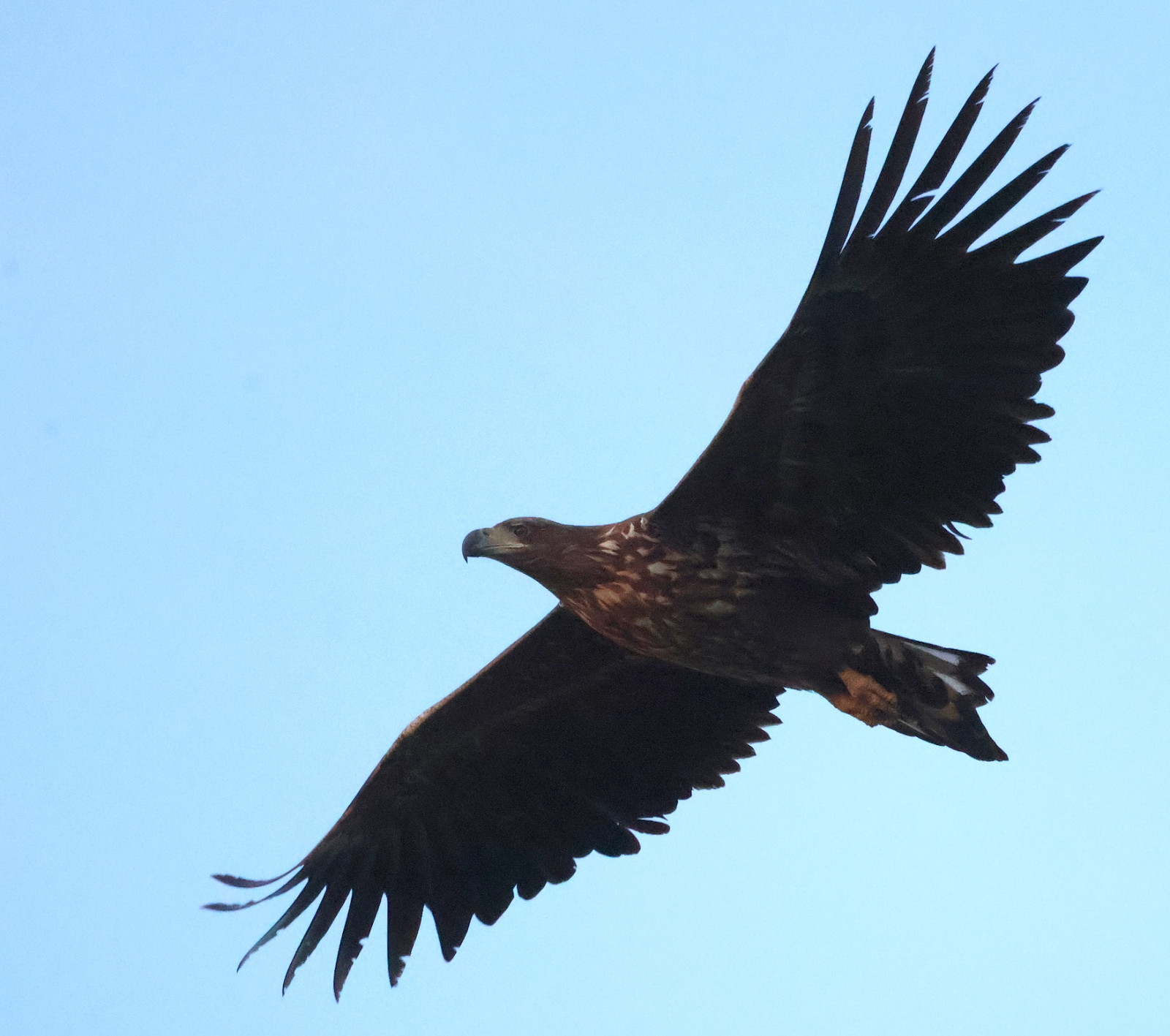
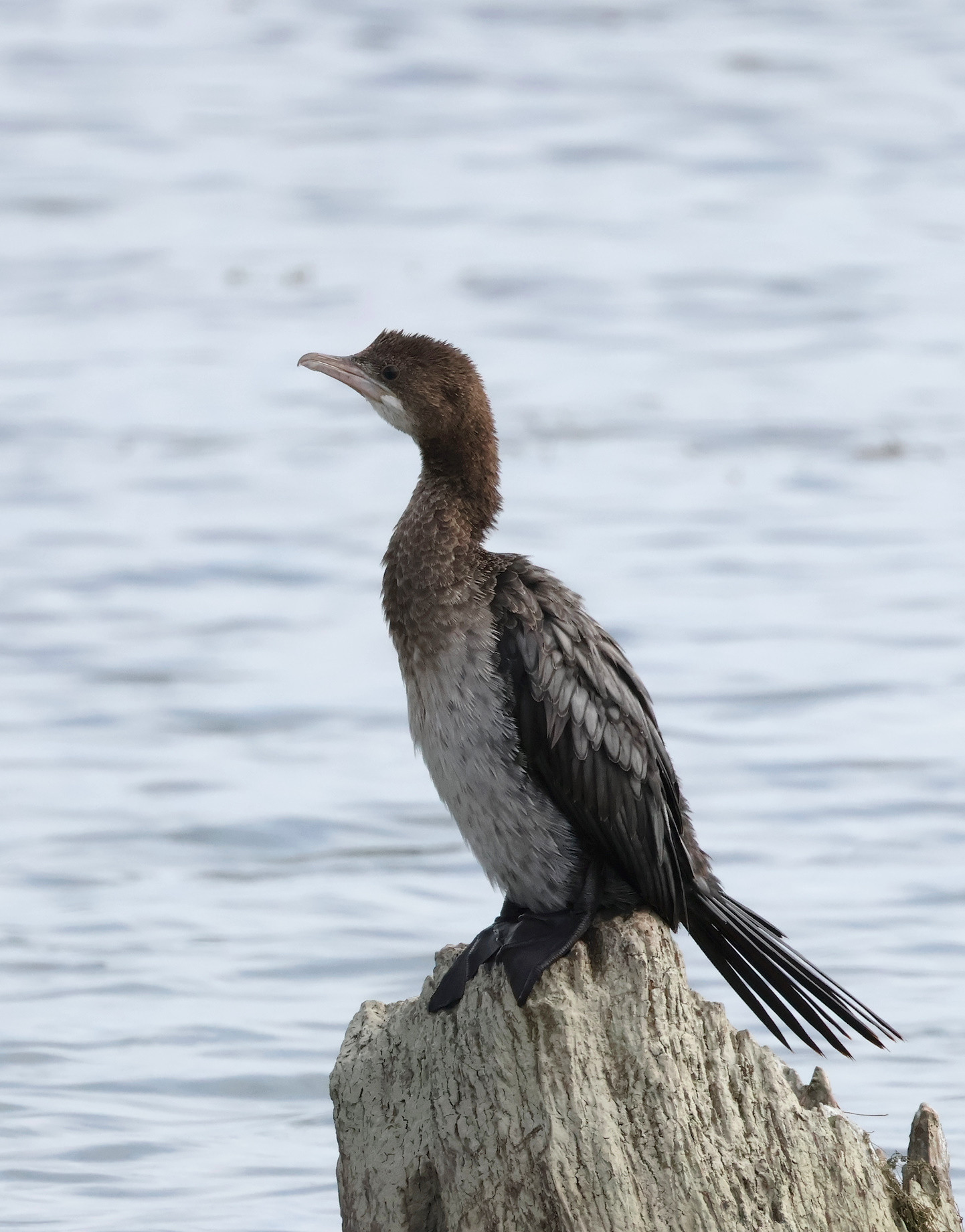
Once you reach the wetland, checking the western/upriver section is more rewarding in winter, while going east/downriver is more productive in spring. In winter you may look for större skrikörn, tajgasädgås, bläsgås, grågås, gravand, salskrake, storskrake, vitögd dykand, storlom, dvärgskarv, kaspisk trut, björktrast, rödvingetrast, dubbeltrast.
From March onwards for årta, svart stork, vit stork and natthäger. From April for purpurhäger, dvärgrördrom, örnvråk and three marsh terns ( svarttärna, skäggtärna, vitvingad tärna ). vattenrall and småfläckig sumphöna were also recorded here, as well as skärfläcka, kärrsnäppa and småsnäppa. turturduva, biätare, törnskata, Härfågel and backsvala (about 5,000 pairs downriver from Dubovac) breed here and are conspicuous in spring.
A strong easterly wind is common in the area, which can make birding challenging.
Photos by Slobodan Puzovic, Mileta Cekovic and Dragan Simic.
Detaljer
Tillgänglighet
Access is from the village of Dubovac, 70 km / 80 min east of Belgrade. See the map and click on the "P" for the turn-off directions.
The western section is more disturbed by development, although the levee up the Danube is well worth checking, especially in winter. To reach the western section, turn right at the cross junction (coming from the direction of the town of Kovin, route marked on the map).
The eastern section has a more natural feeling and preserved habitats. For the eastern section, follow the second dirt track right, after the Dubovac village.
Technically, you can park wherever and explore further on foot. There's not much shade, so wear a hat and take water with you.
Terräng och habitat
Skog , Våtmark , Gyttjig strand , Vassar , Flod , Slätt , Spridda träd och buskarFörhållanden
Öppet landskap , DammigtRundtur
NejTubkikare behövs?
Kan vara användbartBästa säsong för skådning
Året runtBästa tid för ett besök
Vinter , Vårsträck , HöststräckRutt
GrusvägHur ansträngande vandring
Genomsnittlig vandringNås
Till fots , BilFågeltorn / plattform
NejExtra information
A spotting scope is necessary in winter, but not in warmer months when binoculars are sufficient.


 ) Lägg till fågelnamen på ditt egna språk, namnen kommer automatiskt översättas till andra användare.