

Beskrivning
The Drapolicz observation tower was built in cooperation with the Nadleśnictwo Elbląg (Forest District) and the "Drapolicz" association (The name "Drapolicz" seems to be a combination of words that can be translated as : "counting birds of prey").
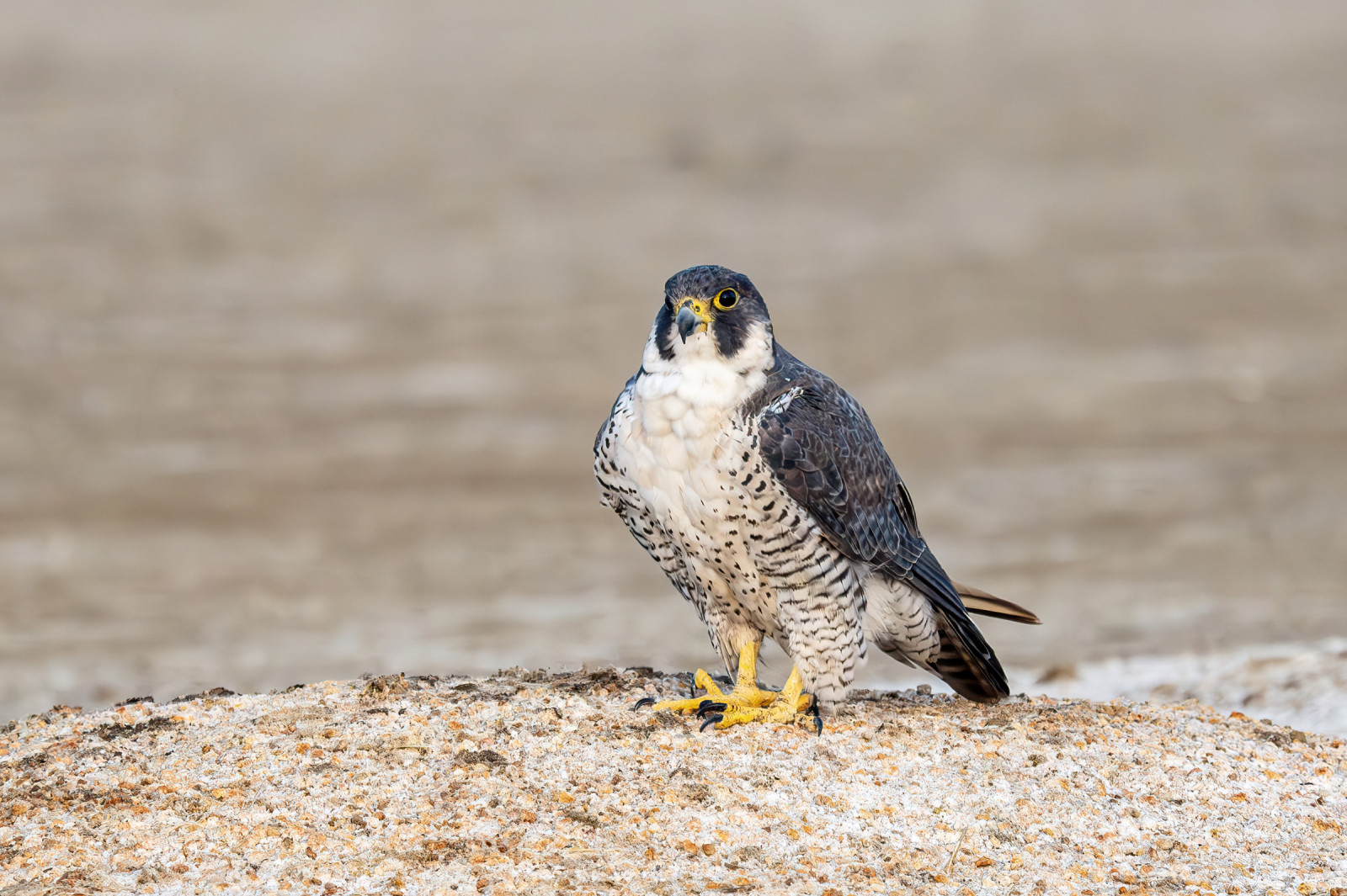
The location of the tower on the hill is not accidental. One of the most important bird migration routes runs through here. The Vistula Spit in this place is about 800 meters wide, which encourages birds to fly over this narrow strip of land (the so-called bottle neck effect). The Drapolicz Tower is one of the best places in Europe to observe migrating Pilgrimsfalk, fjällvråk, lärkfalk and blå kärrhök.
_________________________
Polski: Wieża powstała we współpracy nadleśnictwa Elbląg oraz stowarzyszenia "Drapolicz". Miejsce posadowienia wieży na wzgórzu nie jest przypadkowe. Tędy przebiega jeden z ważniejszych ptasich szlaków migracyjnych. Mierzeja Wiślana ma w tym miejscu około 800 metrów szerokości - co skłania ptaki do przelotu nad tym wąskim pasem lądu (tzw. efekt lejka).
Wieża Drapolicz jest jednym z najlepszych miejsc w Europie do obserwacji migrujących Pilgrimsfalk, fjällvråk, lärkfalk, blå kärrhök.
Detaljer
Tillgänglighet
The most convenient way to get to the Drapolicz observation tower is by car or bike from Krynica Morska. The terrain is very hilly. You can leave your car in the place marked with the letter P on the map. From the parking lot, the entrance is very steep (about 50 meters), from there you can ride a bike to the tower itself.
_________________________
Polski: Najwygodniej dostać się do tego miejsca samochodem lub rowerem od strony Krynicy Morskiej. Teren jest bardzo pagórkowaty. Samochód można pozostawić w miejscu oznaczonym literą P na mapie. Od strony parkingu wejście jest bardzo strome (około 50 metrów), dalej można jechać rowerem do samej wieży.


 ) Lägg till fågelnamen på ditt egna språk, namnen kommer automatiskt översättas till andra användare.