
Beskrivning
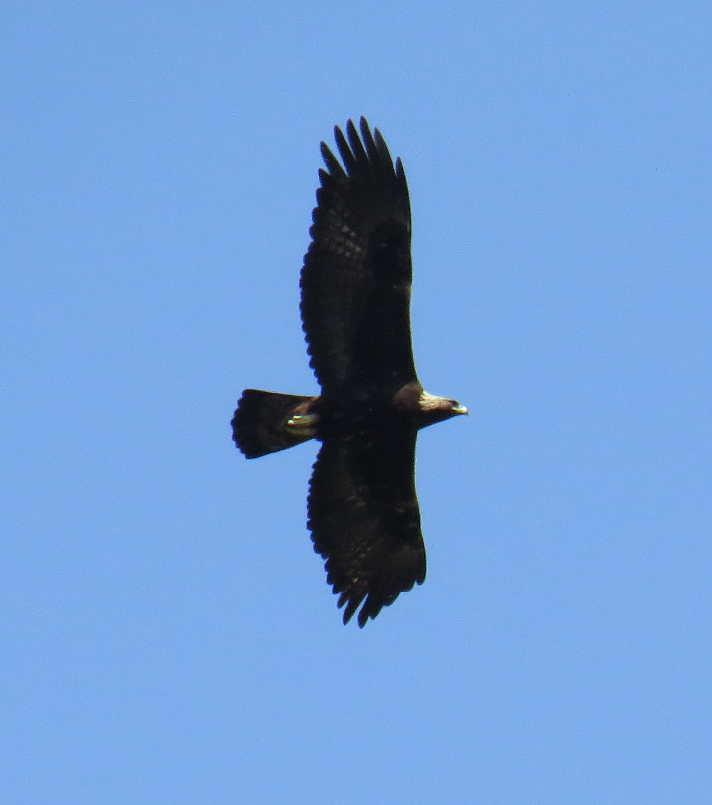
The small village of Saignon is dominated by steep rocks with old castle ruins. The views from these rocks over the Luberon area are fantastic. In the distance you can even see the Mont Ventoux. It is a great place for birdwatching. You can observe birds of prey soaring by and klippsvala flying just over your head. During bird migration surprising birds can fly by every day.
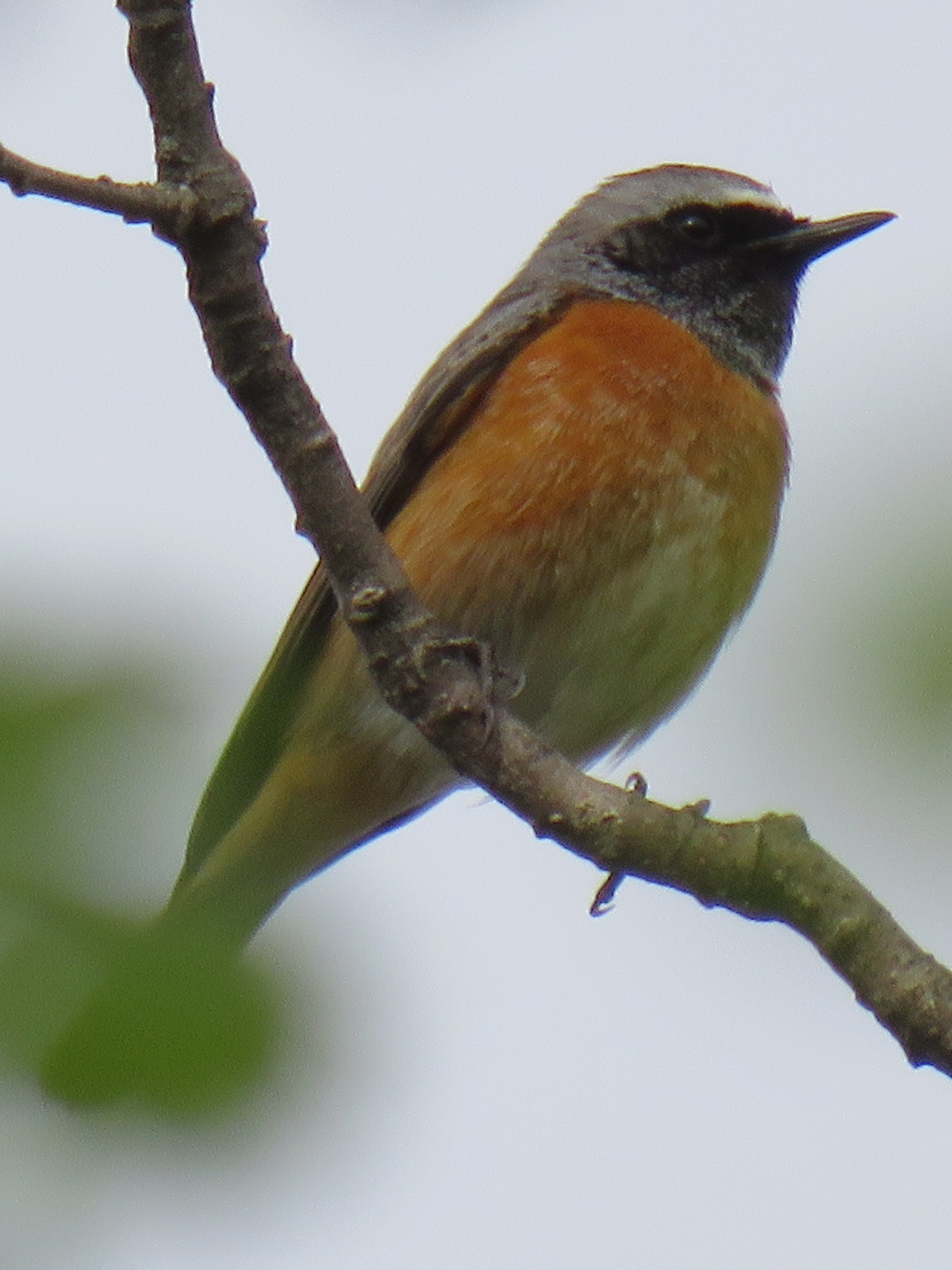
The surrounding area of Saignon is a mix of agricultural fields, forest, gardens, wild and overgrown bushy parts and therefore rewarding to also explore for birds. Härfågel is very common here. biätare can be seen flying over several times a day. In the lower parts near the town of Apt sommargylling are quite numerous. blåkråka breed in the lower valleys of the Luberon quite a distance away, but are sometimes seen flying by in Saignon. More easy to see are gulhämpling, Gröngöling, Nötväcka, svart rödstjärt, ormörn and korp.
Detaljer
Tillgänglighet
There are two ways to visit the area. The first one is to drive up to Saignon, park the car there (see the P on the map), walk to the rockruins and enjoy the views and birds. The second possibility is to make a 10 km walk from Apt to Saignon (5 km one way). The walk bridges 250 meters of height difference. It is not a very difficult walk, but there and back is still a distance of 10 km. So you must be in a reasonable condition and not have difficulty walking. Anyway: bring enough water and put on good walking shoes. Part of the trail is on a narrow path. But most of it on a wide path or on a paved road. About 400 meters of the route (near Saignon) is along a busier road. The hiking option brings you definitely more birds and you walk through a nice and varied landscape. You can start the walk in the center of Apt or you can walk from the residential area a little higher up the hill and park there (see the P on the map). The trail is marked with yellow markers, but they are not always very visible, especially in the beginning of the trail. In this case follow the trail on your phone on the map below.


 ) Lägg till fågelnamen på ditt egna språk, namnen kommer automatiskt översättas till andra användare.