

Beskrivning
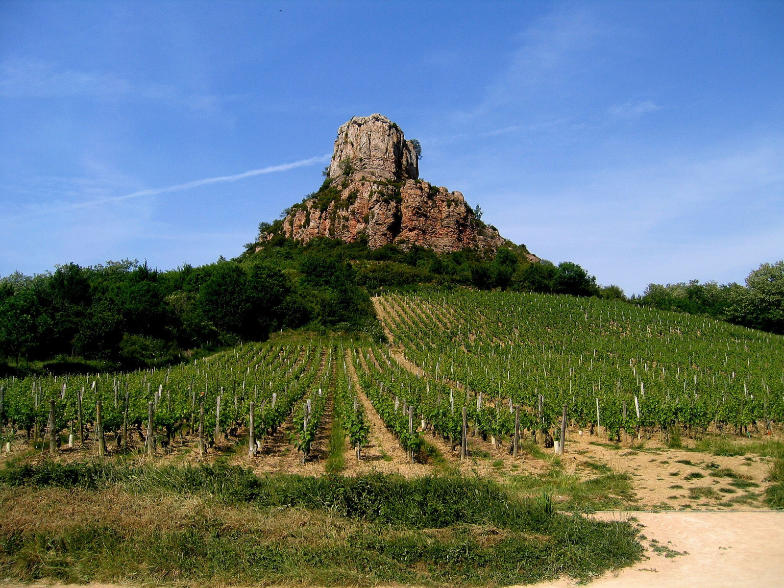
Roche de Solutré is a rock that stands at an altitude of 495 metres. At the top of this escarpment, there is a spectacular panoramic view of the Mâconnais vineyards. On the site there are grassy areas and bushes sheltering species such as sammetshätta, nattskärra, svarthakad buskskvätta or more rarely ormörn.
_________________________
Français: Il s'agit du site naturel le plus célèbre de la région. Le site de solutré est un promontoir rocheux surplombant le vignoble. On retrouve sur le site des zones de pelouses et de buis abritant des espèces comme la sammetshätta, l' nattskärra, le svarthakad buskskvätta ou plus rarement le ormörn.
Detaljer
Tillgänglighet
Roche de Solutré is accessed via the village of Solutré by following then taking the road which leads to the archaeological museum. Click the P on the map to get directions to the parking spot. From the parking lot to the viewpoint, it's a 1.5 km walk.
_________________________
Français: On accède au site via le village de Solutré en suivant puis en empruntant le chemin qui mène au musée archéologique. Cliquez sur un P sur la carte pour obtenir un itinéraire vers une place de stationnement. Du parking au point de vue, il y a 1,5 km à pied.
Terräng och habitat
Kanjon/klippa , JordbrukFörhållanden
Kulligt , KlippigtRundtur
NejTubkikare behövs?
NejBästa säsong för skådning
Vinter , VårBästa tid för ett besök
Vår , VinterRutt
Bred stigHur ansträngande vandring
Genomsnittlig vandringNås
Till fotsFågeltorn / plattform
NejExtra information
The site is one of the most visited in the region, for birdwatching it is advisable to come early in the morning to enjoy the birds.
_________________________
Français: Ce site est l'un des plus visité de la région, pour l'observation ornithologique il est conseillé de venir tôt le matin pour profiter des oiseaux.


 ) Lägg till fågelnamen på ditt egna språk, namnen kommer automatiskt översättas till andra användare.