
Beskrivning
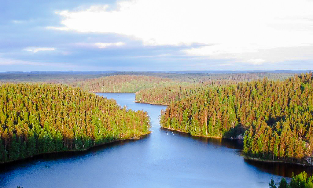
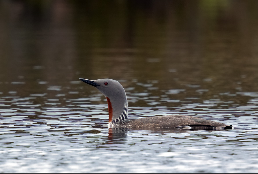
Repovesi National Park covers an uninhabited forest landscape of rugged rocky cliffs and dozens of crystal-clear lakes and ponds. Pine and birch trees dominate the park. Formerly a site for intensive commercial forestry, the Repovesi area successfully transformed into a pristine national park. The mosaic-like quality of the landscape offers a wide range of habitats, from sunnier and rockier surfaces to sheltered areas with lush amounts of vegetation. Repovesi abounds with wildlife including bear, deer and many birds. One of the area’s most famous residents is the smålom. But the national park is also very good for woodpeckers and owls. Also Fiskgjuse, gråhakedopping, storlom and several other water birds can be observed.
The Ketunlenkki Trail is the most popular and most easy accessible walking route in the park. The 3.5 km trail runs through the picturesque Lapinsalmi bridge and Ketunlossi ferry. The circle trail can be hiked in its entirety when the lake is not frozen over.
Detaljer
Tillgänglighet
Repovesi National Park is located in the northern region of Kouvola. The drive to the park is around 180 km from Helsinki, about 45 km from the centre of Kouvola and about 80 km from Mikkeli via Mäntyharju. There are three entrances around the national park. Each entrance includes a parking area with directions to the park’s many trails. During the hiking season, the park is also easily accessible via public transport. Many local tourism companies also offer accommodation and transportation services, guided programming and equipment rentals. For more information about these services, see Repovesi’s page on the nationalparks.fi website, see the link below.
Along the Ketunlenkki Trail (3,5 km, indicated on the map below) there are places to make fires, a camping area and several jetties. The route is marked with orange and Ketunlenkki symbols. The entire circuit is not passable in winter because it is not safe to cross the strait when the ferry is not in use. Click on the P in the map for directions to the parking at the start of the trail.
There are more marked trails in Repovesi National Park. For example the Koppelon Kierros Trail (8.3 km, 3-4 hours) leads hikers along the light-filled pine forests of the clifftop and the shoreside sights of Tervajärvi Lake. Or Korpinkierros Trail (4.5 km, 3-5 hours) that takes visitors up to the top of Olhava hill.
Terräng och habitat
Skog , SjöFörhållanden
Kulligt , KlippigtRundtur
JaTubkikare behövs?
NejBästa säsong för skådning
Vår , Höst , SommarBästa tid för ett besök
SommarRutt
Bred stig , Smal stigHur ansträngande vandring
Lätt vandringNås
Till fotsFågeltorn / plattform
JaExtra information
Aerial photo by M. Passinen, CC BY-SA 3.0, http://creativecommons.org/licenses/by-sa/3.0/, via Wikimedia Commons


 ) Lägg till fågelnamen på ditt egna språk, namnen kommer automatiskt översättas till andra användare.