

Descrição
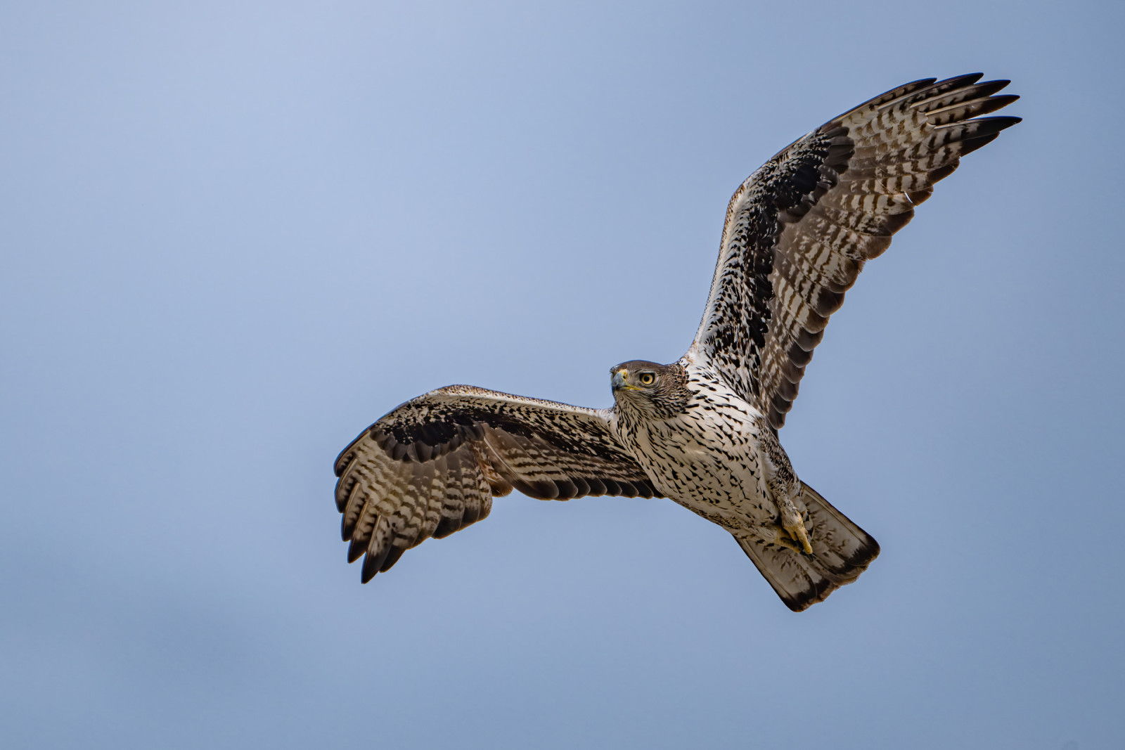
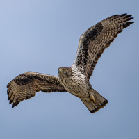
El Chorro is the gateway to Desfiladero de Los Gaitanes (the Vultures' Gorge), a stunning nature reserve at the confluence of three rivers, forming three large reservoirs. On the high cliffs of the gorge, there is a large breeding population of Grifo-comum and the famous hiking trail, the Caminito del Rey, snakes through it, following the Guadalhorce River. While the Caminito is amazing, you're probably better off visiting some less popular areas if you want to see as many birds as possible. Resident species include Poupa, Melro-azul, Chasco-preto, Cotovia-montesina, Chapim-de-poupa, Androinha-das-rochas, picanço-real, Toutinegra-de-cabeça-preta, Felosa-do-mato, Cruza-bico-comum, Chamariz-comum, Escrevedeira-de-garganta-preta, Cia, falcão-peregrino, Águia-real and the rare Águia de Bonelli. In summer and during migration, they're joined by Abelharuco-comum, Andorinhão-real, Andorinha-dáurica, Picanço-barreteiro, Bútio-vespeiro, Águia-calçada, Águia-cobreira and more. There are also Spanish ibex in the reserve and occasionally, Abutre do Egipto and Black Vulture are seen. Some of the best viewpoints for birding in the reserve include Conde de Guadalhorce Dam Viewpoint, Mirador de las Buitreras and Tajo del Cabrero, with the routes and other locations detailed in a link below. You'll get the most out of a day of birding here if you drive around to different trails and viewpoints.
Detalhes
Acesso
By train: You can go direct from Málaga María Zambrano railway station to El Chorro, which takes 40 to 50 minutes. A shuttle bus leaves from a stop near the station and takes you to the start of a trail leading to the Caminito del Rey and other routes.
By car: Follow the A-357 and leave at Ardales to follow signs to El Chorro along the MA-5403. Alternatively, from Málaga, take the A-357, the A-343 to Valle de Abdalajís and then the MA-4401 to El Chorro.
Details of routes to take around the reserve are in the link below.


 ) para inserir nomes de aves no seu idioma. Os nomes das aves serão traduzidos automaticamente para outros utilizadores!