Descrição
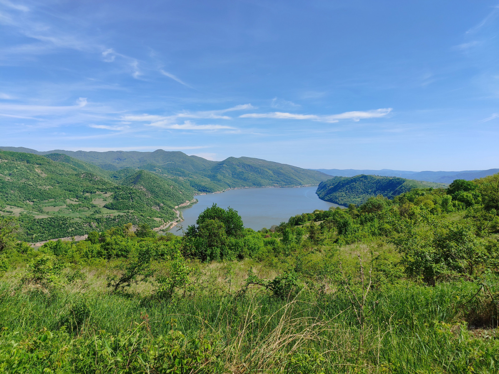
This is a 19 km long section of till 1980s the main regional route. Nowadays mostly abandoned, the Forgotten Road connects the village of Boljetin and the hamlet of Kožica, at first (coming from Boljetin) passing through meadows interspersed with oak groves and orchards, and further north, through dark and old beech forests. My usual way of visiting this site is to start the morning at Boljetinska River Canyon (by the Boljetin Village) and then to return driving upriver.
The turn off from the main road is marked for Boljetin (44.540039°N, 22.030813°E), and it comes soon after one of the tunnels – be sure not to overshoot it. After the Boljetin turn off (the sothern "P" at the map), the road goes down until you reach a small bridge, marked with the international Danube cycling route sign post. The Forgotten Road is also the detour no. 12 of the EuroVelo 6 cycling route.
You can park by the side and check the Boljetinska River Canyon (1) for the Melro-d'água that breeds there and with some luck, you may even encounter a Cia, or a Androinha-das-rochas among the multitude of Andorinho-dos-beirais s.
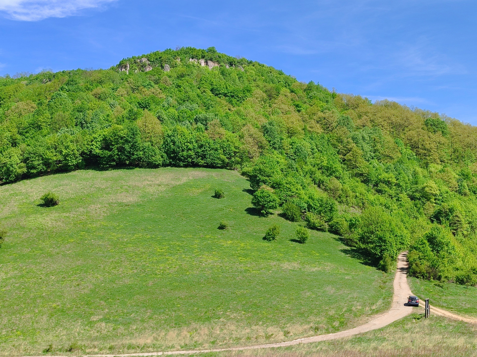
From there, follow the cycling route towards Kožica/Golubac, cross the bridge (2) and continue uphill. This is a productive area of mostly open habitats, where easy species here are Bico-grossudo, Papa-moscas-cinzento, Picanço-de-dorso-ruivo, Cotovia-pequena, Papa-figos, Rola-comum. Somewhat harder but realistic finds may include Sombria, Andorinha-dáurica and chapim-sombrio.
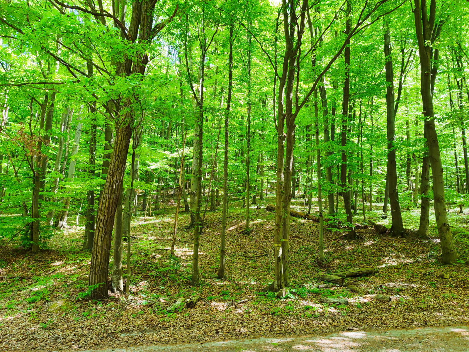
After 8 kilometres, you will reach the pass (3) and, at 510 m a.s.l., the highest section of the Forgotten Road where there is a Y junction, left for the Šomrda Reserve (dirt track), right for Kožica Hamlet (and, farther upriver, Dobra) – keep right down the northern slope and into the forest for the next 11 kilometres.
The higher beech forest is where I found the best woodpeckers, such as Pica-pau-de-dorso-branco, Pica-pau-preto and Pica-pau-cinzento. Pica-pau-mediano and Pica-pau-malhado-pequeno were mostly in lower, oak sections. Beside woodpeckers, look out for Trepadeira-comum, Felosa-assobiadeira, Papa-moscas-de-colar, Chapim-palustre and Pombo-bravo.
Finally, you reach the Danube riverbank (at 90 m a.s.l.) and the good tarmac of the main road. Donji Milanovac, where the park HQ is situated, is at your right, while Dobra, Golubac, as well as Belgrade (about 155 km) are at your left.
Detalhes
Acesso
By car only. Park wherever you like, explore by walking, or further driving. For driving directions, zoom in on the map and click on the "P" (parking) sign.
In some sections (closer to the village of Boljetin), the Forgotten Road tarmac is heavily broken by hefty lorries full of beech tree trunks (however illegitimate, mostly legally logged within the park), while in the northern, forested section, it is potholed, but not too bad.
Terreno e Habitat
Floresta , Montanha , Árvores e arbustos dispersos , Campina , PlanaltoCondições
Montanhoso , RochosoCaminho circular
Nãoé útil um telescópio?
Pode ser útilBoa temporada de observação de aves
Primavera , VerãoMelhor hora para visitar
Migração da primavera , Primavera , Verão , Migração de outonoRota
Estrada pavimentadaCaminho dificil
ExtenuanteAcessível por
CarroAbrigo/plataforma deobservação de aves
NãoInformação extra
The riverside town of Golubac (130 km or two hours’ drive from Belgrade) is the entrance point to the area. Almost every village between Golubac and the next town of Donji Milanovac (a further 60 km) offers rooms to let, but petrol stations are to be found only in the towns.
In the village of Dobra (by the upstream end of the tour) there is a guest house Artemida (400 m from the Danube) and the family pension Cvetković (on the bank of the Danube), and 6 km west of Dobra, on the bank of the Čezava river Camp Asin is located, so you can spend the night right there and go birding the next day at the crack of dawn.
The asterisk marks the Lepenski Vir Museum of an important Mesolithic archaeological site housing a large village with unique stone head-sculptures created 8000 years ago.
Ligações
- Guide to birding the Forgotten Road in the Djerdap National Park
- eBird Boljetinska River Canyon
- eBird the southern section
- eBird the northern section
- Djerdap National Park authorities
- Free map app (iOS and Android)


 ) para inserir nomes de aves no seu idioma. Os nomes das aves serão traduzidos automaticamente para outros utilizadores!