Descrição
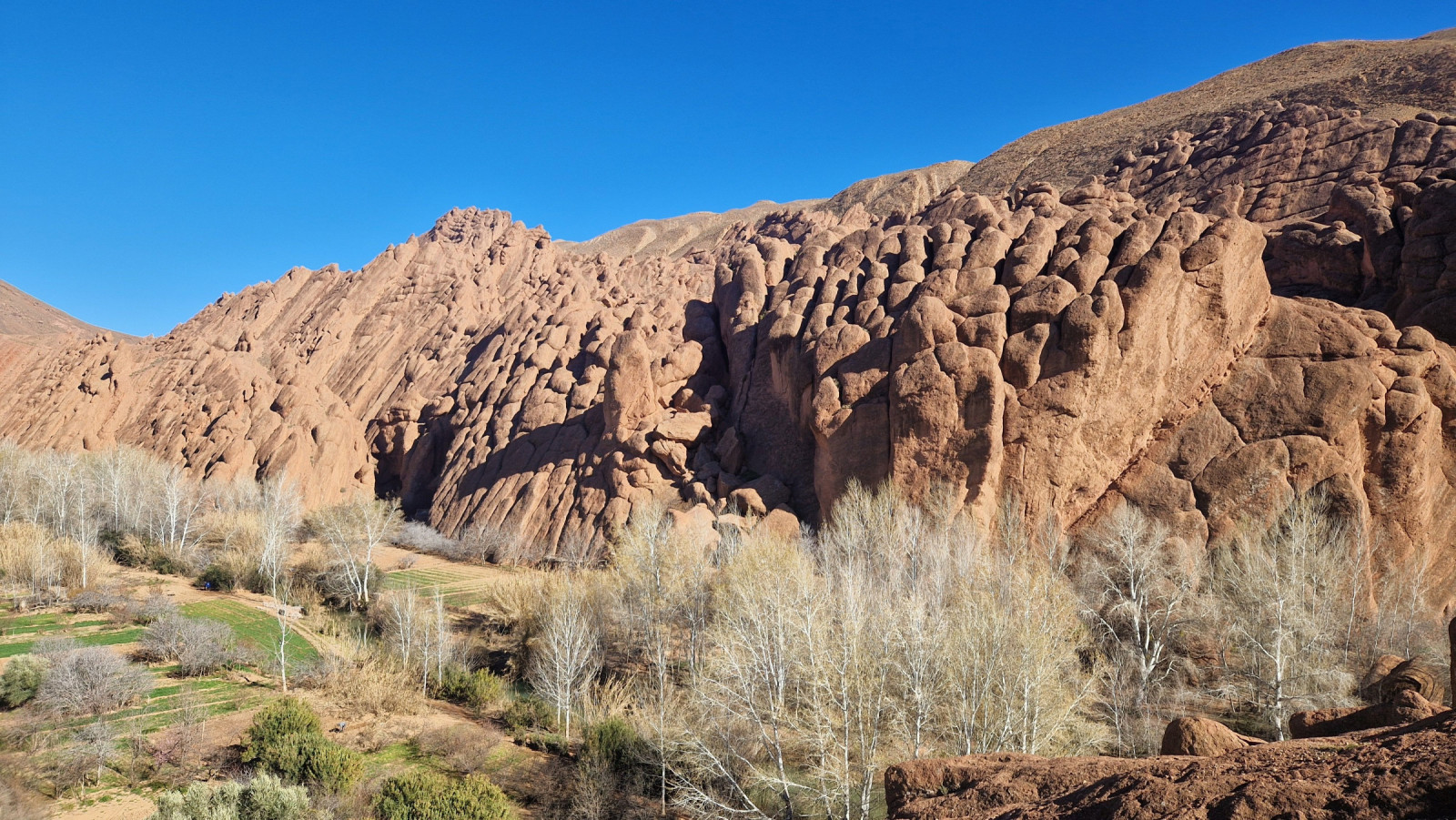
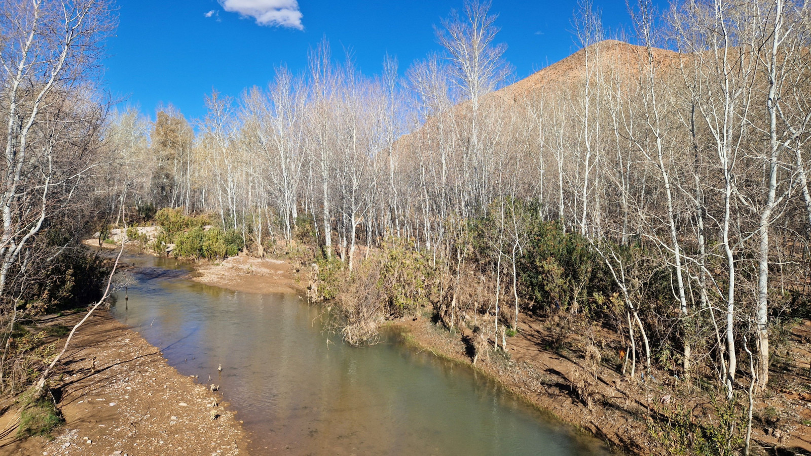
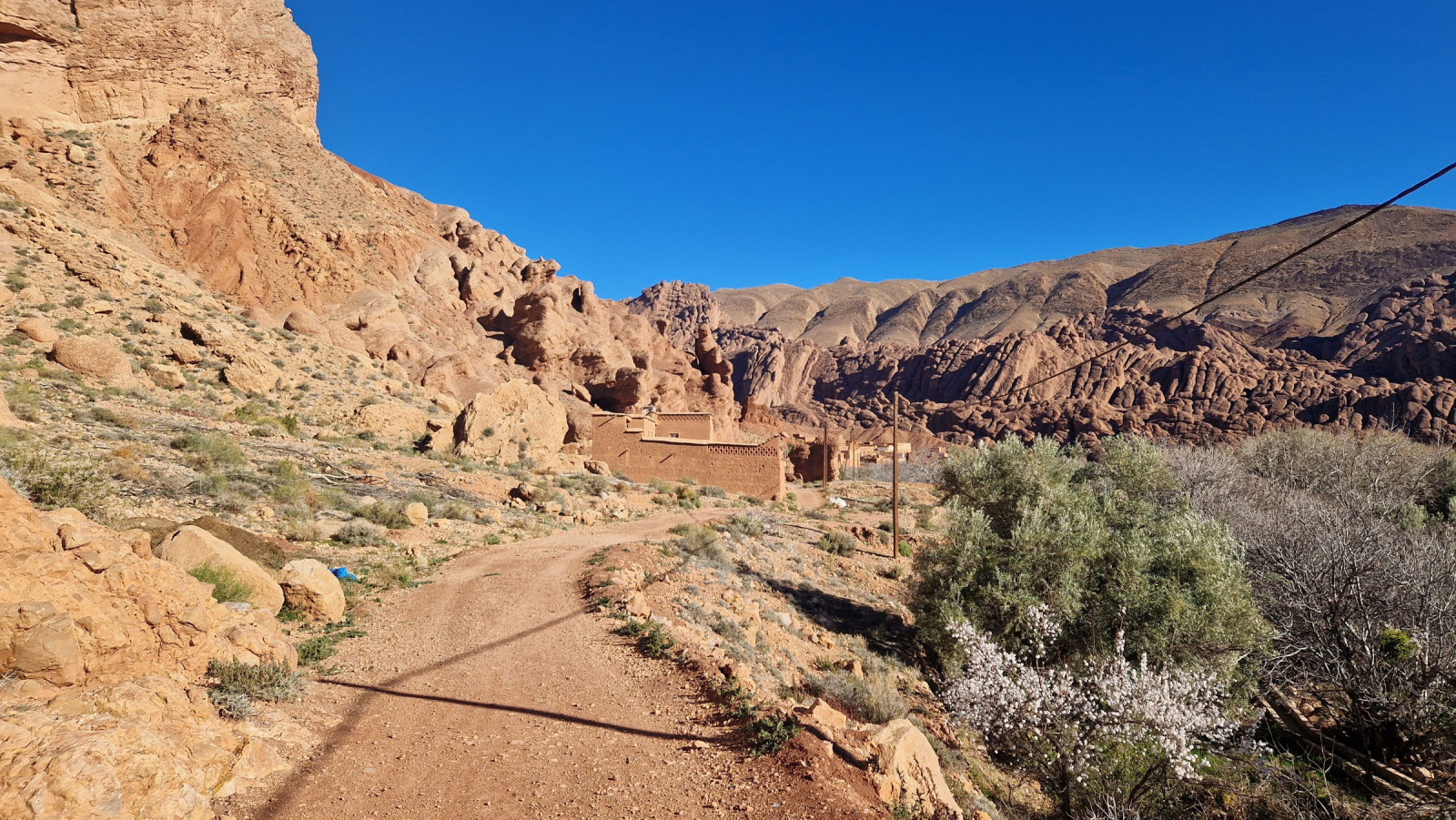
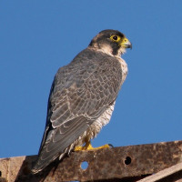
A spectacular valley, especially in spring (March-April), with beautiful landscapes. The Oued Dades River flows through the valley, its banks dotted with agricultural land: fields and orchards. The dry, rocky slopes of the valley are sparsely covered, but at the junction of these two habitats, you can see many interesting bird species. Following the path between the villages of Aït Arbi and Aït Ouglif, you'll pass a nesting area of Falco-tagarote and Búteo-mouro. In the bushes and in the valley, birds typical of this region: Escrevedeira-de-garganta-preta, Pica-pau-malhado-grande, Chapim-azul-africano, Tuta-negra, Rola do Senegal and Perdiz-moura.
Detalhes
Acesso
The Dades Gorge is located north of the town of Boumalne. First, it's worth stopping at the valley Monkey Fingers viewpoint (see the map). It can be crowded, but it's also a good vantage point for birds flying through the valley. Then, you can park your car at the bridge near the village of Aït Arbi. Press a P on the map for directions to a parking spot.
Terreno e Habitat
Árvores e arbustos dispersos , Montanha , Rio , AgriculturaCondições
Montanhoso , Rochoso , Seco , Paisagem aberta , MontanhosoCaminho circular
Simé útil um telescópio?
Pode ser útilBoa temporada de observação de aves
Durante todo o anoMelhor hora para visitar
Primavera , Migração da primaveraRota
Estrada pavimentada , Caminho estreito , Estrada não pavimentada , Caminho largoCaminho dificil
FácilAcessível por
PéAbrigo/plataforma deobservação de aves
NãoInformação extra
The walking route indicated on the map is about 3,5 km. The return along the river is a very narrow path, you have to walk a bit by feel along the river back to the car (or return by the asphalt road).


 ) para inserir nomes de aves no seu idioma. Os nomes das aves serão traduzidos automaticamente para outros utilizadores!