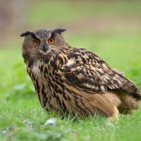
Descrição
The Kühkopf is an island created by the Upper Rhine and one of its oxbow lakes, which was created in 1829 when the Rhine was straightened out. Natural dynamics combined with high structural diversity are the basis for an extraordinary wealth of species. The various species lists also show an extremely high proportion of particularly endangered species.
Detalhes
Acesso
Bus: Bus routes 28, 41, 48, K62 to the Riedstadt-Leeheim Bensheimer Hof stop. Parking lot in front of the floodplain forest. Click on the P in the map to get directions. A tour of the Kühkopf island on the Rhine leads mostly over the old summer dykes and is around 17 kilometers long. On the map an 18 km walking trail is shown, with the possibility for a shortcut halfway.
Terreno e Habitat
Floresta , Rio , Campina , Terras húmidasCondições
Plano , Paisagem abertaCaminho circular
Simé útil um telescópio?
Pode ser útilBoa temporada de observação de aves
Durante todo o anoMelhor hora para visitar
PrimaveraRota
Estrada pavimentadaCaminho dificil
FácilAcessível por
Pé , BicicletaAbrigo/plataforma deobservação de aves
NãoInformação extra
The nature reserve is well equipped with approx. 60 kilometers of cycling and hiking trails. The best place to start is in the environmental education center in the north wing of the Gunterhausen estate. There you will find maps and other diverse information about the protected area.


