

Descrição
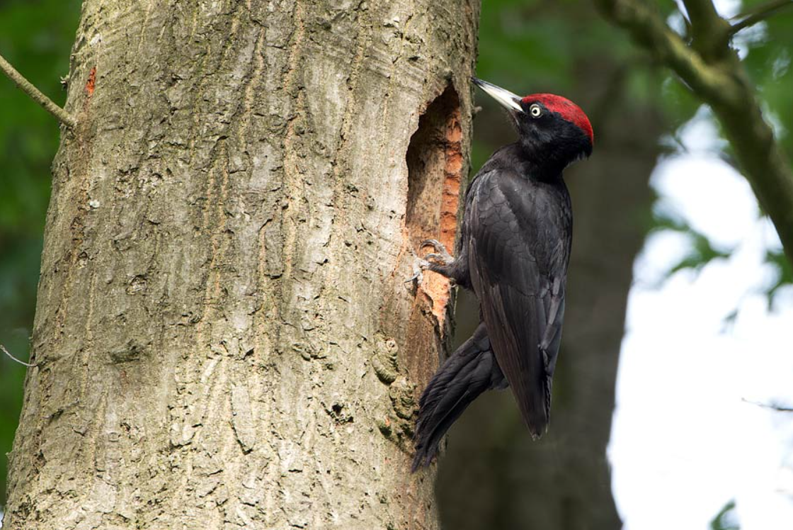
The small Massif des Voirons dominates the Chablais foothills and reaches its highest point at the Signal des Voirons, which rises to 1,480 meters. The massif is almost entirely covered in forest, with beech, fir, and spruce dominating the landscape. The massif is a protected area because of its ecological, faunal, and floral value. Birds you can encounter include Mocho-pigmeu, Mocho de Tengmalm, Coruja-do-mato, Pica-pau-preto, Trepadeira-azul, Galinhola, Quebra-nozes, Chapim-preto, peneireiro-de-dorso-malhado / peneireiro, Pica-pau-malhado-grande, Dom-fafe, Trepadeira-do-bosque, Cruza-bico-comum, Chapim-de-poupa, chapim-montês, and Ferreirinha-comum.
_________________________
Français: Le massif des Voirons est protégé par différentes mesures, ZNIEFF de type 1 et 2. C'est un site natura 2000, avec un arrêté de biotope. Le petit Massif de Voirons domine l’avant-pays chablaisien. ll s'agit d'un massif forestier de moyenne altitude (pessières, sapinières), peu morcelé.
Detalhes
Acesso
The Massif des Voirons lies in Haute-Savoie, France, just east of Geneva and north of the Vallée Verte. From Annecy or Chamonix, you can reach the area in about an hour by car. If you are coming from Geneva, the massif is only about 20 kilometers away. You can drive via Annemasse and then toward Boëge or Saxel, where several trailheads begin. You can also drive up to one of the parkings near the Signal des Voirons. Press a P on the map for directions. Public transport is limited.
Marked hiking trails vary from short walks to full-day treks. A popular route is the loop from Boëge, which takes about seven hours and climbs nearly 800 meters. The short circular walk to Signal des Voirons shown on the map is about 1,7 km and starts from one of the upper parkings. It is easy to extend this walk because there are many marked trails around.
_________________________
Français: Le massif des Voirons se situe en Haute-Savoie, à l'est de Genève et au nord de la Vallée Verte. Depuis Annecy ou Chamonix, on peut y accéder en une heure environ en voiture. Depuis Genève, le massif se trouve à une vingtaine de kilomètres. Boëge, Fillinges, Bonne sur Menoge, Saxel, Bons en Chablais, Habère Poche, Burdignin.


 ) para inserir nomes de aves no seu idioma. Os nomes das aves serão traduzidos automaticamente para outros utilizadores!