Opis
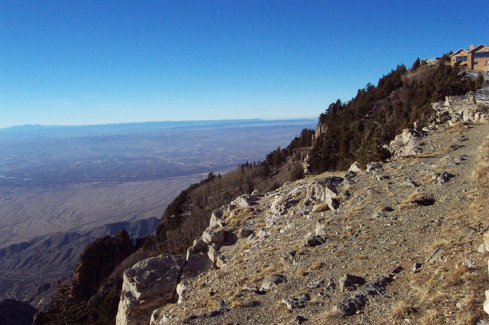
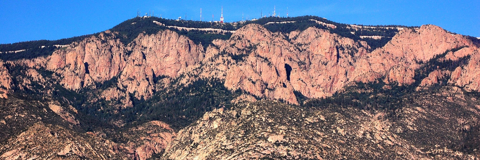
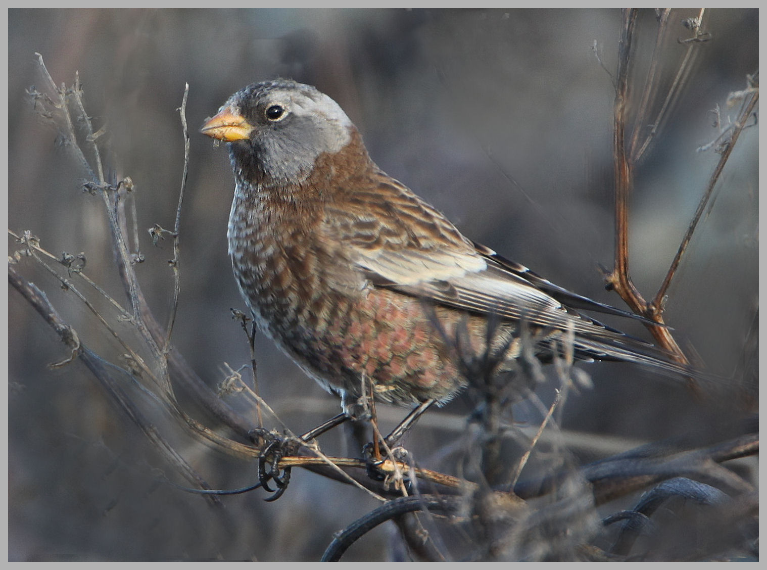
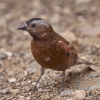
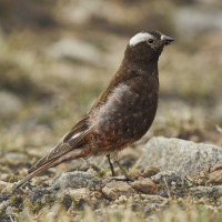
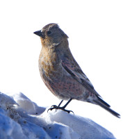
The Sandia Mountains are a small range east of Albuquerque. The mountains do not have a summit. Instead, the high point is a long ridge called the Sandia Crest. The site is best known to birders as a place to see three species of rosy-finch (Gray-crowned Rosy-Finch, Black Rosy-Finch and Brown-capped Rosy-Finch) in winter, at and near the parking lots and feeders at the summit.
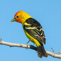
The winding road to the top passes through various habitats from pinyon-juniper to coniferous forest, adding to the variety of a visit. The road is usually plowed and passable, but caution is advised after heavy snow. At picnic areas and other stops on the way up the mountain, look for birds such as Red-naped Sapsucker, Plumbeous Vireo, Western Scrub-Jay, Juniper Titmouse, Pygmy Nuthatch, Virginia’s Warbler, Spotted Towhee, and Western Tanager.
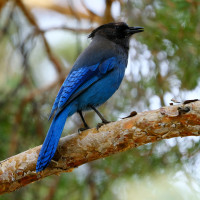
In breeding season, birds at Sandia Crest include Band-tailed Pigeon, White-throated Swift, American Three-toed Woodpecker, Cordilleran Flycatcher, Steller’s Jay, Clark’s Nutcracker, Mountain Chickadee, Brown Creeper, Ruby-crowned Kinglet, Townsend’s Solitaire, Hermit Thrush, Grace’s Warbler, Yellow-rumped Warbler, Dark-eyed Junco, Red Crossbill, and Pine Siskin.
Szczegóły
Dostęp
From Albuquerque, take I-40 east to the Tijeras Exit and then NM-14 north to the junction with NM-536. Take NM-536 (Sandia Crest National Scenic Byway) to the Sandia Crest. This road has many switchbacks but is otherwise a well-maintained paved road. The highway ends at the Sandia Crest which has a restaurant, gift shop, handicap-accessible viewing, and toilets. Click on a P in the map for directions.
 ) aby wstawić nazwy ptaków w swoim języku ojczystym. Nazwy ptaków zostaną automatycznie przetłumaczone dla innych użytkowników!