

Opis
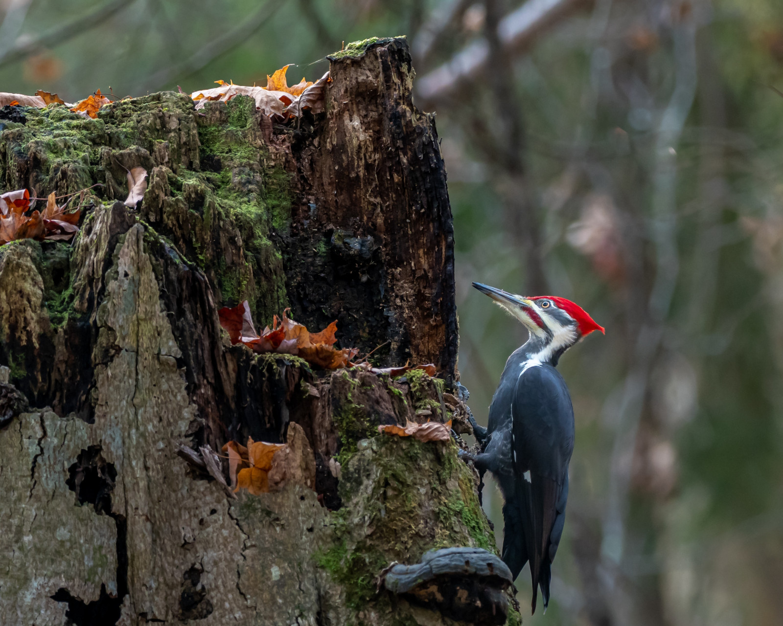
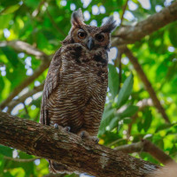
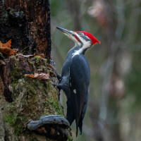
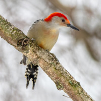
Fort Snelling State Park is a picturesque area with breathtaking views of the Mississippi and Minnesota Rivers. The park's diverse ecological zones provide habitats for a variety of bird species, making it an excellent spot for birding. You can spot a range of birds, including Bald Eagle, Red-bellied Woodpecker, Great Horned Owl, Black-capped Chickadee, Mallard and Spotted Sandpiper. The park's trails and picnic areas make it a relaxed destination for birdwatchers and nature enthusiasts.
Szczegóły
Dostęp
To get to Fort Snelling State Park, you can take the Hwy 55 exit from the MSP airport. The park has ample parking space available, and you can park your vehicle near the visitor center or picnic area. Click on the P in the map for directions or coordinates. Exploring the park on foot is the best way to appreciate its natural beauty and birdlife. The park has several hiking trails, ranging from easy to difficult, that wind through the diverse ecological zones. You can also bike on designated trails, rent canoes or kayaks, or fish in the rivers. The park has several picnic areas and historical sites, which you can explore at your leisure.
Teren i siedlisko
Plaża , Tereny podmokłe , Rzadkie drzewa i krzewy , Rzeka , Miasto/wieś , Błota , LasWarunki
Płaski , Bagienny , Możliwy wysoki poziom wody , SuchyTrasa dookoła
TakCzy luneta będzie przydatna ?
Może być przydatnaUdany sezon obserwacyjny
Przez cały rokNajlepszy czas na wizytę
Wiosenne migracjeTrasa
Wąski szlak , Droga utwardzona , Szeroka ścieżkaPoziom trudności szlaku pieszego
Średnio wymagający spacerDostępne
Pieszo , Rower , Samochód , Wózek inwalidzki , ŁódźCzatownia/platforma obserwacyjna
NieDodatkowe informacje
If you're just passing through the MSP airport and have a few hours to spare, you can still explore Fort Snelling State Park and enjoy some birding. The park is located next to the airport, and you can get there within a few minutes by car or taxi. Once you're there, you can take a short walk on one of the park's trails or visit the picnic areas for a quick birding session. Even a brief visit can offer a chance to spot several bird species that are unique to the area.

 ) aby wstawić nazwy ptaków w swoim języku ojczystym. Nazwy ptaków zostaną automatycznie przetłumaczone dla innych użytkowników!