

Opis
Ness Islands and Whin Park form one of the most pleasant green areas in Inverness, combining river channels, small wooded islands, open parkland and quiet walking paths. The River Ness flows through the area, creating a mix of habitats that attract a wide variety of birds throughout the year.
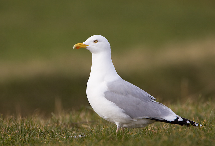
Along the river, you can regularly see species such as czapla siwa, nurogęś, krzyżówka and łabędź niemy. With a bit of luck, zimorodek and gągoł may also appear along the quieter stretches of the river. The wooded islands are home to birds like bogatka (zwyczajna), modraszka, rudzik, kos (zwyczajny), strzyzyk zwyczajny, pełzacz leśny and zięba, while dzięcioł duży is sometimes heard or seen in the trees.
In winter, the river becomes especially interesting with more waterfowl gathering, while spring and summer bring active songbirds and nesting behaviour. The open grassy areas of Whin Park also attract gawron, kawka and grzywacz.
What makes this place special is how easy and relaxing birding feels here. You can walk slowly along the river, cross small bridges between the islands, and observe birds at close range without leaving the city. It’s perfect for a short, enjoyable birding session.
Szczegóły
Dostęp
Ness Islands and Whin Park are located just southwest of Inverness city centre, along the River Ness. The area is very easy to reach. By foot, it’s about a 20–25 minute walk from the city centre along the riverside paths. By car, you can park near Whin Park, where there is a dedicated parking area. Street parking is also available nearby. Public transport is convenient, with local buses stopping close to Bught Park and Whin Park, from where it’s only a short walk to the islands.
The area is best explored on foot. Well-maintained paths and small bridges connect the islands, making it easy and enjoyable to walk around. For birdwatching, allow 1–2 hours, though you can stay longer for a relaxed visit. The route shown on the map is about 6,5 km out and back.
Teren i siedlisko
Las , Park , Rzeka , Miasto/wieś , Łąka , Rzadkie drzewa i krzewyWarunki
Płaski , Otwarty krajobrazTrasa dookoła
TakCzy luneta będzie przydatna ?
Może być przydatnaUdany sezon obserwacyjny
Przez cały rokNajlepszy czas na wizytę
Jesienne migracje , Wiosenne migracjeTrasa
Droga utwardzona , Szeroka ścieżkaPoziom trudności szlaku pieszego
ŁatwyDostępne
Pieszo , RowerCzatownia/platforma obserwacyjna
NieDodatkowe informacje
Early morning and late afternoon are the best times for bird activity, especially along quieter sections of the river. The area is very accessible and suitable for all levels, including beginners.
Ness Islands are especially good for photography thanks to the combination of water reflections, wooden bridges and close bird encounters. The park can be busy on weekends, but quieter corners are always available if you explore a bit further along the paths.


 ) aby wstawić nazwy ptaków w swoim języku ojczystym. Nazwy ptaków zostaną automatycznie przetłumaczone dla innych użytkowników!