

Opis
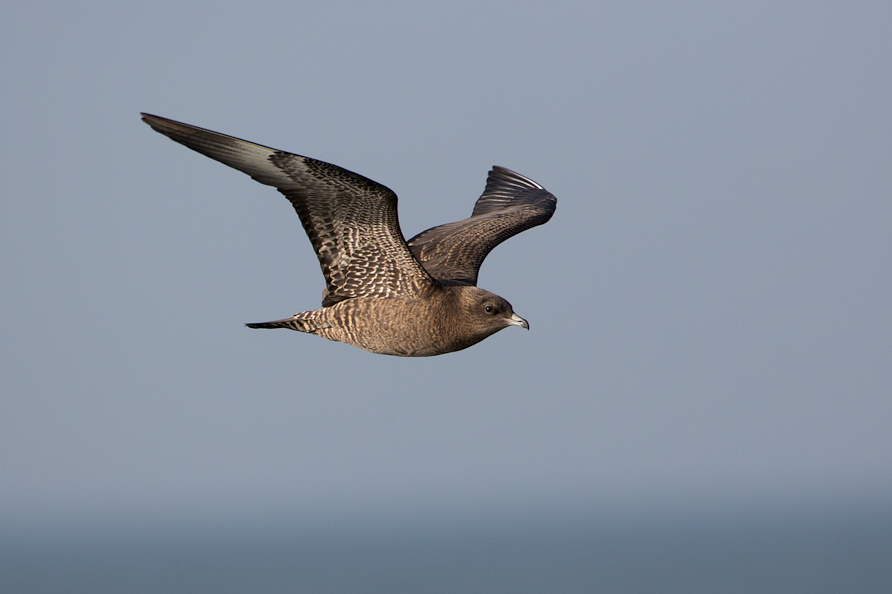
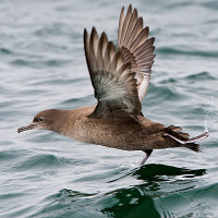
Dodman Point (or locally called The Deadman), is the South Cornwall coasts highest sea cliffs rising up to 374 feet (114 meters), the point is dominated by a 20 foot granite cross, once erected as a religious symbol it is now used as a ship navigational aid. Just inland of the cross is an old coastal watchpoint built in the the late 1700's, living testament to the sensational long distance sea views available here. Whilst the headland is primarily a seawatching point, it does have a good list of landbirds as well such as gajówka, świerszczak, krogulec and kapturka. For those seawatching markaczka, edredon, nur rdzawoszyi and passing nawałnik burzowy, burzyk balearski and wydrzyk tęposterny depending on season and weather/wind direction.
Szczegóły
Dostęp
The A390 main road runs between the village of Grampound (to the West) and the town of St Austell (to the East). Leave Grampound Eastwards on A390 to St Austell. Soon after leaving Grampound look for Right turn sign (often obscured) and turn Right using middle turning lane, this road with high hedges becomes narrow and eventually becomes the B3287, (*A) continue on this road and turn Left signed Portholland/Caerhays/Polmassick Vineyard. At next junction turn Left signed Polmassick/St Ewe, this road becomes very narrow. Continue through Polmassick (Note village sign spells it Polmassick), continue on narrow roads until junction and turn Right signed Gorran/Gorran Haven, this road now widens. Continue on this road and at next junction (with large trees on a bend) turn Right at small sign to Penare. At crossroads go straight ahead signed Penare, this road now narrows, at next farm entrance road bends sharp to the Right, continue on this narrow road (Note sea comes into view). This road bends sharp to the Right, road passes through farm buildings, turn Right at sign Single Track Road With Passing Places, National Trust car park (Fee Payable) is just on the Right. If traveling from St Austell on A390, at village of Hewas Water turn Left signed Tregony B3287, continue on B3287, at next junction turn Right signed Tregony B3287/St Mawes (A3078), at next junction turn Left signed Tregony/St Mawes B3287 and follow from (*A) above.
Teren i siedlisko
Rzadkie drzewa i krzewy , Łąka , Morze , Rolnictwo/uprawy , Kanion/klifWarunki
Płaski , Otwarty krajobraz , PagórkowatyTrasa dookoła
TakCzy luneta będzie przydatna ?
TakUdany sezon obserwacyjny
Przez cały rokNajlepszy czas na wizytę
Zima , Wiosenne migracje , Jesienne migracje , Jesień , WiosnaTrasa
Droga utwardzona , Szeroka ścieżka , Droga nieutwardzona , Wąski szlakPoziom trudności szlaku pieszego
Średnio wymagający spacerDostępne
Pieszo , Rower , SamochódCzatownia/platforma obserwacyjna
NieDodatkowe informacje
The circular walk indicated on the map is about 4 km.


 ) aby wstawić nazwy ptaków w swoim języku ojczystym. Nazwy ptaków zostaną automatycznie przetłumaczone dla innych użytkowników!