


Opis
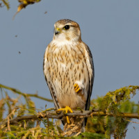
Cross Fell is the highest mountain in the Pennine Hills of Northern England. The summit, at 893 metres (2,930 ft), is a stony plateau. The area is important for its wide variety of upland habitats, especially blanket bog, sub-montane and montane heath, montane bryophyte heath, limestone grassland and flushes, and for the fauna and flora that they support. More than 40 species of birds breed in the area, including drzemlik, sokół wędrowny, uszatka błotna, siewka złota, biegus zmienny, czajka, kulik wielki, brodziec piskliwy, krwawodziób, mornel and kszyk.
Szczegóły
Dostęp
Park in Kirkland. Click on the P on the map to get directions. From Kirkland you can walk up Cross Fell and make a 15 km a circular walk. See the Birdingplaces-map below. The walk begins in the village of Kirkland and takes you to the 893 metres (2,930 ft) summit using bridleways and the Pennine Way. From the summit there are magnificent views of the Eden Valley, the Solway Firth, the Scottish mountains and the mountains of the Lake District. This is a challenging walk on mostly well defined paths, but put on sturdy walking shoes. It's best attempted in fine weather as the area can be quite inhospitable in rough conditions.


 ) aby wstawić nazwy ptaków w swoim języku ojczystym. Nazwy ptaków zostaną automatycznie przetłumaczone dla innych użytkowników!