


Opis
The Bere Peninsula has the River Tamar estuary on it's Western side and the River Tavy estuary on it's South Eastern side. The site was known for Tin, Silver Lead Ore and Arsenic mining in the past and more recently better known for fruit and flower production. The walk starts by the railway station in Bere Ferrers (Bere here meaning a woodland for pigs), crossing farm fields (livestock may be present) to Thorn Point giving wide views of the Tamar estuary. The walk continues along farm wooded hedges and finishes by returning along a quiet narrow road back to the start point.
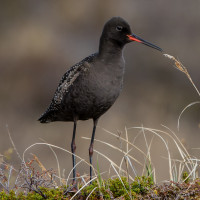
During World War II large areas of coastal East Anglia were flooded to help prevent invasion, for 100 years szablodziób were missing as a British breeding bird, in 1947 a very small number of szablodziób bred on these flooded areas for the first time, during following Winters some of those British breeding birds and continental migrants were to be found on the Tamar estuary and so it still is today. Other birds to be found in Winter are szlachar, Płaskonos, rożeniec, bernikla obrożna, świstun, cyraneczka, ostrygojad, siewka złota, rycyk, szlamnik, biegus zmienny and siewnica, sometimes in small numbers but during periods of freezing conditions further North numbers can be greater.
Szczegóły
Dostęp
From Plymouth (to the South) leave on A386 signed Tavistock, on leaving built up area road goes through moorland. Turn Left at sign Bere Alston 2 miles/Milton Combe/Lopwell/Moristow/Nature Reserve, pass over cattle grid (WARNING open moorland livestock may be in road). At next junction follow sign to Milton Combe/Bere Alston, continue on this road and pass over cattle grid (livestock no longer in road). Road starts to narrow pass straight through next crossroads signed Buckland Monachorum/Bere Alston, at next junction turn Right and immediately Left signed Buckland Mon./Bere Alston. Continue on this road and turn Left at sign 2•0m 6'-6' Bere Alston, on reaching wooded area the road gets extremely narrow with limited passing places. At bottom of hill road bends to Left and passes over narrow Denham Bridge, road climbs through woodland, at next crossroads continue straight ahead signed Bere Ferrers 3/Bere Alston. At next junction turn Left, shortly turn Left signed Bere Ferrers (Note do not enter Bere Alston), continue on this road. On passing Bere Ferrers village sign turn Right signed Station/Tamar Valley Line, turn Right signed Clamoak/Weir Quay/Hole's Hole/Station/Tamar Valley Line, turn Left at sign Station/Tamar Valley Line, road bends to Left and park beside railway station (11 spaces).
Teren i siedlisko
Rzadkie drzewa i krzewy , Łąka , Dolina , Rzeka , Miasto/wieś , Rolnictwo/uprawy , Błota , Plaża , LasWarunki
Płaski , Pagórkowaty , Skalisty , Otwarty krajobraz , Możliwy wysoki poziom wody , Ślisko , BagiennyTrasa dookoła
TakCzy luneta będzie przydatna ?
TakUdany sezon obserwacyjny
Przez cały rokNajlepszy czas na wizytę
Zima , Wiosenne migracje , Wiosna , Jesień , Jesienne migracjeTrasa
Droga utwardzona , Szeroka ścieżka , Droga nieutwardzona , Wąski szlakPoziom trudności szlaku pieszego
Średnio wymagający spacerDostępne
Pieszo , Rower , SamochódCzatownia/platforma obserwacyjna
NieDodatkowe informacje
The circular route indicated on the map is about 5 km.


.jpg)
 ) aby wstawić nazwy ptaków w swoim języku ojczystym. Nazwy ptaków zostaną automatycznie przetłumaczone dla innych użytkowników!