Opis
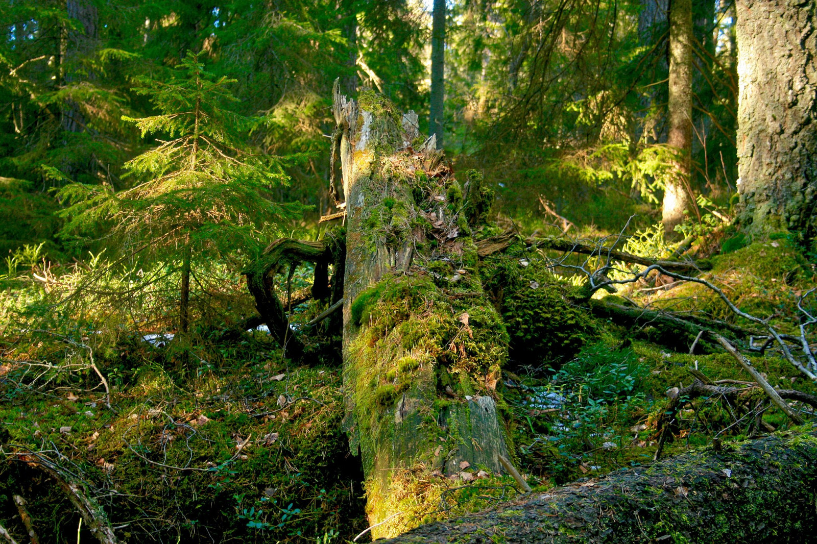
Tyresta National Park is the largest area of ancient forest in the southern part of Sweden. The park is surrounded by Tyresta Nature Reserve, and together they contain 5,000 hectares with 55 km of walking trails. The forest is characterized by thick, knotty pines with centuries of growth and towering spruce trees with mosses and lichens. The forest cover is interrupted by rivers, lakes and ponds. Tyresta National Park has several entrances and areas to explore. Here we describe the area around Barnvagnsslingan loop, a 5 km circular walk from the main entrance.
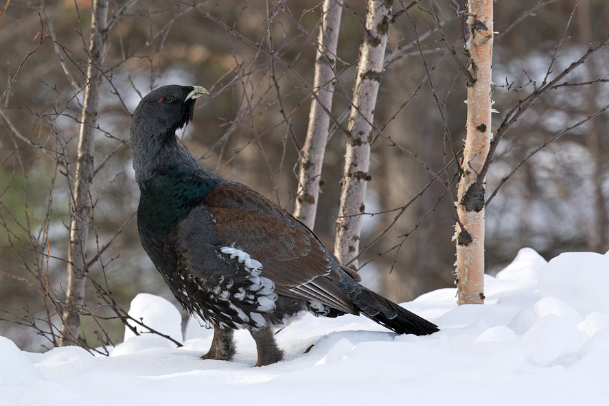
Breeding bird species in Tyresta National Park include głuszec, cietrzew, gągoł, cyraneczka, czernica, łabędź krzykliwy, nur czarnoszyi, perkoz rogaty, rybołów, czajka, muchołówka żałobna, cierniówka, brodziec piskliwy, samotnik, słonka, czarnogłówka (zwyczajna), kowalik, pełzacz leśny, lelek, krętogłów, żuraw and Trzmielojad.
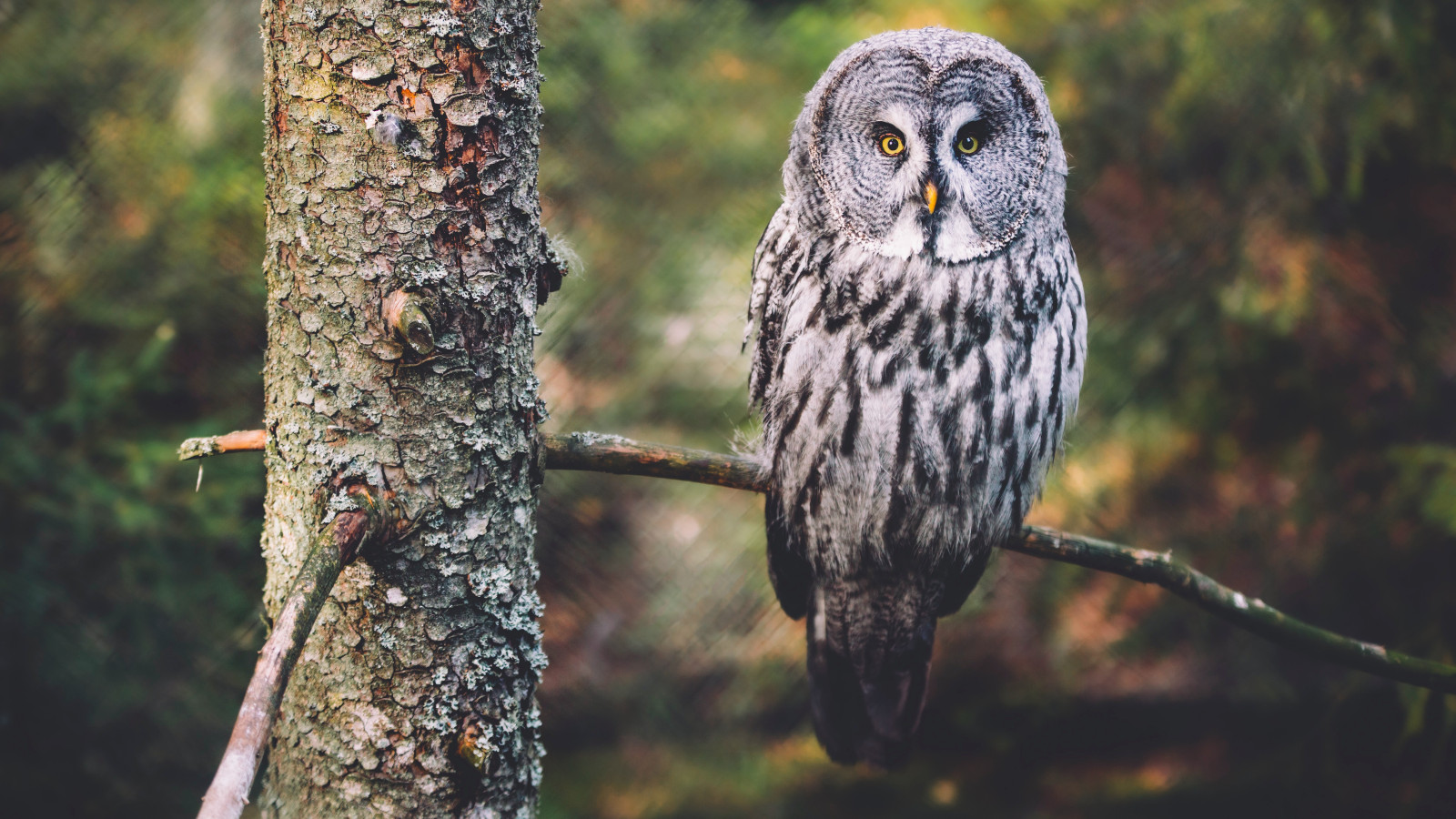
Species such as puszczyk mszarny and sóweczka are sometimes seen with luck. jarząbek is probably also a resident but very difficult to see. Otherwise there are species such as trznadel and gil which are regularly seen in the winter half of the year in particular. bielik is seen regularly.
Szczegóły
Dostęp
Tyresta National Park is only 20 kilometres from Stockholm city. Take route 73 from Stockholm toward Nynäshamn, exit toward Brandbergen, then follow the signs to Nationalpark. Click on the P in the map for directions.
Tyresta village and Nyfors are served by public transport. To visit via public transport, buses 807 and 809 depart from Gullmarsplan, and bus 834 from Haninge commuter train station. The name of the end station is Tyresta by.
From the entrance to the national park, a concrete path stretches across a meadow to the forest edge. From there a wooden boardwalk leads to a small gathering place beside Bylsjöbäcken stream. Here starts Barnvagnsslingan loop (5 km long, red markings) which is free of roots and rocks, and thus easy to walk. At some places it is quite steep, especially at the beginning. From this path you can explore several smaller side paths which are often best for birding. Near the parking is a visitor center, a cafe and toilets.


 ) aby wstawić nazwy ptaków w swoim języku ojczystym. Nazwy ptaków zostaną automatycznie przetłumaczone dla innych użytkowników!