Opis
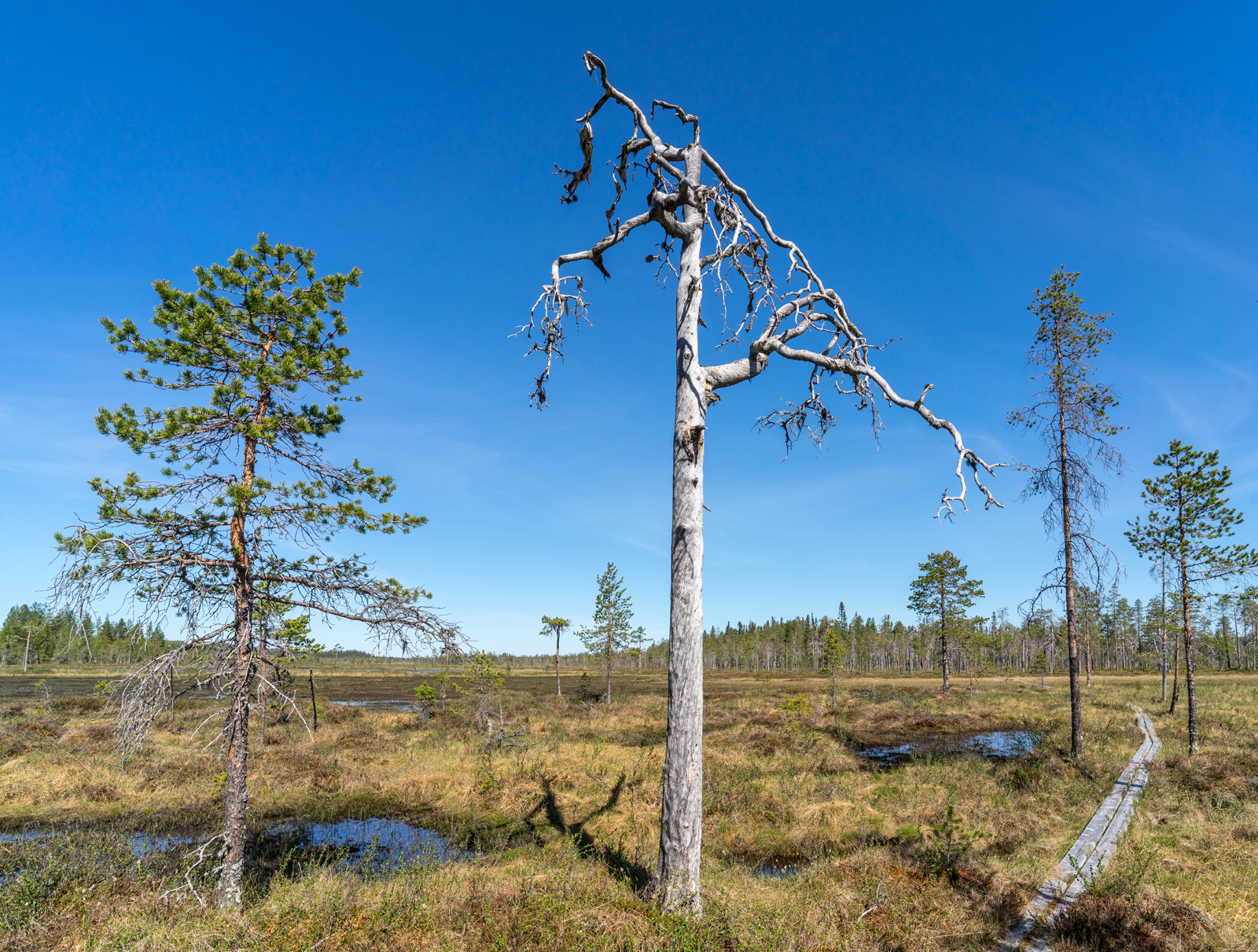
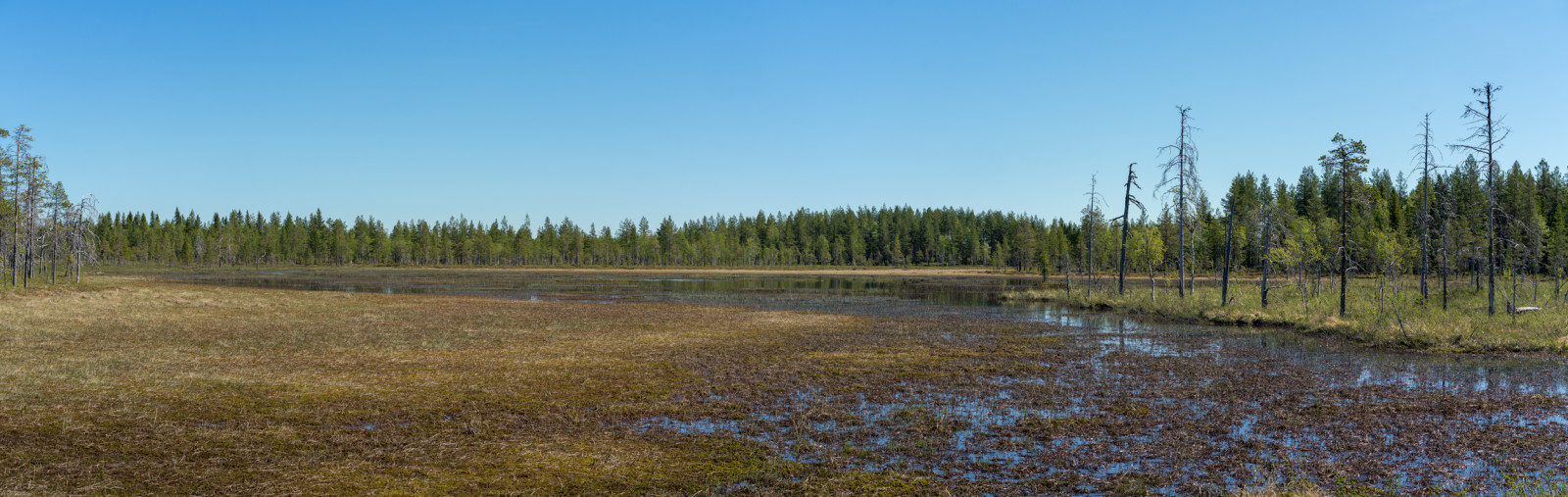
With over 900 hectares Mossaträsk-Stormyren is one of the county's largest forest and bog complexes. It is the mosaic of marshes and forests that makes the area so valuable. The wetland consists of two long narrow marsh arms to the northwest and two wider marsh arms to the southeast, where there are several islets.. The bird wealth is great both in terms of the number of species and individuals. The bog is on the so-called Ramsar list of the world's most protected wetlands.
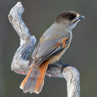
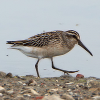
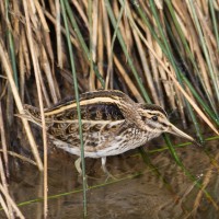
The bird life on the marsh is rich with breeding batalion, bekasik and biegus płaskodzioby. Other species that can been observed include łabędź krzykliwy, ges zbozowa, pardwa mszarna, kszyk, kulik wielki, kulik mniejszy, czajka, siewka złota, brodziec śniady, kwokacz, łęczak, sójka syberyjska, uszatka błotna, trznadel czubaty and kukułka. Best time for a visit is early in the morning from the end of May until the middle of June.
Szczegóły
Dostęp
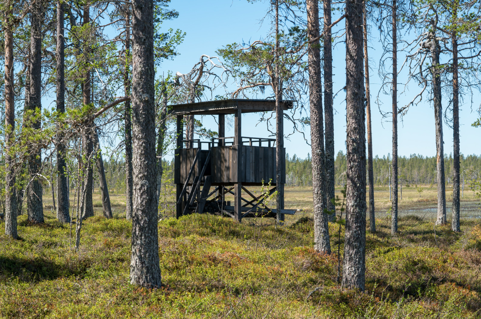
Mossaträsk-Stormyran is located west-northwest of Solberg and east of the Gulsele and Hällby reservoirs in the Ångerman River between Junsele and the Lapland border. There are three suitable roads into the area. The nature reserve's main entrance is signposted. From highway 90 between Junsele and the county border, turn off in Gulsele towards Degersjö. From this road, after about a mile, a forest road with signs Mossaträsk-Stormyran goes north to a parking lot south of the bog complex. If you come from Sagavägen (road 348) between Solberg-Åsele, there is a road sign that leads you towards the village of Degersjö, from where you then take the same forest road to the west and follow the signs to the turnpike. From here, a marked path leads up to a bog islet in its southwestern part. There is a bird tower on the northwestern part of that marsh islet.
From the east, you can also enter the reserve from the village of Mossaträsk. From highway 90 in Hälla take road 348 (Sagavägen) towards Örnsköldsvik to the village of Käl. There you turn right towards the villages of Sjö and Mossaträsk 3.9 km and then right again to the end of the road in the village of Mossaträsk. It can be difficult to find good parking there, but it is possible to park a couple of cars here. From here there is no path, but you have to follow a map and compass to the west for a shorter hike to the south-eastern part of the bog. Coming from Sagavägen (road 348) from Solberg, take the south exit at Käl as above.
Finally, there is also a way to get to the marsh from the west. From highway 90 between Junsele and the county border, take the exit just north of Gulkäl towards Nymyra (unsigned and less good road approx. 2 km). After Nymyra, continue southeast and after about 1.5 km turn left (Jaktstugevägen), drive 1.7 km, and turn right towards Hästberget to the end of the road. There you can camp just outside the reserve. Here you then go down to the north-western part of the bog.
Click on a P in the map for directions. Don't forget to bring waterproof shoes and insect repellent!
Teren i siedlisko
Las , Tereny podmokłe , WrzosowiskoWarunki
BagiennyTrasa dookoła
NieCzy luneta będzie przydatna ?
NieUdany sezon obserwacyjny
Wiosna , Lato , JesieńNajlepszy czas na wizytę
WiosnaTrasa
Droga nieutwardzona , Szeroka ścieżkaPoziom trudności szlaku pieszego
Średnio wymagający spacerDostępne
PieszoCzatownia/platforma obserwacyjna
TakDodatkowe informacje
Photos Mossaträsk-Stormyran by SiberianJay, CC BY-SA 4.0, https://creativecommons.org/licenses/by-sa/4.0, via Wikimedia Commons


 ) aby wstawić nazwy ptaków w swoim języku ojczystym. Nazwy ptaków zostaną automatycznie przetłumaczone dla innych użytkowników!