
Opis
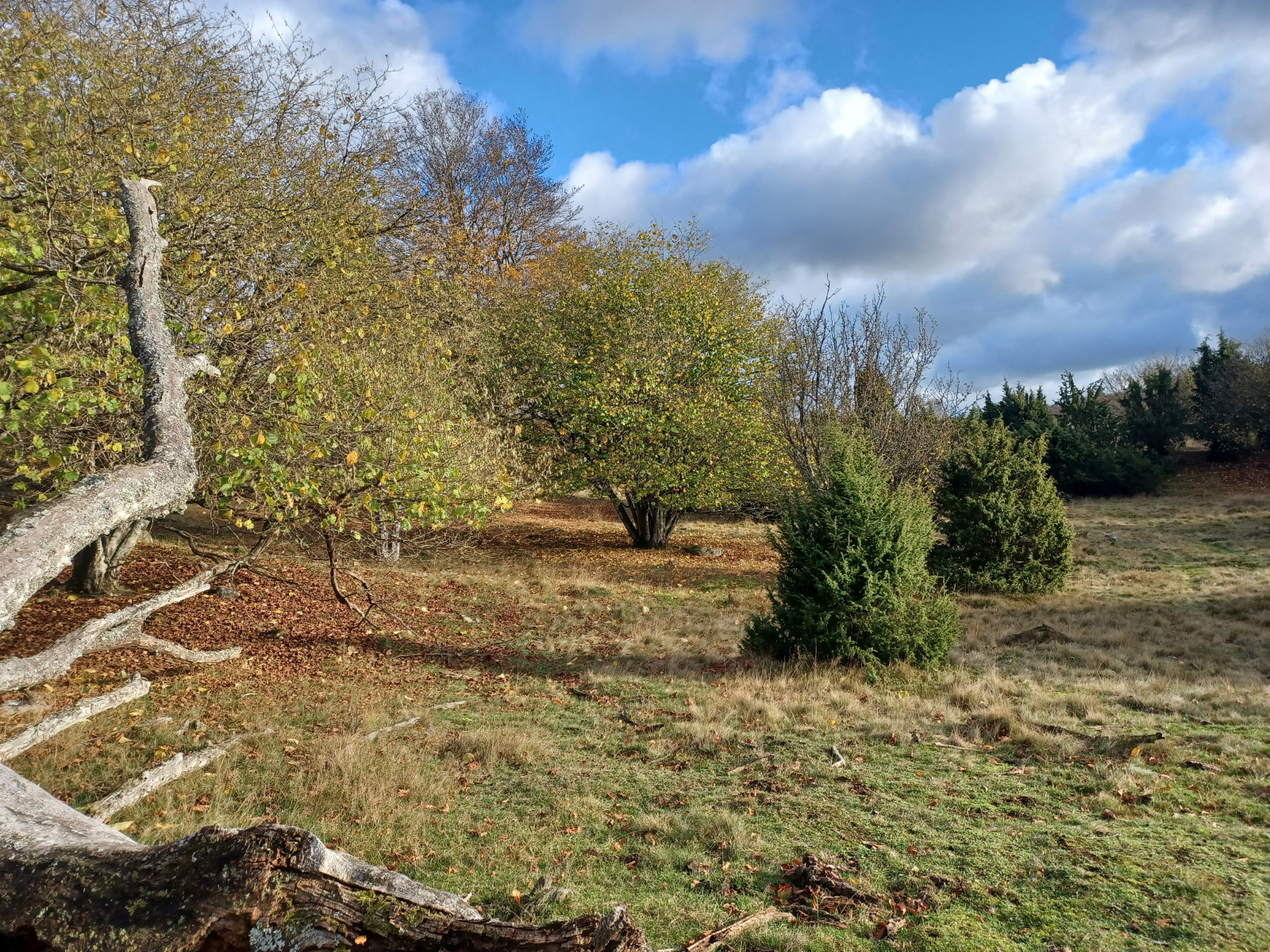
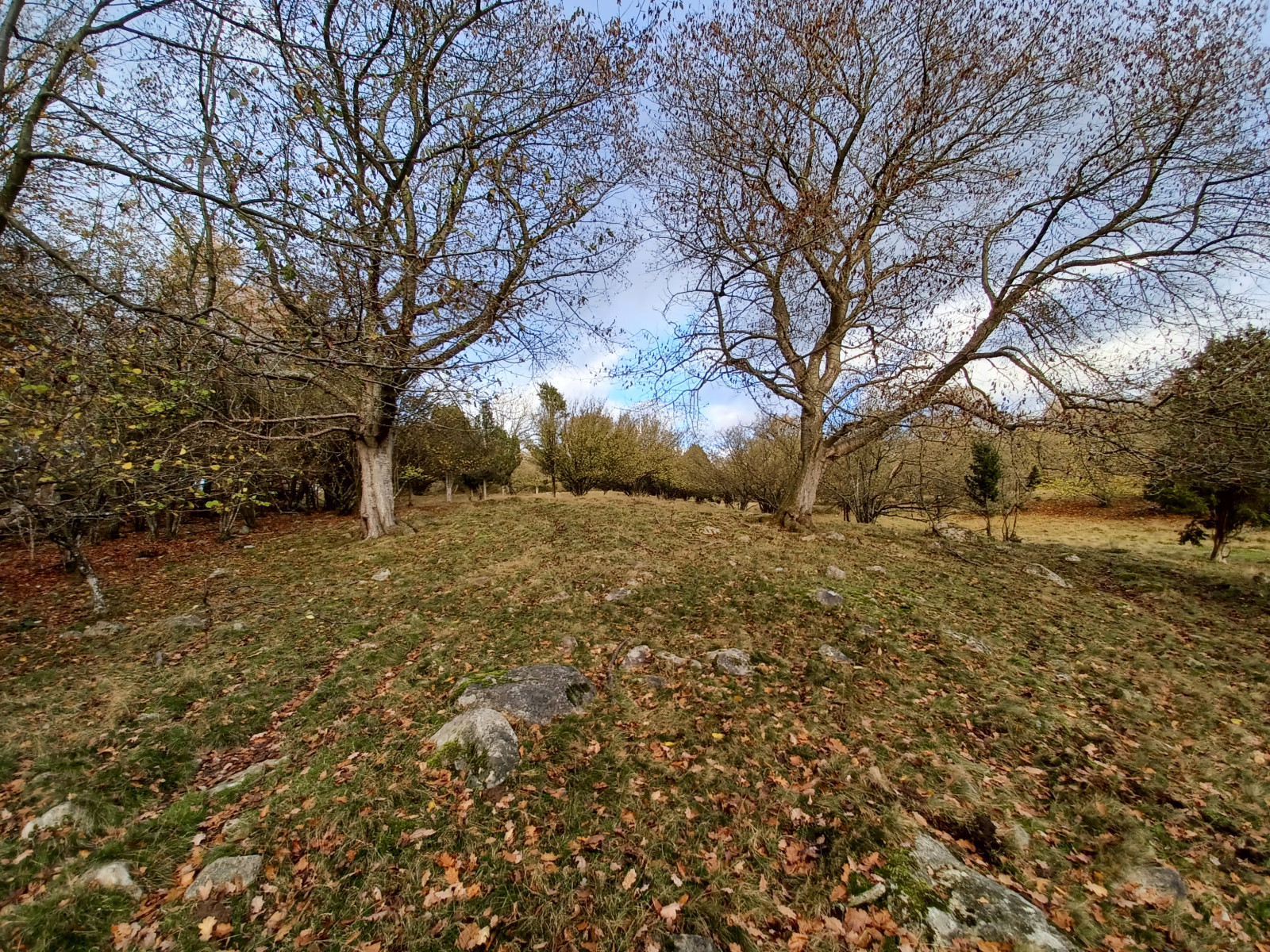
Walking the Dörröds Fälad pastures is a nice thing for several reasons. First of all its a special natural location on a height where you look down on the forest below. It is also a rare example of how the land was used in the old days. The area is well known for being a good place to see orzechówka (zwyczajna). The best period is between late august and early october. Other birds that can be seen are mostly common forest birds such as grubodziób, raniuszek zwyczajny, mysikrólik, gil and a good variety of woodpeckers; dzięciołek, dzięcioł duży , dzięcioł zielony and dzięcioł czarny. Both krzyżodziób świerkowy, krzyżodziób sosnowy and occasionallykrzyżodziób modrzewiowy can be seen, and in late autumn and winter srokosz.
The area is also known for having Hazel dormouse. It is possible to connect to the hiking trails in the area leading to fex Häckeberga and Genarp.
Szczegóły
Dostęp
Unfortunately there is no easy way to get to Dörröds fälad by public transport. There is a busstop "Grönland" along road 102 but to get there you have to order a Bus/taxi nr 309. After that it is a 5 km walk (follow the direction for the car). It might be possible to walk there as the crow flies (I haven't tried it) which would shorten the walk considerably.
Further information;
There are other options for reaching Dörröds fälad by foot: 1. Take the bus (as mentioned above) to bus stop Grönland. Then look at Google Maps for directions by foot. This path is at least 2 km shorter than the car route. 2. Take bus 172 or 162 to Genarp, walk towards Häckeberga kvarn. Then follow Skåneleden towards Dörröd. (Maps can be found at skaneleden.se) This hike is about as long as the car route from bus stop Grönland, but you do not have to book the bus in advance.
If going by car from the E65, turn N at Skurup and follow road 102 until you reach the small village of Dörröd. About 1 km N of the village turn left and follow the dirt road, when it splits after 200 meters turn right and follow the road to the parking for Rommelklint, then turn left and soon left again and follow the forest road to the parking. Walk from there, when you reach Kullatorpet turn left and follow the conifer plantation for 100 meters.
Teren i siedlisko
Las , Rzadkie drzewa i krzewyWarunki
PagórkowatyTrasa dookoła
TakCzy luneta będzie przydatna ?
Może być przydatnaUdany sezon obserwacyjny
Wiosna , JesieńNajlepszy czas na wizytę
Wiosna , JesieńTrasa
Wąski szlakPoziom trudności szlaku pieszego
Średnio wymagający spacerDostępne
PieszoCzatownia/platforma obserwacyjna
NieDodatkowe informacje
A small but special nature reserve where the old grazed landscape with shrubs of hazel is maintained.


 ) aby wstawić nazwy ptaków w swoim języku ojczystym. Nazwy ptaków zostaną automatycznie przetłumaczone dla innych użytkowników!