Opis
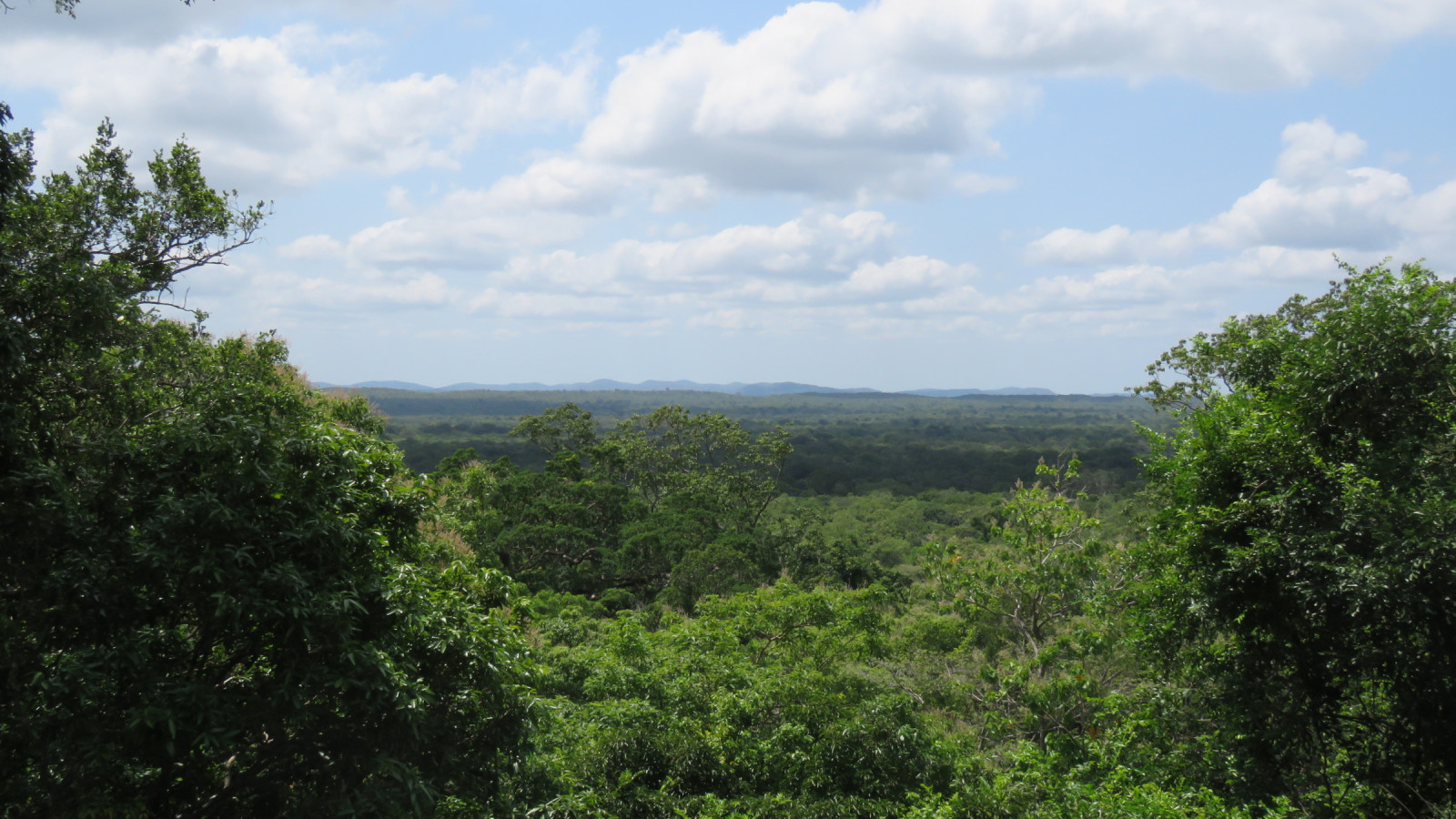
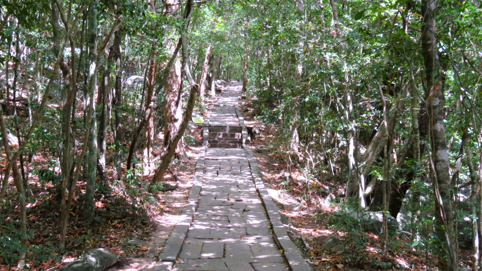
Ritigala is a lone mountain range between Anuradhapura and Polonnaruwa. Due to its rich vegetation and biodiversity, this mountain range has been declared a nature reserve covering an area of 1528 hectares with dry monsoonal, evergreen and montane forests. Part of this mountain range is also an archaeological site because of the ruins of an ancient Buddhist monastery from the 9th century. The old stairway and path to the monastery gives perfect access to the jungle. The birding is by far the best in the first few hours of the day, later on the day it can be hard to spot any birds.
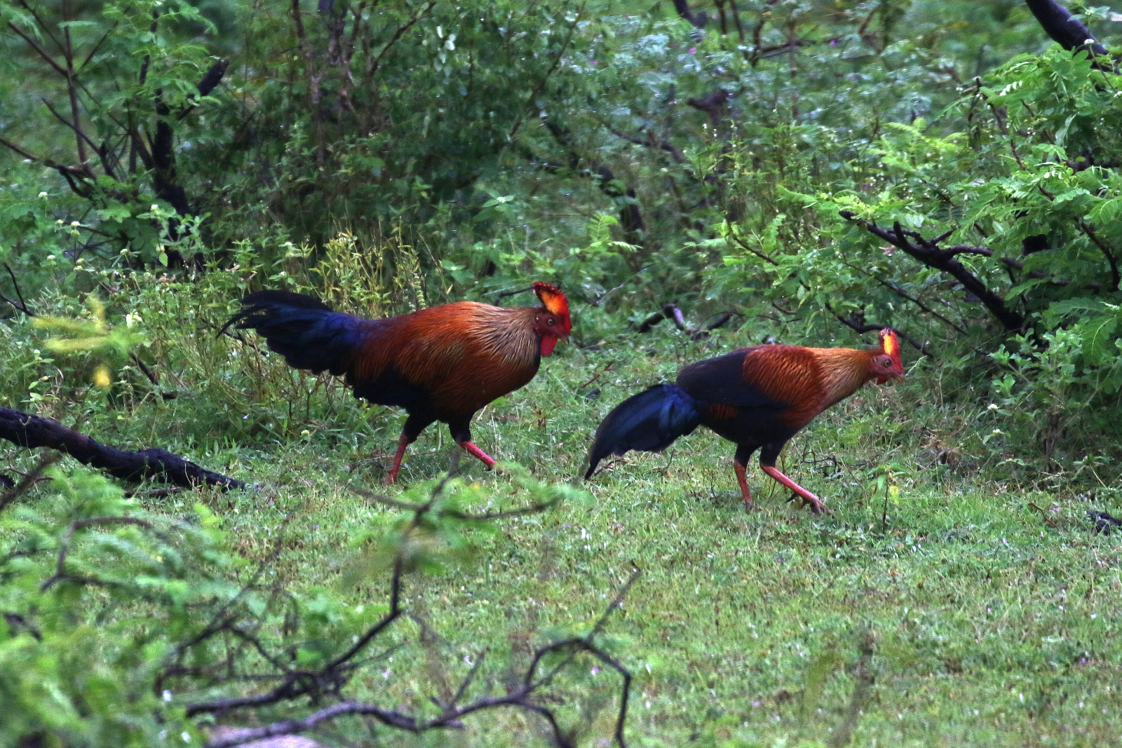
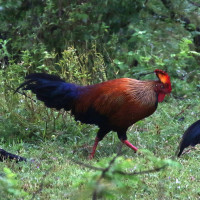
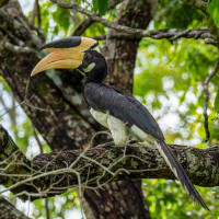
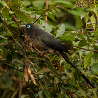
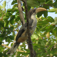
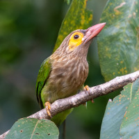
More than 100 species of birds are known to frequent Ritigala, including the endemic Spot-winged Thrush, Sri Lanka Junglefowl, Sri Lanka Grey Hornbill and Sri Lanka Spurfowl. Also Greater Racket-tailed Drongo, Malabar Pied-Hornbill, Blue-faced Malkoha, Rufous Woodpecker and Mountain Hawk-Eagle can be observed. Also over 30 species of mammals, including the endemic Golden Palm Civet and Toque Macaque call Ritigala home.
Szczegóły
Dostęp
Ritigala is located between Anuradhapura and Polonnaruwa, near the village of Ganewalpola. An unpaved road in good condition gives access to the entrance point. This road goes through dense jungle and is also already good for birding (look out for Sri Lanka Spurfowl crossing the road). From the entrance you can walk up the ancient stairs and path to the monastery. A rather steep walk of almost 1,5 km. Along this path and the open spots and buildings it passes you have often good views of the canopy. Entrance fee of the site is about $ 6.
 ) aby wstawić nazwy ptaków w swoim języku ojczystym. Nazwy ptaków zostaną automatycznie przetłumaczone dla innych użytkowników!