Opis
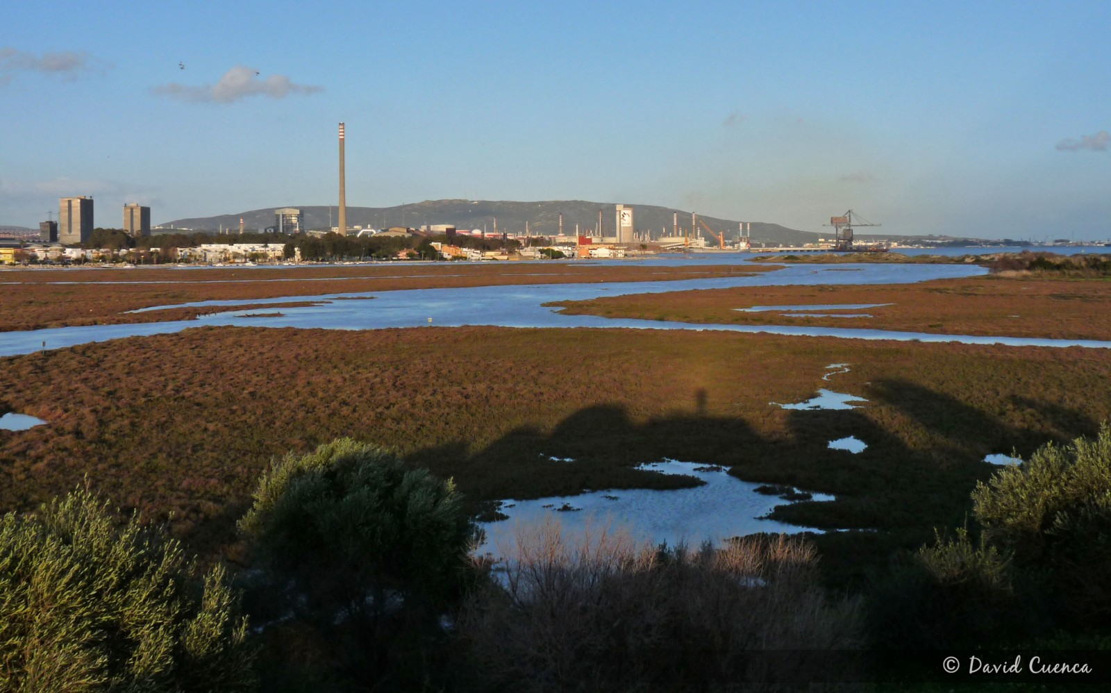
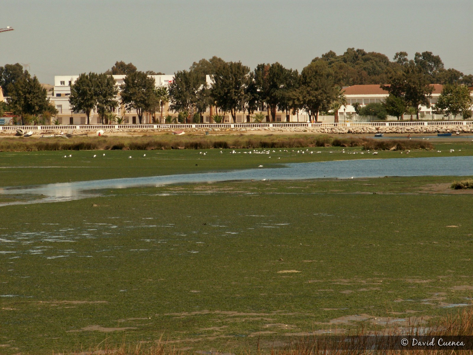
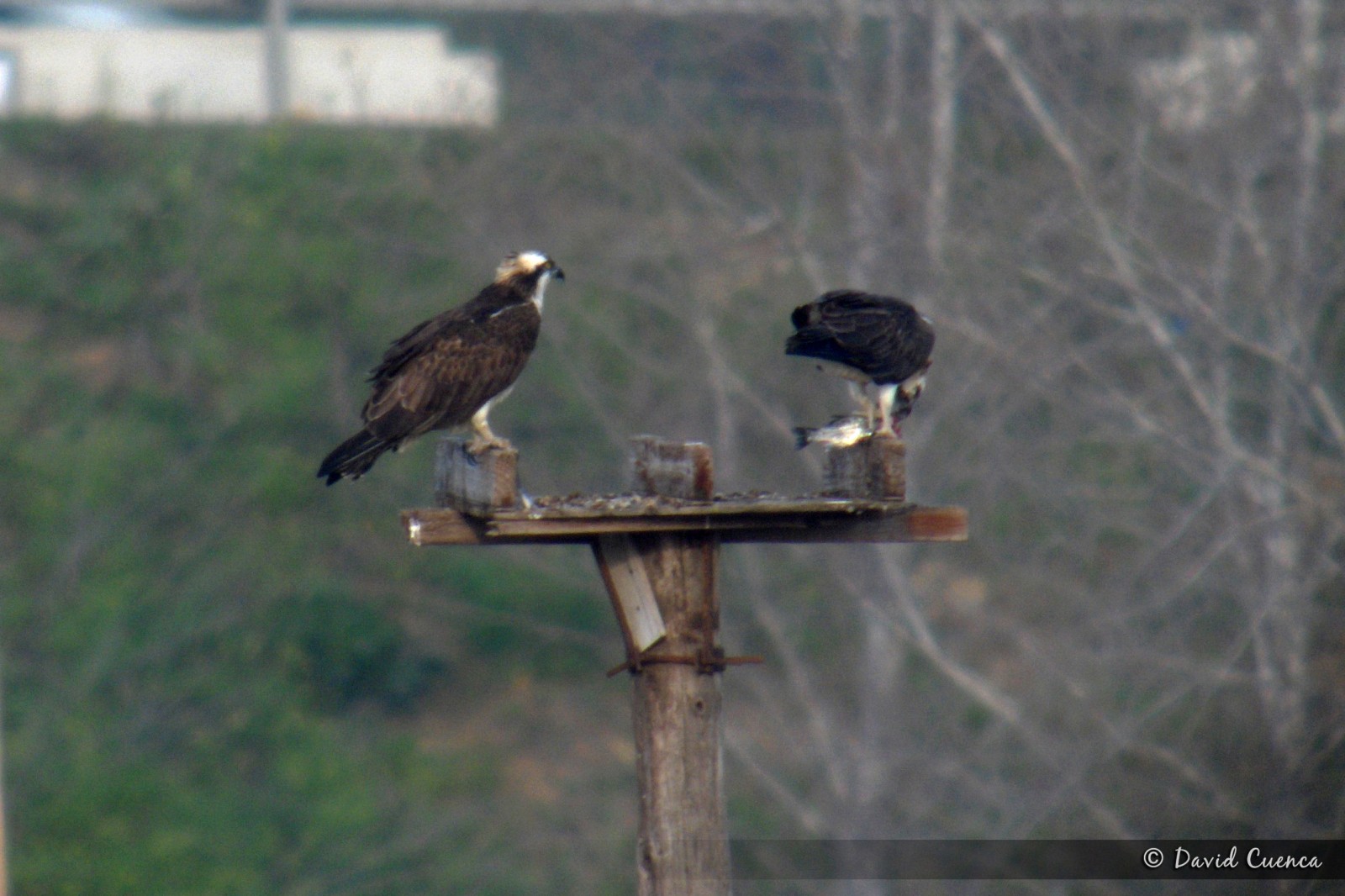
This natural park in the mouth of the river Palmones, covers the only marshes of the whole Strait of Gibraltar. It's an important place for birds, especially in migration periods and in winter, with more than 200 species recorded. The marshes, intertidal zone and coastal dunes attract lots of wildfowl species, herons, gulls, terns and waders. The warzęcha is easy to see in small numbers and it's the most important wintering area for rybołów in the Strait. Some of the main species are: breeding sieweczka morska, pliszka żółta, skowrończyk krótkopalcowy and wróbel sródziemnomorski (in the orchards); migrants szczudłak, flaming różowy, żwirowiec łąkowy, rybitwa rzeczna and pokrzewka wasata and wintering kormoran, błotniak stawowy, świstun, krwawodziób, kulik wielki, uszatka błotna, ohar (some years), rybitwa wielkodzioba and siwerniak. The rybitwa bengalska is one of the annual rarities. Moreover, swistun amerykanski, słonka, zaganiacz and trznadel czubaty have been seen.
There is an observatory in the place called Torrejon Park, from where you have an excellent panoramic sight of all the area. In early spring, it is easy to see kukułka czubata and several species of warblers and others songbirds in the forest and scrubland.
Palmones is also a good place to see migration of raptors, storks, swifts and swallows with the west winds.
Szczegóły
Dostęp
The best option to visit this area is to access from the south. Take exit number 108 of the A7 motorway towards Embarcadero Avenue. Then, in the first traffic circle turn right until a junction with a stop (you can see a sign for the Observatory for Public Use 1 km. away) where you turn left onto the Mediana road. If you continue along this street until the end, in its final section it continues as a dirt track to the vicinity of the Torrejon Park observatory, which you have to explore walking. If you turn right onto Cabo Ajo street and then turn left onto Cabo Finisterre street, you will come to an orchard area from where you can access, on foot too, the eastern part of the area, with wide intertidal mudflats, the dunes and the beach.
Teren i siedlisko
Tereny podmokłe , Plaża , Błota , Rolnictwo/uprawy , Rzadkie drzewa i krzewy , Rzeka , WydmyWarunki
Płaski , Piaszczysty , Otwarty krajobraz , BagiennyTrasa dookoła
NieCzy luneta będzie przydatna ?
TakUdany sezon obserwacyjny
Przez cały rokNajlepszy czas na wizytę
Zima , Wiosna , Jesień , Wiosenne migracje , Jesienne migracjeTrasa
Szeroka ścieżka , Droga nieutwardzonaPoziom trudności szlaku pieszego
ŁatwyDostępne
Pieszo , SamochódCzatownia/platforma obserwacyjna
TakDodatkowe informacje
If you want to see waders feeding and groups of gulls and terns resting, it is better to visit the eastern part of the area at low tide.
To take advantage of the time it is better to drive to the car parks and walk from there.


.jpg)

 ) aby wstawić nazwy ptaków w swoim języku ojczystym. Nazwy ptaków zostaną automatycznie przetłumaczone dla innych użytkowników!