Opis
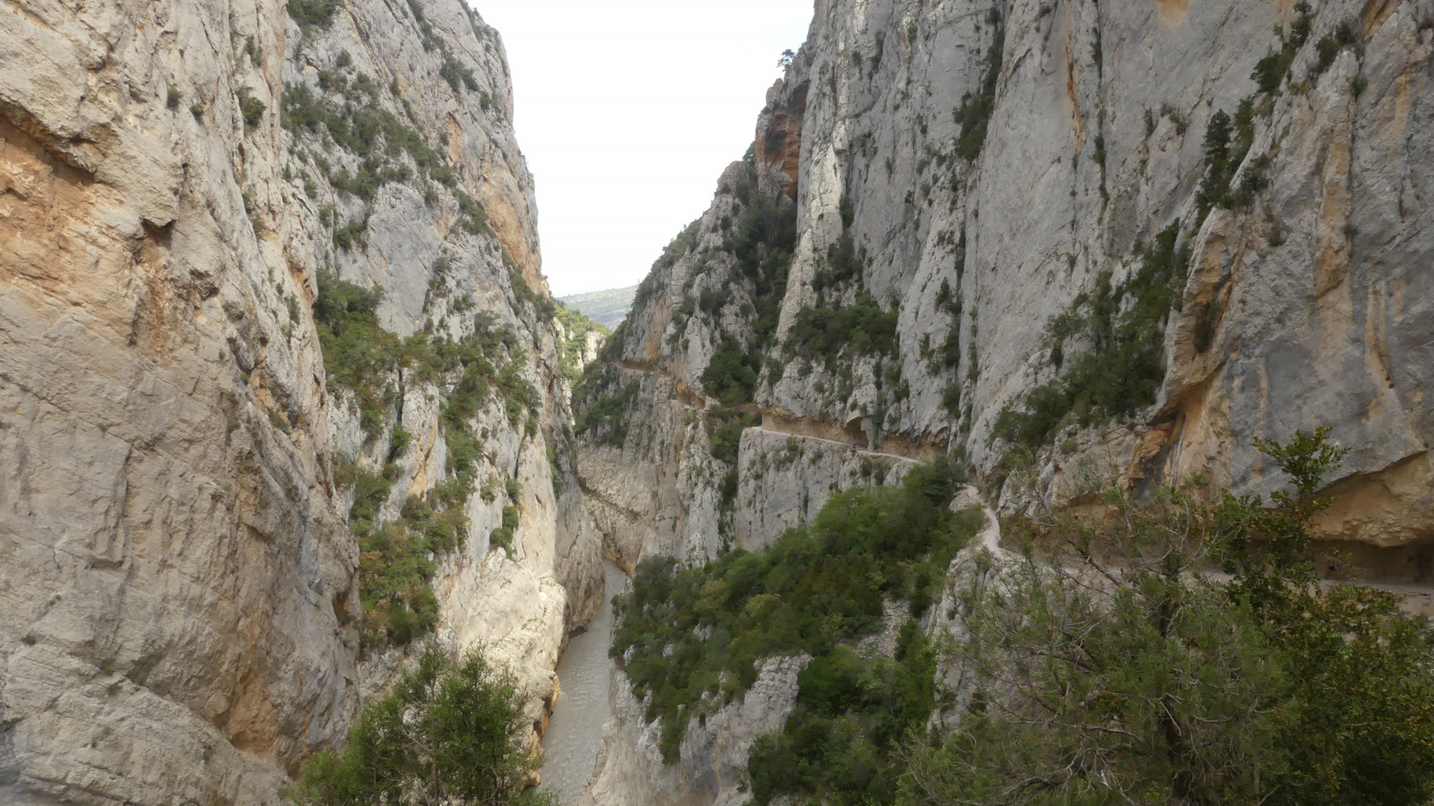
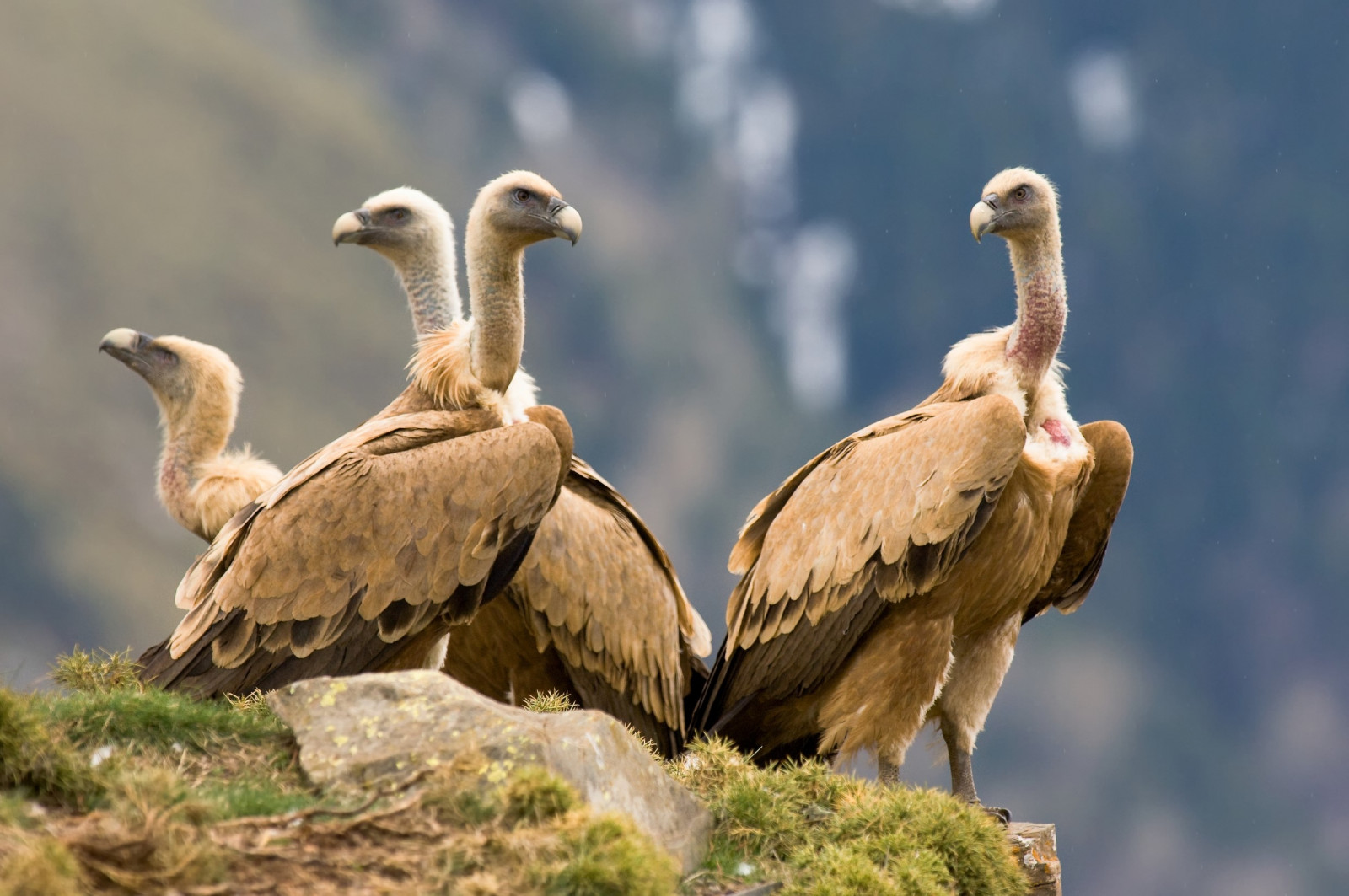
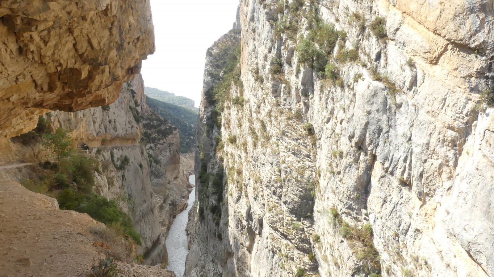
The Congost de Mont Rebei canyon is located on the border of Catalonia and Aragón and has one of the most beautiful hiking trails in Europe. It's also a great place to watch rock-dwelling birds, including all of Europe's vulture species. sęp płowy is the most common. We also saw ścierwnik. According to a local birdwatcher, a pair of orłosęp can be seen regularly and sęp kasztanowaty sometimes passes by.
In the summer you can also see modrak and many żołna. During the walk we also saw a number of jaskólka skalna. At the start of the trail we found dzierzba rudogłowa, głuszek and pleszka. In the autumn it is also a good area for pomurnik.
_________________________
Espagnol: Congost de Mont Rebei está situado en la frontera entre Cataluña y Aragón y cuenta con una de las rutas de senderismo más bonitas de Europa. También es un gran lugar para observar aves que habitan en las rocas, incluidas todas las especies de buitres de Europa. sęp płowy es el más común. También vimos ścierwnik. Según un observador de aves local, un par de orłosęp pueden verse regularmente y sęp kasztanowaty a veces pasa de largo.
En verano también puedes ver modrak y muchos żołna. Durante el paseo también vimos una serie de jaskólka skalna. Al comienzo del sendero encontramos dzierzba rudogłowa, głuszek y pleszka. En otoño también es una buena zona para pomurnik.
Szczegóły
Dostęp
You can park in the La Masieta car park (click on the P in the map for directions to the car park). If you come early there is enough space. Otherwise, it is better to reserve a parking space. Parking costs 5 euros. There are walking routes of different lengths. The 10 km walk takes about four to five hours. You can't walk in a circle so you will have to take the same way back, but the route looks so different in both directions that it doesn't bother you. Vultures fly above the rocks. If the water is high enough, you can also rent a kayak and follow the route with a kayak (see the web link at the bottom of this page for prices and reservations).
_________________________
Espagnol: Puedes aparcar en el parking de La Masieta (haz clic en la P del mapa para ver las indicaciones para llegar al parking). Si vienes temprano hay suficiente espacio. De lo contrario, es mejor reservar una plaza de aparcamiento. El aparcamiento cuesta 5 euros. Hay rutas de senderismo de diferentes longitudes. La caminata de 10 km toma alrededor de cuatro a cinco horas. No puedes caminar en círculo, así que tendrás que tomar el mismo camino de regreso, pero la ruta se ve tan diferente en ambas direcciones que no te molesta. Los buitres vuelan sobre las rocas. Si el agua está lo suficientemente alta, también puedes alquilar un kayak y seguir la ruta con un kayak (ver el enlace web al final de esta página para precios y reservas).


 ) aby wstawić nazwy ptaków w swoim języku ojczystym. Nazwy ptaków zostaną automatycznie przetłumaczone dla innych użytkowników!