
Opis
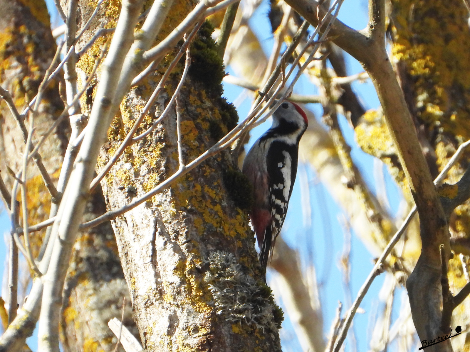
Parque Natural de Izki consists of a high valley (700 m) and is surrounded by limestone mountains of which the Kapildui (1117 m) is the highest point. The Izki river winds nicely through it and has left gorges and canyons. The park is densely wooded (half of the park) with mostly beech forests, but also with birch, holm oak and winter oaks. It also has numerous wetlands such as ponds and peat bogs that bring great biological diversity to this enclave. The star bird of the Park, dzięcioł średni, is a challenge to find. Easier to see are great birds like sęp płowy and orzeł przedni and of course the other woodpeckers along the forest paths. After centuries of constant erosion, the Izki river has carved out a beautiful gorge between mount Soila and La Muela, on its route from Korres to Bujanda. A circular trail of about 5 km (see the map) leads you through the Izki canyon (Barranco de Izki) and the forests and visits the Mirador (viewpoint) with great views on the area and soaring raptors.
Szczegóły
Dostęp
Access to the towns in the area north of the Park (Vírgala, Apellániz, Atauri, Antoñana, Bujanda and Maeztu) is achieved via the A-132. From Maeztu, take the A-4124 that goes to San Román de Campezo and this will take you to Korres.
Access from the south is via the A-2124 that links Vitoria-Gasteiz with Logroño and turn off at Ventas de Armentia in direction Bernedo via the A-126, which will take you to Markinez, Arluzea, Urturi and Quintana
The walking trail starts in the village of Korres. You can park your car there next to the visitor center.


 ) aby wstawić nazwy ptaków w swoim języku ojczystym. Nazwy ptaków zostaną automatycznie przetłumaczone dla innych użytkowników!