_couple_(31762928244).jpg)
Opis
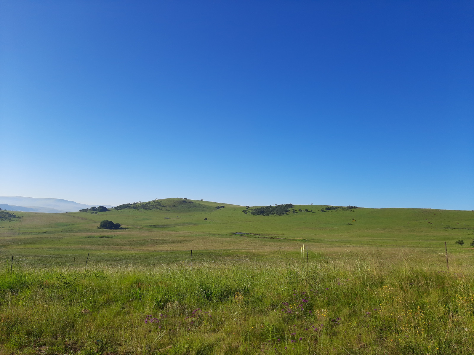
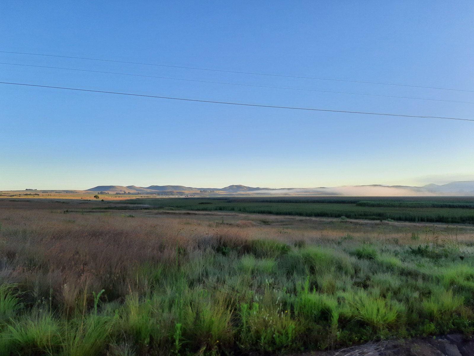
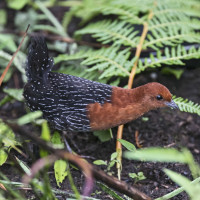
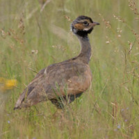
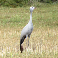
The whole area of Wakkerstroom covers around 1200 km², so most birding is done by driving in the roads leading in the hills around the town. Just drive along the loops to the south, east and north of Wakkerstroom and check the hills for grassland birds (Denham's Bustard, Blue Bustard, Black-bellied Bustard, White-bellied Bustard, Southern Anteater-Chat, Blue Crane, Pale-crowned Cisticola). You can also find African Rock Pipit and Yellow-breasted Pipit, Rudd's Lark , Spike-heeled Lark, and others in the more rocky areas near Groenvlei and the Naauwhoek Pass. The wetland near the town is easy accessible due to several hides in the large reedbeds. It is possible to get very close to the more secretive birds of the wetland areas such as Red-chested Flufftail, Little Bittern, etc.
Szczegóły
Dostęp
Due to the far distances it is absolutely recommended to have a 4x4 car. The hides around the wetland are accessible only by feet, and during wet season (Sept. - Jan.) they are sometimes not accessible due to the high water level. There is always safe parking close to the hides and you can also drive around the wetland by bike.
BirdLife South Africa is running a centre on the western side of the wetland. It offers accommodations and in any case it is worth a visit. You can book tours with very competent guides and borrow a very elaborated brochure with loads of tips concering birding in the area (a true piece of art with decades of work and passion included).
Teren i siedlisko
Tereny podmokłe , Łąka , Płaskowyż , Jezioro , Trzcinowiska , Błota , Rolnictwo/uprawy , Miasto/wieśWarunki
Pagórkowaty , Skalisty , Otwarty krajobraz , Bagienny , Możliwy wysoki poziom wodyTrasa dookoła
TakCzy luneta będzie przydatna ?
TakUdany sezon obserwacyjny
Wiosna , LatoNajlepszy czas na wizytę
Wiosna , LatoTrasa
Droga utwardzona , Szeroka ścieżka , Wąski szlak , Droga nieutwardzonaPoziom trudności szlaku pieszego
Średnio wymagający spacerDostępne
Pieszo , Samochód , RowerCzatownia/platforma obserwacyjna
TakDodatkowe informacje
Photo Blue Bustard by Bernard DUPONT from FRANCE, CC BY-SA 2.0 <https://creativecommons.org/licenses/by-sa/2.0>, via Wikimedia Commons.
 ) aby wstawić nazwy ptaków w swoim języku ojczystym. Nazwy ptaków zostaną automatycznie przetłumaczone dla innych użytkowników!