Opis
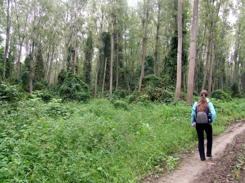
Walking paths mostly follow the edge of industrial poplar plantations, but you will find some indigenous oaks and ashes and, the further downriver you go, riverine belts of willows and poplars. The wet meadows are mostly overgrown with the invasive North American desert false indigo or indigo bush (Amorpha fruticosa).
In recent years some 150 bird species were recorded, among them cyranka, bocian czarny, kormoran mały, czapla modronosa, ślepowron, krogulec, kobuz, samotnik, dzięciołek, zimorodek, wilga (zwyczajna), kruk, zaganiacz, świstunka leśna, pierwiosnek and raniuszek zwyczajny.
Kožara is a part of the international ecological corridor along the Danube River, the “Confluence of the Sava and the Danube Rivers” Important Bird Area (IBA) and, since 2022, part of the new, backwaters nature reserve "Foreland of the Left Bank of the Danube near Belgrade".
Photos by Mileta Cekovic, Jelena Nikolic Antonijevic, Nikica Kukolj, Dragoslav Miladinovic, "Stribog" and Dragan Simic.
Szczegóły
Dostęp
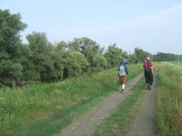
Easy to reach from central Belgrade by bus #104. Click on the preferred P in the map to get driving directions to that spot. Aim for early mornings and from the end of April, carry an insect repellent for mosquitoes.
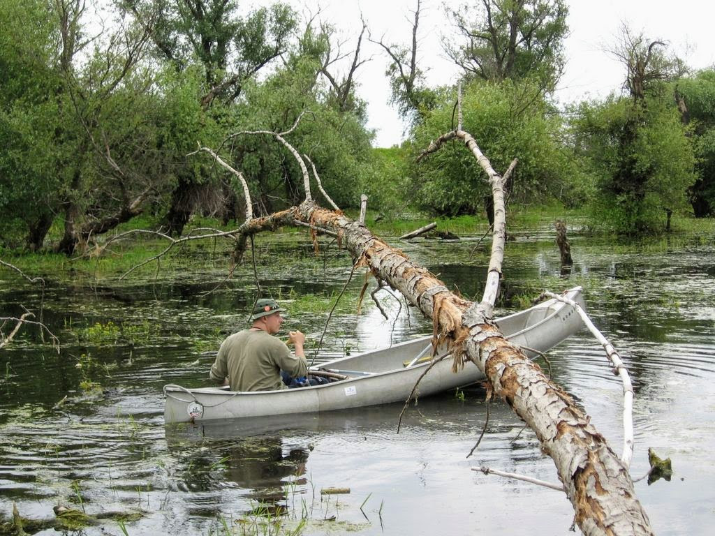
When you enter the Kozara Floodplain over the dyke, you can explore both left and right hand side, but going left offers a greater choice of habitats and a larger area. Depending on the water level, consider wearing rubber boots.
Teren i siedlisko
Las , Tereny podmokłe , Równina , Jezioro , Błota , RzekaWarunki
Płaski , Bagienny , Ślisko , Możliwy wysoki poziom wodyTrasa dookoła
TakCzy luneta będzie przydatna ?
NieUdany sezon obserwacyjny
Wiosna , JesieńNajlepszy czas na wizytę
Wiosenne migracje , Jesienne migracje , WiosnaTrasa
Szeroka ścieżka , Droga nieutwardzonaPoziom trudności szlaku pieszego
Średnio wymagający spacerDostępne
PieszoCzatownia/platforma obserwacyjna
NieDodatkowe informacje
After 12 years of campaigning by the local NGO League for Ornithological Action, in August 2022 Kozara flood retention basin and the wider Danube Backwaters upriver finally became officially protected: based on Article 42, Paragraph 8 of the Law on Nature Protection ("Official Gazette of the RS", No. 36/09, 88/10, 91/10-amendment, 14/16, 95/18-other law and 71/21) The Ministry of Environmental Protection informed the public about the procedure for initiating the protection of the natural area of the I (first) category, as an Area of Exceptional Characteristics "Foreland of the Left Bank of the Danube near Belgrade" [which includes Kozara].
“The foreland of the left bank of the Danube near Belgrade is, in addition to the Gornji Podunavlje and the Koviljsko-Petrovaradin Backwaters, one of the largest flood zones in all of Serbia, of great importance for the ecological integrity of the Danube ecosystem. In the zone between the embankment and the river (foreland), the natural water regime of the "green corridor" is maintained, which includes ponds, islands, floodplain forests, “cubicle” ponds, river arms and other wet habitats. In the recent past, the area of today's Foreland was part of a large floodplain between the Tamis and the Danube, better known as Pancevački rit, which was mostly drained due to rapid urbanization and land reclamation during the last century. This area is extremely important from the point of view of preserving biological diversity, since water and wet habitats that provide shelter to many rare and endangered plant and animal species depend on the occurrence of periodic flooding. The goal of the proposal for the protection of the Foreland area is to preserve the identified fundamental natural values, i.e. the original, representative and aesthetic features of the landscape, as well as to create conditions for sustainable and controlled use of the area.” (Institute for Nature Conservation of Serbia)


 ) aby wstawić nazwy ptaków w swoim języku ojczystym. Nazwy ptaków zostaną automatycznie przetłumaczone dla innych użytkowników!