
Opis
Golija (from old Serbian 'golema' - huge) stretches for 32 km (20 mi) between the towns of Ivanjica and Novi Pazar in a C-shape. The highest peak is Jankov Kamen at 1833 meters (Janko's Stone, which Janko allegedly carried to the mountaintop as a part of a bet with his brother Rajko).
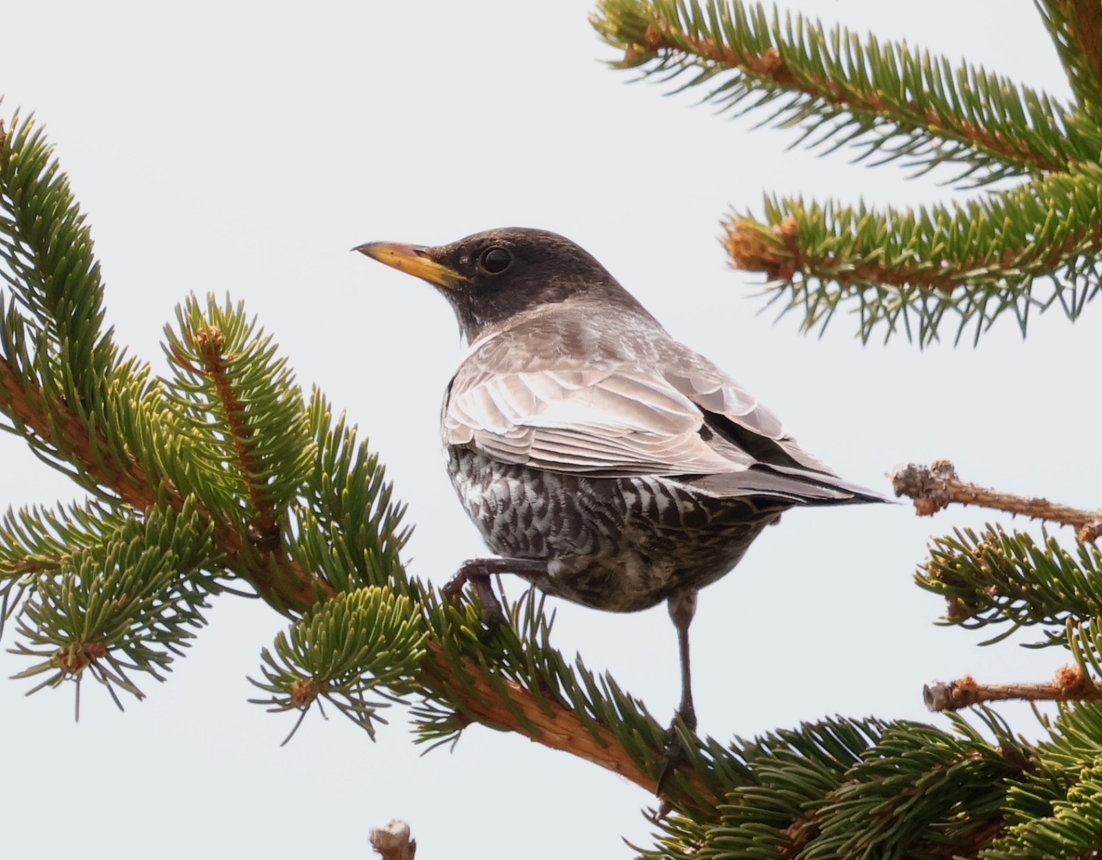
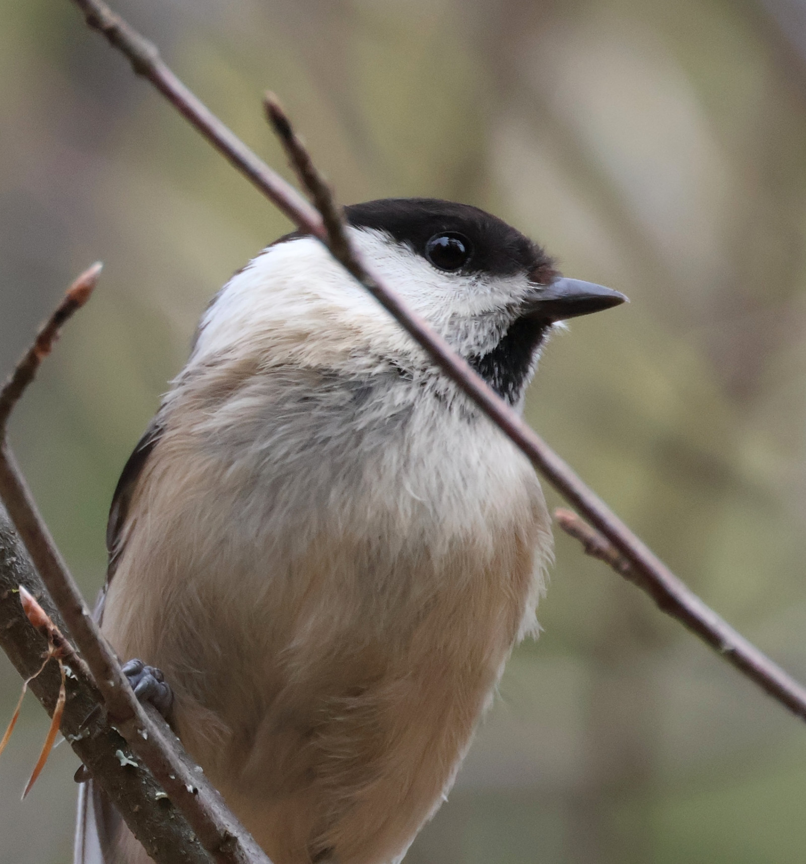
The northern slopes of Jankov Kamen are overgrown with Spruce forests in which you can find paszkot, drozd obrożny, orzechówka (zwyczajna), sosnówka, czubatka, czarnogłówka (zwyczajna), zniczek, pokrzywnica and słonka. Southern slopes are mostly covered by meadows and scrubs, hosting skowronek, siwerniak, and sometimes górniczek. Golijska Reka (Golija's Stream) is just one of many streams descending northern Golija slopes, usual suspects like pluszcz and pliszka górska can be found there.
Jankov Kamen and its surroundings are part of the protected area Golija Nature Park and IBA Golija.
Szczegóły
Dostęp
Jankov Kamen can be accessed from four sides, from the town of Ivanjica from the north, from the town of Novi Pazar from the southeast, from the town or Raška from the east, and from the village of Duga Poljana from the southwest. Note that the road from Duga Poljana to Jankov Kamen is not fully paved, with a section of ~5km dirt road (soon to be paved too, but not yet as of writing this guide).
Teren i siedlisko
Las , Rzadkie drzewa i krzewy , Łąka , Płaskowyż , GóryWarunki
GórzystyTrasa dookoła
TakCzy luneta będzie przydatna ?
NieUdany sezon obserwacyjny
Lato , Wiosna , JesieńNajlepszy czas na wizytę
Lato , Wiosna , JesieńTrasa
Droga nieutwardzona , Droga utwardzona , Szeroka ścieżkaPoziom trudności szlaku pieszego
Średnio wymagający spacerDostępne
Pieszo , Samochód , RowerCzatownia/platforma obserwacyjna
NieDodatkowe informacje
Golija, while not very high in altitude, is a huge mountain. There are more than 25km of paved road over 1500 meters passing through high mountain forests and along the forest edge, making it an ideal place for birding high mountain habitats while not needing to walk around a lot. The paved road from Ivanjica passes 1500m mark around Golijska Reka, continues up to 1750m below the Jankov Kamen peak, then follows the famous Golija C shape over Odvraćenica and Crni Vrh to Jadovita peak.


 ) aby wstawić nazwy ptaków w swoim języku ojczystym. Nazwy ptaków zostaną automatycznie przetłumaczone dla innych użytkowników!