

Opis
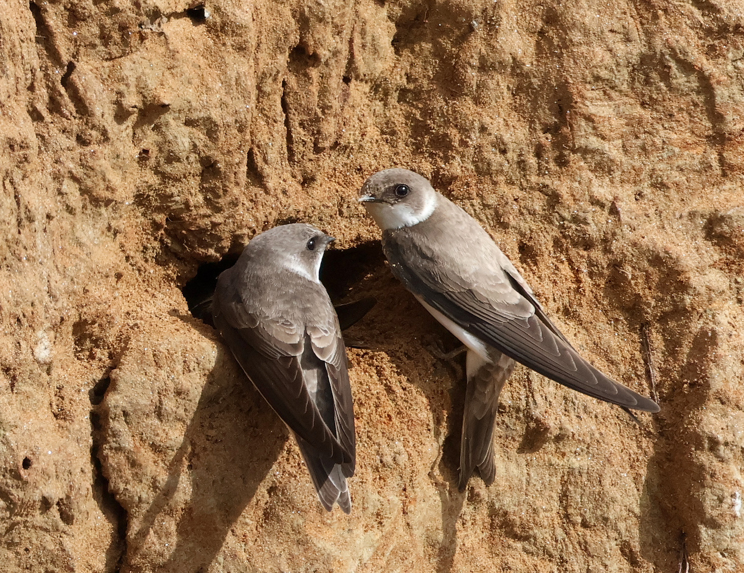
Takkenhoogte has a beautiful viewing hill where you have a view of a wall where brzegówka nest. It is also a heather landscape interspersed with water and forest.
_________________________
Nederlands: Takkenhoogte bestaat uit een groot ven (pingo) met een duidelijke ringwal. De rest van het gebied bestaat uit heide met waterpartijen en een stuk bos. Er is een mooie uitkijkheuvel waarbij je zicht hebt op een wand waar oeverzwaluwen nestelen. Verder is het een heide landschap afgewisseld met water en bos.
Szczegóły
Dostęp
There is a parking lot. The area is best explored on foot. There is a walking route of 4.5 km. The route that is shown on the map is 5,2 km.
_________________________
Nederlands: Er is een parkeerplaats. Het gebied is het beste te verkennen te voet. Er is een wandelroute van 4,5 km. De route op de kaart beneden is een iets langere versie van 5,2 km.


 ) aby wstawić nazwy ptaków w swoim języku ojczystym. Nazwy ptaków zostaną automatycznie przetłumaczone dla innych użytkowników!