

Opis
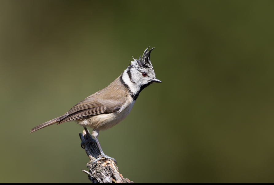
De Lange Bleek is a nature reserve of approximately 170 hectares that mainly consists of coniferous forest, in which two heath areas can be found. In addition, there is a fen, called Bultven. In the coming years, the forest will be transformed into a more open forest landscape, with more variation in forest type. The area is partly grazed by cattle and sheep. gąsiorek has been breeding for about five years (3 territories). srokosz visits the area every winter. Other birds you can see in Lange Bleek are sosnówka, czubatka, świergotek drzewny, trznadel, kląskawka, paszkot, muchołówka żałobna, pleszka, dzięcioł duży and dzięcioł czarny.
_________________________
Nederlands: De Lange Bleek is een natuurgebied van ongeveer 170 hectare. Een bosgebied met twee stukken heide en een ven, Bultven genaamd. Het gebied bestaat voornamelijk uit naaldbos. De komende jaren wordt het bos omgevormd naar een meer open boslandschap, met meer variatie in bostype, meer afwisseling in openheid. Het gebied wordt deels begraasd door runderen en schapen. De gąsiorek broedt er al een jaar of vijf (3 territoria). srokosz zit er elke winter. Ook de wolf leeft in dit gebied. Andere vogels die je er kunt zien zijn sosnówka, czubatka, świergotek drzewny, trznadel, kląskawka, paszkot, muchołówka żałobna, pleszka, dzięcioł duży en dzięcioł czarny.
Szczegóły
Dostęp
Parking space in the bend of Vlaamseweg. Drive from Heeze in the direction of Someren. After 3 km turn right. This is the Vlaamseweg. Bend with parking after 500m. There is an information board and routes have been plotted. On the map you see a 4.5 km long walking route, which is marked with yellow markings on the spot.
_________________________
Nederlands: Parkeerplaats in de bocht van Vlaamseweg. Rijdt van Heeze richting Someren. Na 3 km rechts af. Dit is de Vlaamseweg. Bocht met parkeerplaats na 500m. Er is een infobord en er zijn routes uitgezet. Op de kaart zie je een 4,5 km lange wandelroute, die ter plekke met gele markeringen is aangegeven.


 ) aby wstawić nazwy ptaków w swoim języku ojczystym. Nazwy ptaków zostaną automatycznie przetłumaczone dla innych użytkowników!