

Opis
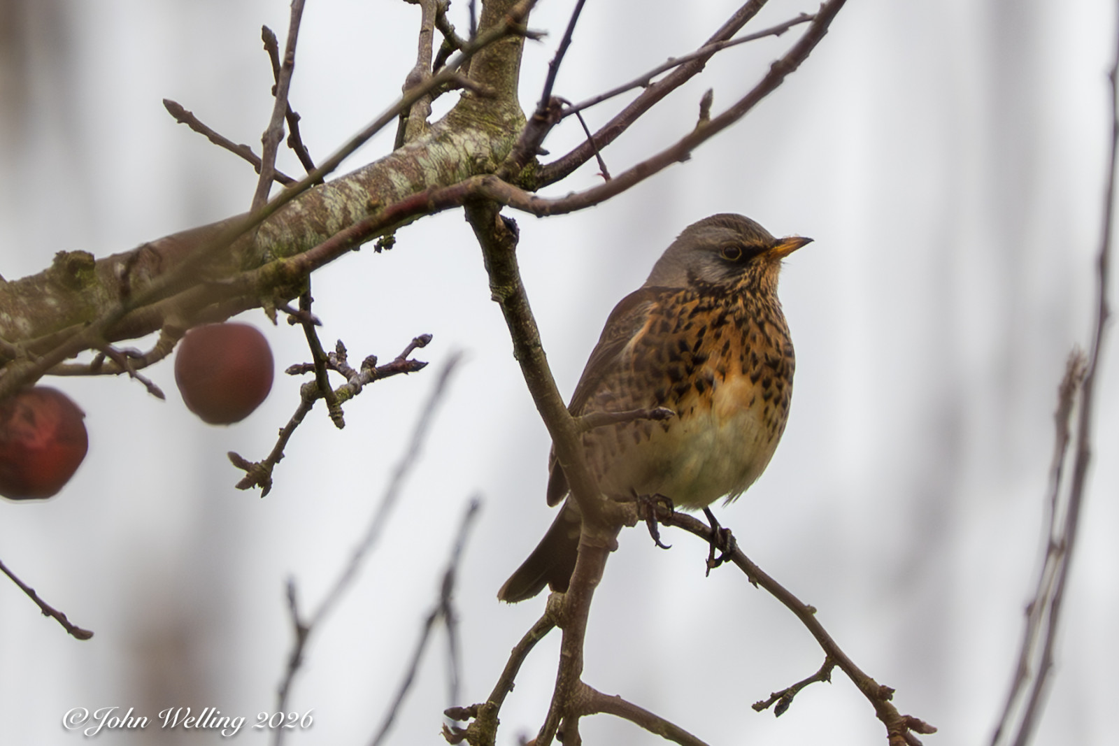
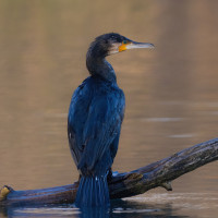
The Douwelerkolk was created as a result of a dike breach in the river IJssel. The area consists of marsh forests, reed and rush vegetation, damp roughs and drier grasslands. Due to the alternation of wet and dry, the different soil types and the natural management, this area attracts quite a few birds for an area that is enclosed by the city. Birds that you can see here include: perkozek, dzięcioł duży, zimorodek, kapturka, czapla biała, kormoran, krakwa and cyraneczka.
_________________________
Nederlands: De Douwelerkolk is het restant van een oude IJsselarm en ontstaan als gevolg van een dijkdoorbraak van de IJssel. De kolk ligt op de grens van het rivierenlandschap en het dekzandlandschap en bestaat uit moerasbosjes, riet- en biezenvegetaties, vochtige ruigten en drogere graslanden. Door de afwisseling van nat en droog, de verschillende grondsoorten en het natuurlijke beheer trekt dit dit gebied redelijk wat vogels voor een gebied dat is ingesloten door de stad. Vogels die je hier kunt zien zijn onder meer perkozek, dzięcioł duży, zimorodek, kapturka, czapla biała, kormoran, krakwa en cyraneczka.
Szczegóły
Dostęp
The Douwelerkolk is enclosed by the city of Deventer. You can easily reach the area on foot or by bike from Deventer. Parking is available at the sports fields. Press P on the map for directions to the parking lot. The circular walk on the map is approximately 4 km.
_________________________
Nederlands: De Douwelerkolk is ingesloten door de stad Deventer. Je kunt het gebied te voet of met de fiets gemakkelijk vanuit Deventer bereiken. Parkeren kan bij de sportvelden. Druk op P in de kaart voor een routebeschrijving naar de parkeerplaats. De rondwandeling op de kaart is ongeveer 4 km.
Teren i siedlisko
Jezioro , Rzadkie drzewa i krzewy , Łąka , TrzcinowiskaWarunki
Możliwy wysoki poziom wodyTrasa dookoła
TakCzy luneta będzie przydatna ?
NieUdany sezon obserwacyjny
Przez cały rokNajlepszy czas na wizytę
WiosnaTrasa
Wąski szlak , Szeroka ścieżkaPoziom trudności szlaku pieszego
ŁatwyDostępne
PieszoCzatownia/platforma obserwacyjna
NieLinki
- Recent bird sightings in the area on Waarneming.nl
- Wandeling vwg De IJsselstreek Douwelerkolkwandeling


 ) aby wstawić nazwy ptaków w swoim języku ojczystym. Nazwy ptaków zostaną automatycznie przetłumaczone dla innych użytkowników!