
.JPG)
Opis
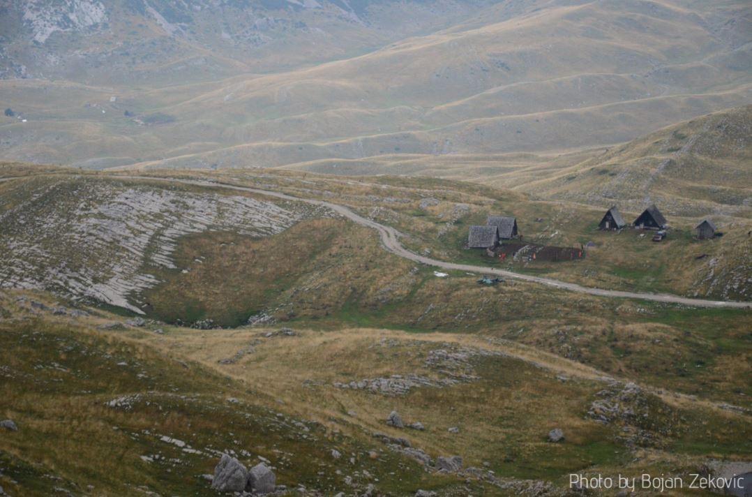
National Park Durmitor is located in the northwest part of Montenegro and covers the area of high mountains, planes and deep canyons. The Tara River Canyon is located in the Park (the highest depth of the canyon is 1,300 m), as well as canyons of rivers Komarnica, Grabovica, Sušica and some small rivers. Mountain Durmitor massif includes more than 40 peaks over 2,000 m altitude and the massif has 18 glacial lakes. Durmitor is the biggest ski center in the country.
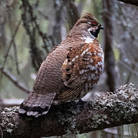
18 mountain lakes, more than 40 rocky peaks above 2,000 m altitude, dense forests of fir, beech forests, pine habitat and the spacious plateau of Durmitor, are habitats which characterise this mountain. Recent research of the flora of Durmitor and surrounding canyons found more than 1,700 plant species. About 900 species make for high mountain flora, which inhabit the area above 1,500 m altitude. As for the characteristic birds, this habitat can be divided into: high mountain rocky ground, rocks and cliffs, high mountain lakes, wet meadows, pastures, glades, high mountain evergreen forests and mixed coniferous – deciduous forests. Every one of these habitats has its own specific ornythofauna: high and steep hillside, and rocky areas are home to siwerniak and górniczek, płochacz halny and pomurnik, while the highest and most inaccessible cliffs are home to breeding wieszczek and orzeł przedni; forests are home to breeding of numerous songbirds, like sosnówka, dzięcioł czarny , krzyżodziób świerkowy, kowalik, then the birds of the family of hen: głuszec, jarząbek; raptors: krogulec, kobuz, Trzmielojad. The pastures and wet meadows are habitats to dzierlatka (zwyczajna), przepiórka, derkacz and on the lakes and riparian vegetation we can register gągoł, perkozek, wodnik (zwyczajny) and others.
Szczegóły
Dostęp
It is best to explore the area by car, or 4x4. Durmitor mountain is the centre of Montenegrin mountain tourism. The tourist facilities are concentrated around the town of Žabljak. There are 25 marked mountain-hiking trails in the Park of various length and for different levels of physical fitness. An easy hike is the Black Lake circle Hike Route. This hike lasts around 1:30 and it goes all around the Black Lake.


 ) aby wstawić nazwy ptaków w swoim języku ojczystym. Nazwy ptaków zostaną automatycznie przetłumaczone dla innych użytkowników!