 22-08-2021.jpg)
 (Branta bernicla hrota) R&T 03-10-2021.jpg)
Opis
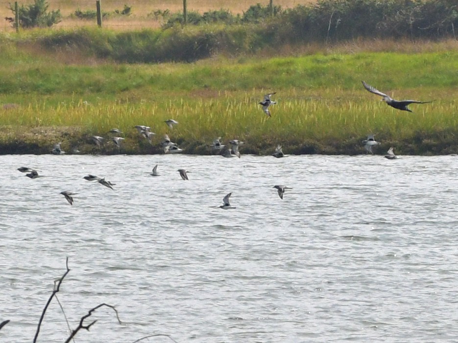
The Rogerstown Estuary / Turvey Nature Reserve is set within the inner Rogerstown estuary – a relatively small, narrow and extremely shallow estuary with extensive mudflats at low tide. The reserve was an area of reclaimed land used as grazing pasture, but is now being restored back to saltmarsh. The saltmarsh is inundated with sea water to varying degrees on a daily basis. It is during these times that the brackish grasslands and inter-tidal creeks are extremely important for birds, providing safe roosting sites for thousands of wintering wildfowl and waders. The soft mud flats, exposed during low tides, are their feeding areas. The winter time is when siewka złota, siewnica, czajka, kulik wielki, rycyk, biegus zmienny, biegus rdzawy, piaskowiec, krwawodziób, ostrygojad, herons, geese and ducks are numerous. During the summer czajka breed and the surrounding trees are home to a variety of summer visitors, such as piecuszek, pierwiosnek and kapturka, especially within the Turvey Parklands, managed by Fingal County Council and Fingal Birdwatch Ireland who look after the two bird hides on site.
Szczegóły
Dostęp
To get to the Frank McManus Memorial South Hide Turvey Nature Reserve from Dublin, take the M1 motorway heading north, taking exit 4 signposted for Skerries, Rush, Donabate and R132. At the double roundabouts, follow signs for Skerries and Donabate and continue north (for 1.6 klm) on the R132 dual carriageway going straight through a small roundabout till reaching a larger roundabout at a large petrol garge forecourt. Take the exit for Donabate along Turvey Avenue (for 960m) A proper large car park is available at the Turvey Nature Reserve entrance. Click on the P in the map for directions. PLEASE BE AVISED, DO NOT LEAVE ANY VALUABLES IN YOUR VEHICLE WHAT SO EVER. No matter where you are or what country you are visiting. There are marked walking/cycling trails, and one leading to the Frank McManus Memorial South Hide; (See Map) please keep to these trails for your own safety and to avoid disturbance to the wildlife. Please do not open gates or climb over fences and be aware that grazing animals are present at all times of the year. Dogs are permitted in the Turvey nature reserve from September to March since kept under control, all other times dogs must be kept on lead to avoid harassment of the ground nesting birdlife and mammals.
The Rogerstown Reserve and the Turvey Parklands are open all year-round. But note that the Frank McManus Hide in the Turvey Parkland is only open to the public every Saturday and Sunday from 10am to 4pm from September to March. The North hide (see separate entry on Birdingplaces) is open year round.
Teren i siedlisko
Tereny podmokłe , Błota , Rzadkie drzewa i krzewy , Łąka , Rzeka , Morze , Las , Trzcinowiska , Rolnictwo/uprawyWarunki
Płaski , Bagienny , Ślisko , Otwarty krajobraz , Możliwy wysoki poziom wodyTrasa dookoła
TakCzy luneta będzie przydatna ?
Może być przydatnaUdany sezon obserwacyjny
Przez cały rokNajlepszy czas na wizytę
Wiosna , JesieńTrasa
Szeroka ścieżka , Wąski szlakPoziom trudności szlaku pieszego
ŁatwyDostępne
Pieszo , RowerCzatownia/platforma obserwacyjna
TakLinki
- Rogerstown Estuary / Turvey Nature Reserve
- Rogerstown Nature Reserve
- TURVEY NATURE RESERVE
- Bird Hides
- PDF link to Rogerstown


 ) aby wstawić nazwy ptaków w swoim języku ojczystym. Nazwy ptaków zostaną automatycznie przetłumaczone dla innych użytkowników!