

Opis
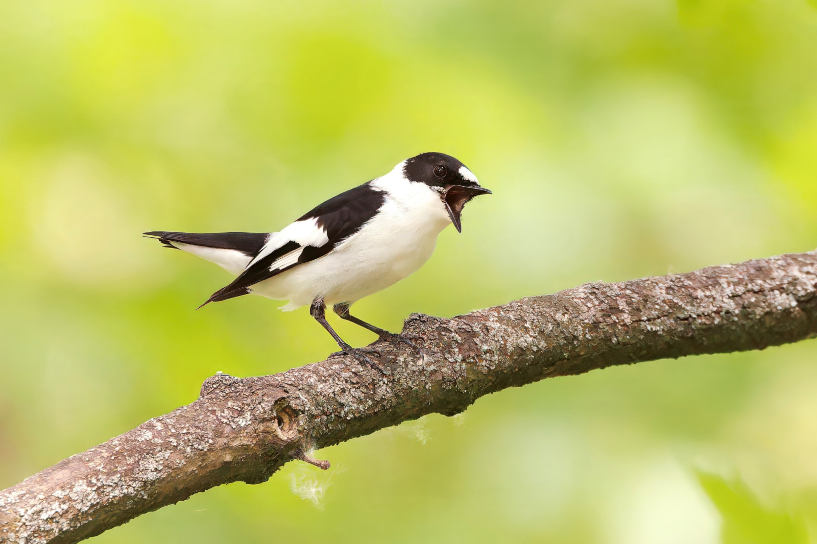
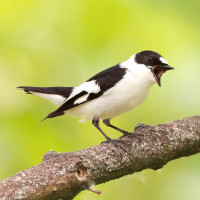
On the circular trail through Zeller Forst (length 10 km) there are good chances to see or hear muchołówka żałobna, muchołówka białoszyja, dzięcioł czarny, dzięcioł średni, grubodziób, zniczek and świstunka leśna. For some years the muchołówka mała has been heard singing (absent in 2020). It is believed to be at least an irregular breeder in the Steigerwald. The circular route is admittedly long, however there is no real shortcut. If you don't have much time turn around after the first 2 or 3 km on the "Schlangenweg". In the valley pay furthermore attention to possible flying over Trzmielojad.
As of 2020 the former hiking car park is closed. You have to find a parking space in the village centre and walk the "Böhlstraße" (closed for public use) to the former car park (250 m). On the left you find a wooden sign post "Schlangenweg" marking the start of the "real" tour.
Szczegóły
Dostęp
Leave the motorway A70 at Knetzgau and follow the signposts to the village Zell am Ebersberg. Just before leaving the latter you find on your right hand side the above mentioned "Böhlstraße" which has been closed for public use.
By public transport: You can reach Zell by bus (line 8178) from Haßfurt where the next railway station is situated.
Teren i siedlisko
LasWarunki
Pagórkowaty , ŚliskoTrasa dookoła
TakCzy luneta będzie przydatna ?
NieUdany sezon obserwacyjny
Wiosna , LatoNajlepszy czas na wizytę
Lato , WiosnaTrasa
Wąski szlak , Droga utwardzonaPoziom trudności szlaku pieszego
Średnio wymagający spacerDostępne
PieszoCzatownia/platforma obserwacyjna
NieDodatkowe informacje
After rainfalls the narrow trail in the wood can be wet and slippery for days. A hiking map is certainly of good use to find the right trail (the are only few signposts and many trails).


 ) aby wstawić nazwy ptaków w swoim języku ojczystym. Nazwy ptaków zostaną automatycznie przetłumaczone dla innych użytkowników!