Opis
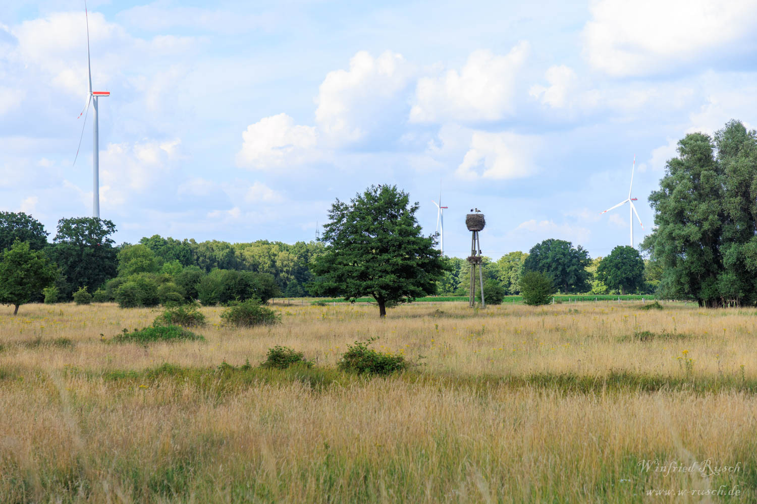
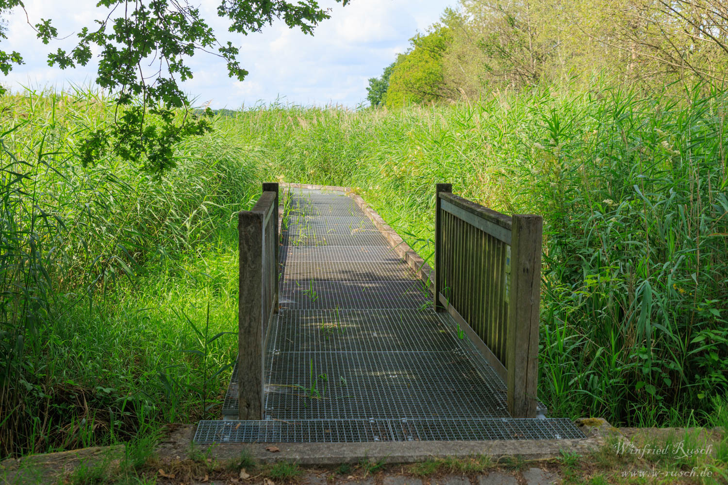
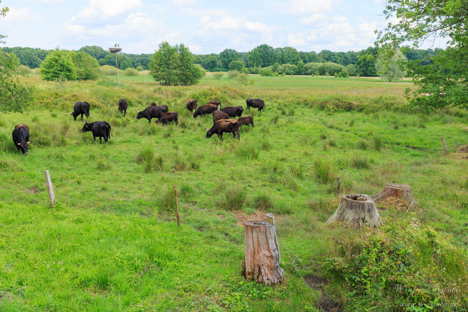
Hervester Bruch is a wetland located near the town of Dorsten in the northern Ruhr area. The area has a small lake and extensive reed beds. Water buffalo and Heck cattle graze the area. Several viewing platforms, an elevated footpath and a small observation tower offer good views of the area and the birds. With a bit of luck you can see kląskawka, świergotek drzewny, trznadel, bocian biały, trzcinniczek (zwyczajny), kszyk or czajka. A circular trail runs around the area. It is the only way to explore the area.
Szczegóły
Dostęp
Between the Gälkenheide, the Wulfener Heide and the Lange Heide stretches the Hervester Bruch. The nature reserve is freely accessible at all times. To get there take the A52 from Essen to exit 45 Dorsten-Ost and continue on the L608. From Marl to exit 46 Marl-Frentrop and turn right onto Dorstener Straße, then after 1 km turn left onto the L608 towards Wulfen. Click on the P in the map for directions. There is limited parking available on the edge of the nature reserve. On sunny weekends during the breeding season, these places can be quickly occupied. You can make a circular walk of about 5.5 kilometers in length (a shortcut in the middle is possible).
Arrival by bus and train: From Essen main station or Coesfeld take RE 14 or RB 45 to Hervest-Dorsten. Alternatively, from Dortmund main station take the RB 43 to Dorsten and the RE 14 or RB 45 to Hervest-Dorsten. Leave the platform and keep right and under the bridge into the street An der Wienbecke. Follow the left and the next right turn, then left to the roundabout. Turn right here and continue along the roadside path. Behind the stream, turn right into the road Gälkenheide until you reach the beginning of the nature reserve (approx. 2.7 km).
Teren i siedlisko
Tereny podmokłe , Trzcinowiska , Łąka , WrzosowiskoWarunki
Bagienny , Otwarty krajobrazTrasa dookoła
TakCzy luneta będzie przydatna ?
NieUdany sezon obserwacyjny
Przez cały rokNajlepszy czas na wizytę
WiosnaTrasa
Szeroka ścieżkaPoziom trudności szlaku pieszego
ŁatwyDostępne
PieszoCzatownia/platforma obserwacyjna
TakDodatkowe informacje
Photo storks nest in Hervester Bruch by Ziltoidium, CC BY-SA 4.0, via Wikimedia Commons


 ) aby wstawić nazwy ptaków w swoim języku ojczystym. Nazwy ptaków zostaną automatycznie przetłumaczone dla innych użytkowników!