

Opis
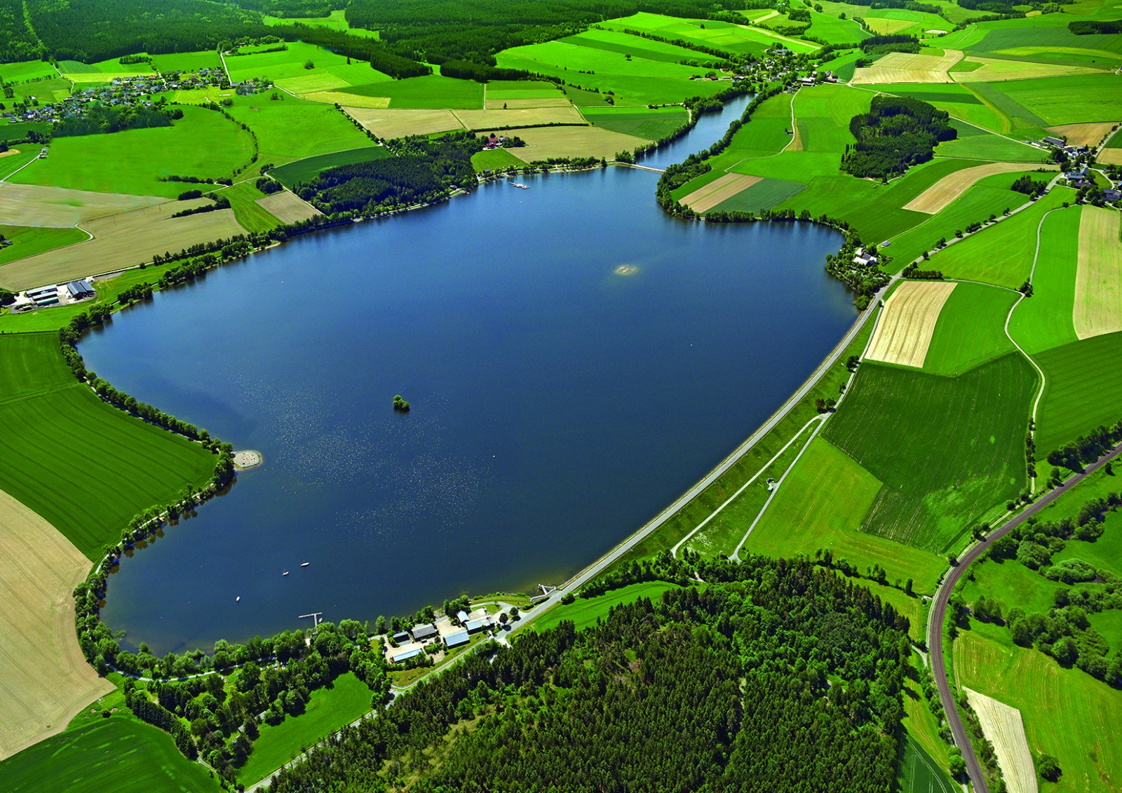
The Förmitzspeicher is a reservoir in the gently hilly landscape of the Münchberger Gneismasse on the northwestern edge of the Fichtelgebirge. It was completed in 1978 and lies 529 m above sea level and has a 126 ha water surface when it is completely filled. The climate here is continental. The reservoir is attractive especially for wading birds and waterfowl during the migration period. Then sometimes remarkable rarities can show up. The total number of bird species seen so far in the Förmitzspeicher is 250, waterrelated species 115. The reservoir is very easily accessible. Best observations mostly in spring and late summer / autumn. In high summer there are many leisure activities on the water: swimming, surfing, sailing.
Szczegóły
Dostęp
The Förmitzspeicher is located approx. 3 km southwest of the town of Schwarzenbach / Saale, coordinates 50 ° 11’39.62 “N 11 ° 54’46.39“ O. Access via Schwarzenbach or Münchberg. Two parking spaces on the north-west bank at both ends of the dam (Navi: Schwarzenbach / Saale, Dammstraße), one on the south-east bank.
Teren i siedlisko
Las , JezioroWarunki
Pagórkowaty , Otwarty krajobrazTrasa dookoła
TakCzy luneta będzie przydatna ?
TakUdany sezon obserwacyjny
Wiosna , JesieńNajlepszy czas na wizytę
Wiosna , Jesień , Wiosenne migracje , Jesienne migracjeTrasa
Szeroka ścieżkaPoziom trudności szlaku pieszego
ŁatwyDostępne
Pieszo , Rower , Samochód , Wózek inwalidzkiCzatownia/platforma obserwacyjna
NieDodatkowe informacje
There are three webcams and a page with the current water levels: see the links below.
Linki
- Der Förmitzspeicher, ein wichtiges Rastgewässer für Wasser- und Watvögel in Oberfranken
- http://www.wwa-webcams.de/ho/p-foermitz-foermitz/p-fm-foermitz.jpg
- http://www.wwa-webcams.de/ho/s-fts/s-fts.jpg
- http://www.foermitzspeicher.de/
- https://www.hnd.bayern.de/pegel/oberer_main_elbe/foermitz-seepegel-56113700


 ) aby wstawić nazwy ptaków w swoim języku ojczystym. Nazwy ptaków zostaną automatycznie przetłumaczone dla innych użytkowników!