
 Costa Rica M.JPG)
Opis
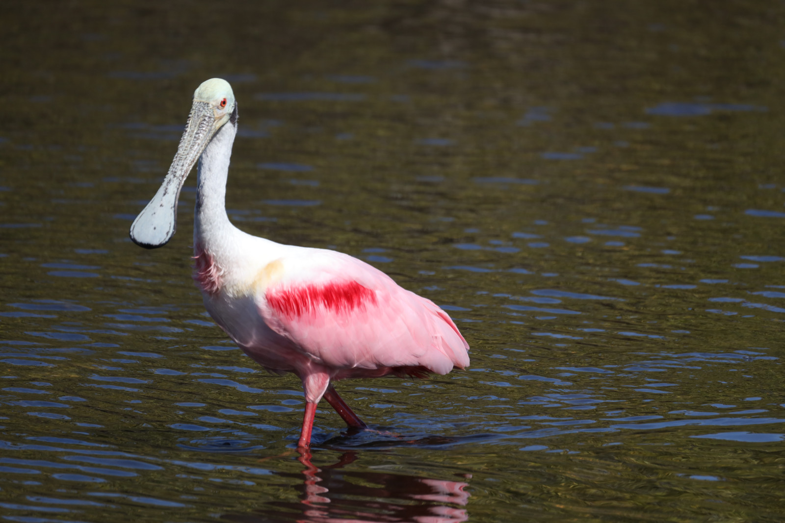
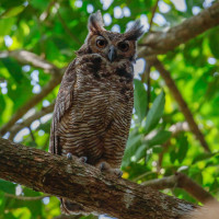
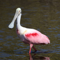
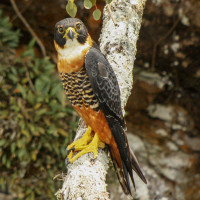
Route de Guatemala is a 13 km road near the town of Kourou. This small departmental road (RD 15) ends in a dead end on the right bank of the Kourou river. It crosses many different environments: wet meadows, secondary forest, savannah, mudflats and mangroves near the estuary. Ornithological observations are therefore all the more numerous and varied. Among the birds you can observe are Yellow-crowned Night Heron, Cattle Egret, Grey-lined Hawk, Black-collared Hawk, Roadside Hawk, White-tailed Hawk, Rufous Crab Hawk, Osprey, Crested Caracara, Yellow-headed Caracara, Laughing Falcon, Little Blue Heron, Snowy Egret, Cocoi Heron, Spot-breasted Woodpecker, Wattled Jacana, Least Tern, Yellow-billed Tern, Black Skimmer, Great Horned Owl, Brown-throated Parakeet, Greater Ani, Smooth-billed Ani, Striped Cuckoo, Cream-colored Woodpecker, Crimson-crested Woodpecker, Buff-throated Woodcreeper, Barred Antshrike, Plain-crested Elaenia, Yellow-bellied Elaenia, Yellow Oriole, Yellow Warbler, American Pygmy Kingfisher, Crimson-hooded Manakin, Great Kiskadee, Tropical Kingbird, Piratic Flycatcher and Red-breasted Meadowlark.
_________________________
Français: La zone d'observation est une route de 13 km qui longe plusieurs biotope tel que des savanes, forets humides et marécages. Sur la commune de Kourou, cette petite route départementale (RD 15) se termine en cul-de-sac sur la rive droite du fleuve Kourou. Elle traverse de nombreux milieux différents : abattis, prairies humides, forêt secondaire, savane, vasières et mangrove près de l’estuaire. Les observations ornithologiques sont donc d’autant plus nombreuses et variées.
Szczegóły
Dostęp
From Cayenne take the Kourou road to the RD15 crossroads then follow the departmental road all the way. The area is passable by car, on foot or by bike, you can park along the road. The savannah area has no shade so it is better to take a hat and sunscreen.
_________________________
Français: A partir de cayenne prendre la route de Kourou jusqu'au carrefour de la rd15 puis suivre la départementale de tout son long. La zone est praticable en voiture, à pied ou en vélo, on peux se garer le long de la route. La zone de savane ne comporte pas d'ombre il vaut mieux prendre casquette et creme solaire.
 Costa Rica M.JPG)

 ) aby wstawić nazwy ptaków w swoim języku ojczystym. Nazwy ptaków zostaną automatycznie przetłumaczone dla innych użytkowników!