

Opis
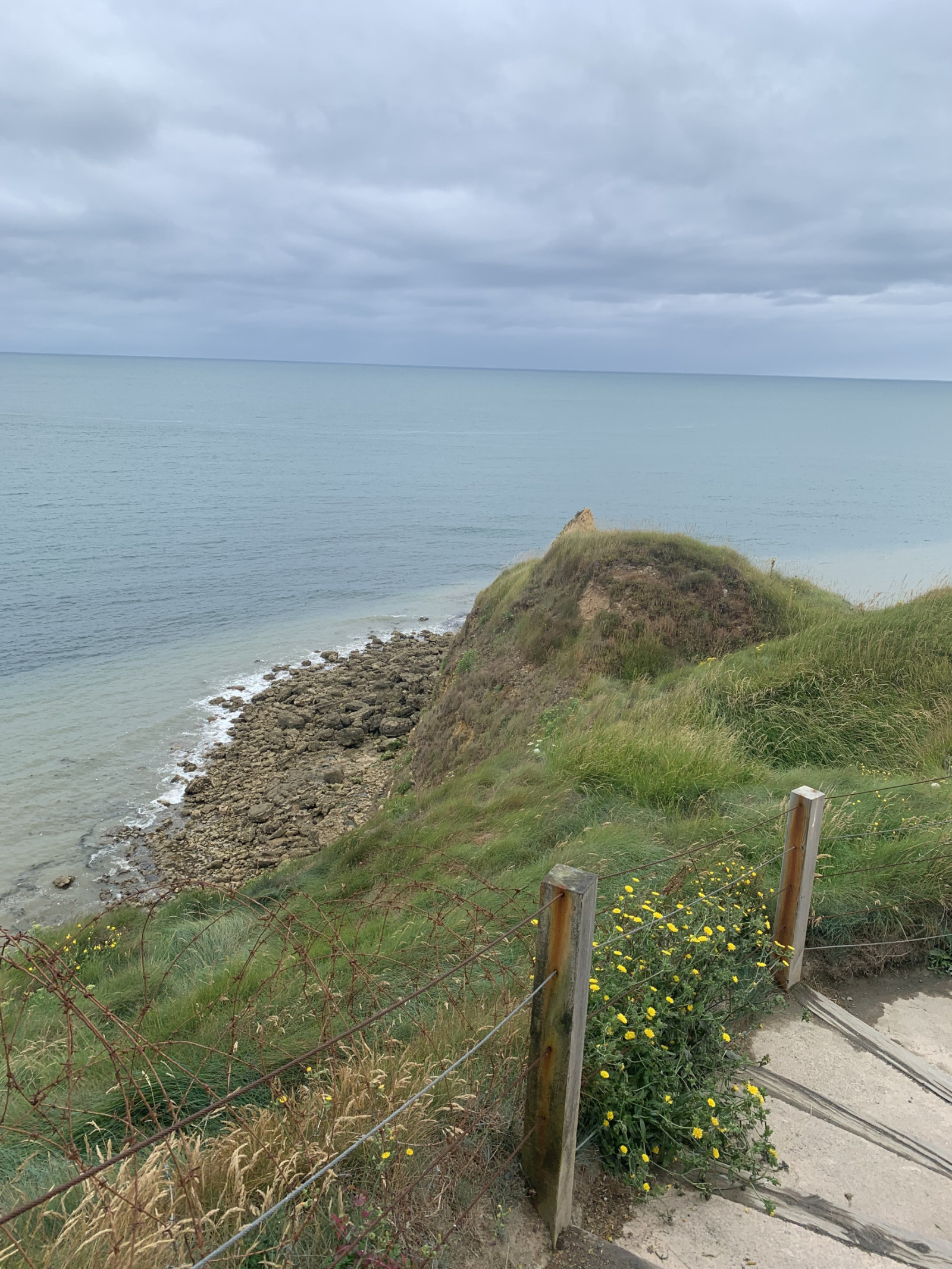
Pointe du Hoc is a prominent cliff on the coast of Normandy that played a significant role during World War II, particularly during the D-Day landings on June 6, 1944. Today, Pointe du Hoc is a memorial site, with remnants of the bunkers and bomb craters still visible.
In the first part of the circular walking route shown on the map you can observe songbirds such as makolągwa or świergotek łąkowy and many other species. Along the coast you can observe mewa trójpalczasta, nurzyk and many other seabirds. A good place for seawatching!
Szczegóły
Dostęp
Pointe du Hoc is located on the northwestern coast of Normandy situated between Omaha Beach and Utah Beach. There is a big parking lot for visitors. Press P on the map for directions to the parking. The circular walking route shown on the map is about 1,5 km.
Teren i siedlisko
Łąka , Morze , WydmyWarunki
Piaszczysty , Brak cienia , Pagórkowaty , PylistyTrasa dookoła
TakCzy luneta będzie przydatna ?
Może być przydatnaUdany sezon obserwacyjny
Przez cały rokNajlepszy czas na wizytę
Wiosna , JesieńTrasa
Szeroka ścieżkaPoziom trudności szlaku pieszego
ŁatwyDostępne
Pieszo , Wózek inwalidzkiCzatownia/platforma obserwacyjna
NieDodatkowe informacje
On D-Day, the United States Army Rangers, led by Lieutenant Colonel James Earl Rudder, scaled the 30-meter-high cliffs to capture the German positions. Despite facing heavy resistance and difficult terrain, the Rangers successfully took control of the area, which was crucial for the success of the Normandy landings.


 ) aby wstawić nazwy ptaków w swoim języku ojczystym. Nazwy ptaków zostaną automatycznie przetłumaczone dla innych użytkowników!