

Opis
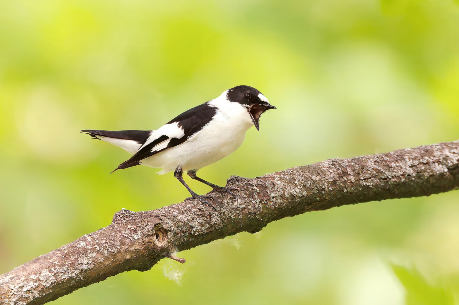
Forêt de Parroy is a stronghold of the muchołówka białoszyja in Lorraine. This small migratory passerine can be observed there between the end of April and mid-June during nesting. The dzięcioł zielonosiwy is also quite common there while the bocian czarny is rare.
________________________
Français: Vaste forêt de plaine et de feuillus de 5000 hectares facilement explorable à pied ou à vélo en dehors de la sasion de chasse. Cette forêt est un bastion du gobemouche à collier en Lorraine. Ce petit passereau migrateur peut y être observé entre fin avril et mi-juin lors de la nidification. Le pic cendré y est également assez commun alorsque la cigogne noire est rare.
Szczegóły
Dostęp
Forêt de Parroy is located 15 km northeast of the town of Lunéville and just south of the village of Parroy. Take the road south of Parroy and park at the Bossupré crossroads. Press P on the map for directions to the parking. Car access is prohibited in the forest. The circular walking route shown on the map is about 5 km. The hunting season is from September to end of February.
________________________
Français: Forêt de Parroy est située à 15 km au nord-est de la ville de Lunéville et juste au sud du village de Parroy. Prendre la route au sud de Parroy et stationner au niveau du carrefour de Bossupré. Appuyez sur P sur la carte pour obtenir les directions vers la place de stationnement. L'accès en voiture est interdit dans la forêt. L'itinéraire circulaire indiqué sur la carte fait environ 5 km.


 ) aby wstawić nazwy ptaków w swoim języku ojczystym. Nazwy ptaków zostaną automatycznie przetłumaczone dla innych użytkowników!