
Opis
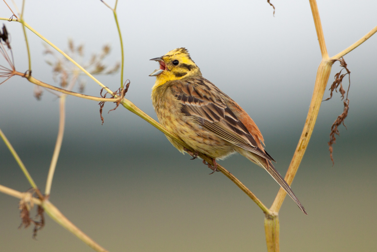
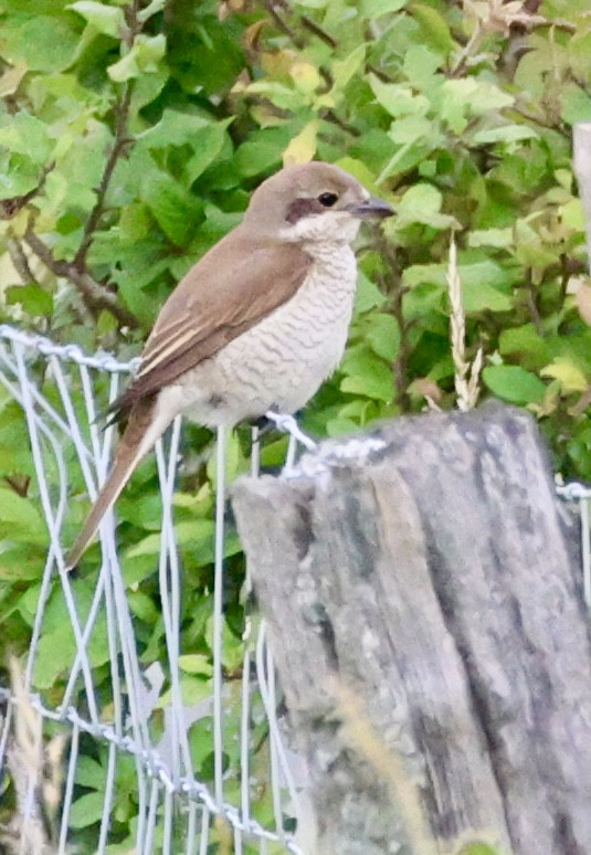
Le désert de Saint Ferréol offers a remarkable panorama over the plains and hillsides of southern Tarn and is an excellent spot for observing the local birds of prey and also migrating birds at the end of summer time: gadożer, Trzmielojad, błotniak łąkowy and błotniak zbożowy. Dry prairies, marshes and fields bordered by thorny bushes host a wide variety of passerines such as pokrzewka kasztanowata, zaganiacz szczebiotliwy, makolągwa and gąsiorek. This last one is easy to observe in this area. Look in summer for a male perched on top of a hawthorn, on the lookout for prey. In the pine forests close to the St. Stapin Oratory overlooking the village of Dourgne, one can observe czubatka and zniczek. In winter płochacz halny and pomurnik can be spotted on the rocky outcrops.
_________________________
Français: Ce plateau calcaire perché sur le versant nord de la Montagne noire offre un beau point de vue sur le sud du Tarn. C’est un excellent site pour observer les rapaces locaux (Circaète Jeanle-Blanc, busards…) et les migrateurs à la fin de l’été. Les pelouses sèches, les landes et les prairies naturelles bordées de buissons épineux accueillent de nombreux passereaux dont la Linotte mélodieuse, la Fauvette des jardins et la Piegrièche écorcheur ainsi que l’Engoulevent d’Europe. En hiver, l’Accenteur alpin et le Tichodrome échelette fréquentent les rochers de Saint-Stapin.
Szczegóły
Dostęp
Le désert de Saint Ferréol is located in the Montagne Noire, in the Tarn department in Occitanie. In the south side of the area you can park. Click on the P in the map for directions. From the parking spot you can make a circular walk of 4 km (indicated on the map).
_________________________
Français: Le désert de Saint Ferréol est situé dans la Montagne Noire, dans le département du Tarn en Occitanie. Depuis le parking, vous pouvez faire une promenade circulaire de 4 km (voir la carte).


 ) aby wstawić nazwy ptaków w swoim języku ojczystym. Nazwy ptaków zostaną automatycznie przetłumaczone dla innych użytkowników!