.jpg)
.JPG)
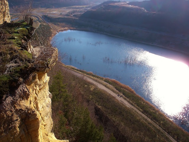
Opis
The Freyming-Merlebach quarry, within the Warndt massif is a new biotope where man, after destroying, now promotes the natural recolonization of places, without upsetting it. Located between the municipalities of L'Hôpital, Saint-Avold and Freyming-Merlebach along the Franco-German border, the old quarry of sandstone and sand runs alongside the natural space of the Warndt forest classified as Natura 2000 Network on the German side. It is the largest of the whole Lorraine coal basin. It is bordered on the south side of the old slag heap of the Sainte-Fontaine coal mine. Operated from 1920 to 20014 to fill the voids left by coal mining, it presents itself as a deep canyon, 7.5 km long and 850 m wide. The bottom is occupied by various bodies of water due to the rise of the water table and fed intermittently by the Doerrenbach (stream).
The best time of the year is spring when interesting species breed here: puchacz, sokół wędrowny, bączek, bąk, świerszczak, krętogłów, lerka.
Szczegóły
Dostęp
Various accesses are possible:
1) Entrance by the forest path through L'Hôpital, Cité La Colline (along the German border).
2) Entrance through the Sainte-Fontaine city from the regional road (D 26) L'Hôpital - Freyming-Merlebach.
3) Entrance through the Freyming-Merlebach rose garden, near the city of Reumaux.
4) Entrance to the Hochwald district, near the Freyming-Merlebach hospital.
5) Enter Warndt through the forest when arriving from Germany.
Access is prohibited to any motor vehicle, the spaces are protected.


 ) aby wstawić nazwy ptaków w swoim języku ojczystym. Nazwy ptaków zostaną automatycznie przetłumaczone dla innych użytkowników!