Opis
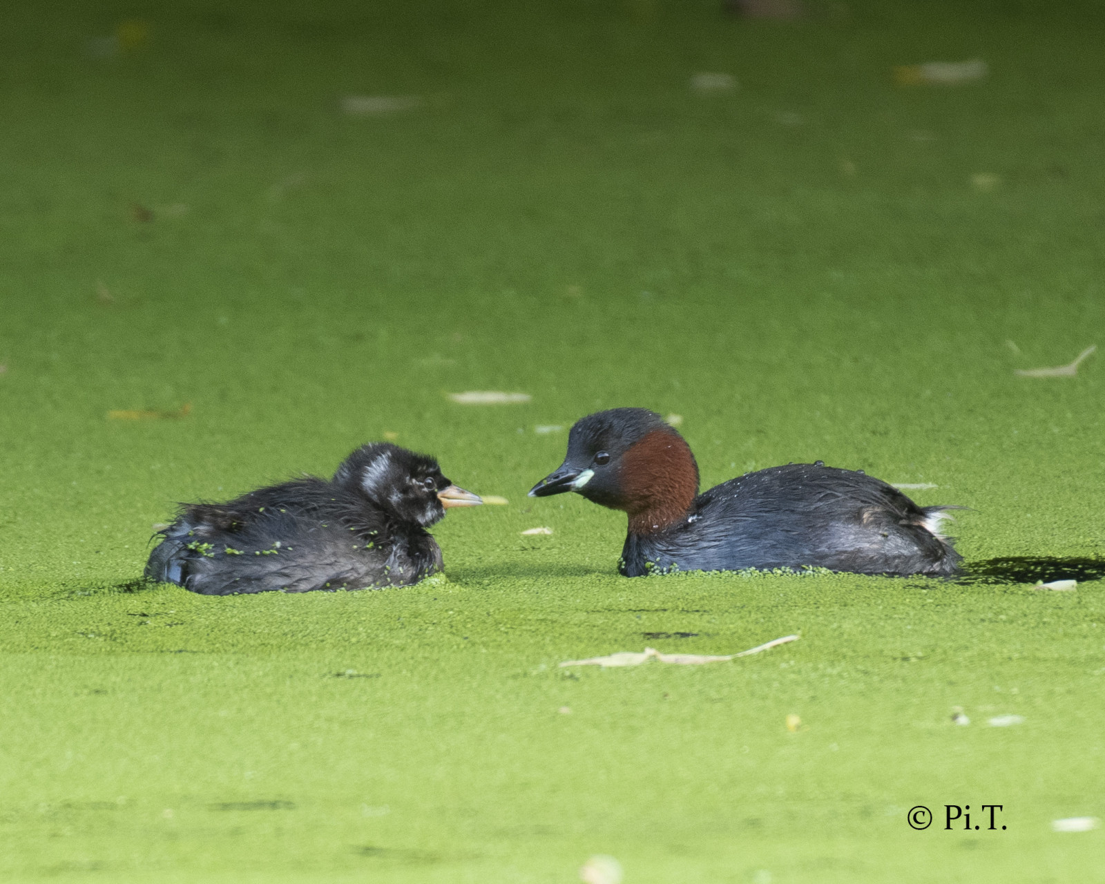
The Palingbeek is a nature reserve located around the old Ypres-Comines canal. In 1864 they wanted to dig a canal that would connect the Lys with the Ypres Canal . After many attempts because the soil is unstable, the structures collapsed. Work was halted in 1913 and World War I broke out a year later. Nature developed around the canal and many birds came to settle, such as dzięciołek and kowalik, but also many birds of prey such as puszczyk zwyczajny and Trzmielojad. The various pools scattered over the area have zimorodek and perkozek.
_________________________
Nederlands: De Palingbeek is een natuurgebied van meer dan 230 hectare groot. Het domein ligt rond het oude kanaal Ieper-Komen. In 1864 wenste men een kanaal te graven dat de Leie met het Ieperkanaal zou verbinden. Na heel wat pogingen doordat de bodem instabiel is, stortte de constructies in. In 1913 staakte men de werkzaamheden en een jaar later brak de Eerste Wereldoorlog uit. Tijdens de Eerste Wereldoorlog lag de Palingbeek aan het front van de Ieperboog. De natuur ontwikkelde zich rond het kanaal en heel wat vogels kwamen zich vestigen zoals de typsiche bosvogels dzięciołek en kowalik maar ook heel wat roofvogels zoals puszczyk zwyczajny en Trzmielojad kan je met wat geluk ontmoeten. De verschillende poelen waar perkozek en zimorodek vertoeven liggen verspreid in het gebied.
Szczegóły
Dostęp
You can park at the end of Palingbeekstraat 8902 Zillebeke, you also have parking at the meeting center Vaartstraat 7, 8902 Zillebeke (Belgium). Click on a P in the map for directions. The walking route indicated on the map is about 3 km.
_________________________
Nederlands: Parkeren kan op het einde van de Palingbeekstraat 8902 Zillebeke, ook aan het ontmoetingscentrum Vaartstraat 7, 8902 Zillebeke (Belgium) heb je parkeergelegenheid. Klik op een P in de kaart voor een routebeschrijving. De wandelroute die is aangegeven op de kaart is ongeveer 3 km.


 ) aby wstawić nazwy ptaków w swoim języku ojczystym. Nazwy ptaków zostaną automatycznie przetłumaczone dla innych użytkowników!