
Opis
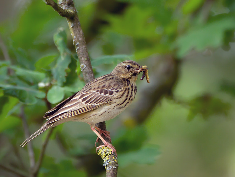
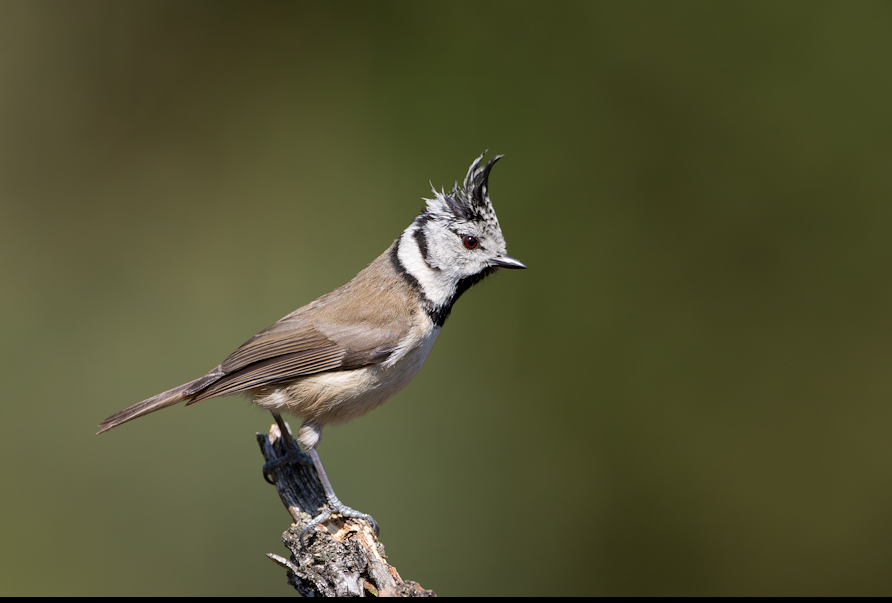
At the Kesselse Heide nature reserve you will find a mix of heather, coniferous and deciduous forests, sandy plains and fens. You will find the typical heather vegetation here: purple heather bushes, sand sedge, bunt grass and heath. There is a grazing project with a flock of sheep in order to remove the unwanted grasses in a natural way. On the Kesselse Heide you can see typical bird species of heathland and forests, such as dzięciołek, dzięcioł duży, dzięcioł czarny, dzięcioł zielony, krogulec, świergotek drzewny, lerka, kukułka, pleszka, muchołówka żałobna and paszkot.
_________________________
Nederlands: In natuurgebied de Kesselse Heide vind je een mix van struikheide, naald- en loofbossen, zanderige vlakten en enkele plassen. Je vindt er de typische heidevegetatie: paarse heidestruiken, zandzegge, buntgras en dopheide. Er een begrazingsproject met een kudde schapen zodat de ongewenste grassen op een natuurlijke manier verwijderd worden. Op de Kesselse Heide zijn typische vogelsoorten van heide en bossen te zien, zoals dzięciołek, dzięcioł duży, dzięcioł czarny, dzięcioł zielony, krogulec, świergotek drzewny, lerka, kukułka, pleszka, muchołówka żałobna en paszkot.
Szczegóły
Dostęp
There are several signposted walks. The red marked walk of 3.5 km takes you along the different corners of the heath. You pass ponds, cross a sandy plain and walk under the trees. An extension with the blue marked trail (2.4 km) on the other side of the Lindekensbaan leads you through the Hoogbos and the Hoge heide. The walks start and end at the parking lot of the Kesselse Heide, Lindekensbaan, Nijlen. Click on the P in the map for directions to the parking lot. Public transport: the Kesselse Heide is within walking distance (1,3 km) of Kessel train station. Near the station you have the bus stop “Kessel Station”, which is served by Line 154: Lisp – Kloosterheide/markt – Kessel station.
_________________________
Nederlands: Er zijn diverse bewegwijzerde wandelingen. De rood gemarkeerde wandeling van 3,5 km brengt je langs de verschillende hoekjes van de heide. Je komt langs vijvers, steekt een zandvlakte over en wandelt onder de bomen. Een uitbreiding met blauwe paaltjes (2,4 km) aan de overkant van de Lindekensbaan leiden je door het Hoogbos en de Hoge heide. De wandelingen vertrekken en eindigen bij de parking van de Kesselse Heide, Lindekensbaan, Nijlen. Klik op de P in de kaart voor een routebeschrijving naar de parkeerplaats. Openbaar vervoer: De Kesselse Heide ligt op loopafstand (1,3 km) van station Kessel en is te bereiken via de trein Antwerpen – Lier. Vlakbij het station heb je de bushalte “Kessel Station”, deze wordt bediend door Lijn 154 : Lisp – Kloosterheide/markt – Kessel station.


 ) aby wstawić nazwy ptaków w swoim języku ojczystym. Nazwy ptaków zostaną automatycznie przetłumaczone dla innych użytkowników!